The Mountains are Calling
Naturalist John Muir famously said “The mountains are calling and I must go…“, this week more than any other in recent history I felt that pull, up up and away from cubicle life. This Friday I was able to slip away from the hustle and bustle of Denver and vanish into the mountains. A little over two hours from our place in southeastern Denver is a lightly traveled patch of 41,232 acres of National Forest where Pike and San Isabel meet. Buffalo Peaks Wilderness was formally designated in 1993 in an act of Congress and features two major peaks, East and West Buffalo. The surrounding area ranges in elevation from 9,200ft to over 13,300ft above sea level, as with most wilderness areas it’s high and out of the way.
Armed with little more than a map dot of a trail head and a favorable weather report I headed out to Jefferson County, Colorado after first light. Unlike many Wilderness areas there is a road that carves through some of it. Weston Pass Road, Jefferson County Road 5 goes from a pothole pocked tar and chip road down by CO-285 to dirt that’s been washboarded by the elements quite quickly. The road itself is an offroad destination from Fairplay to Leadville, the pass topping out at 11,921 feet above sea level.
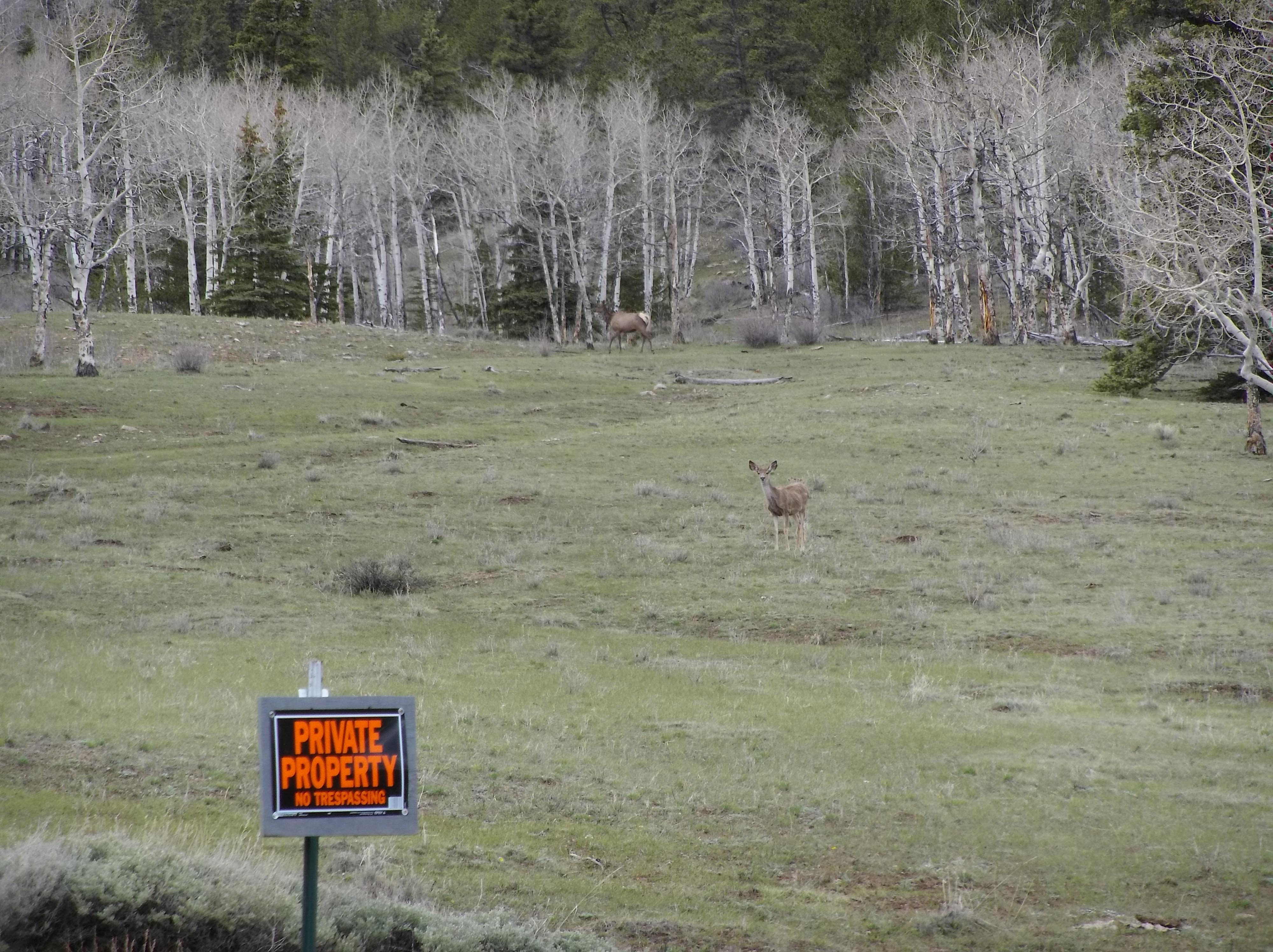
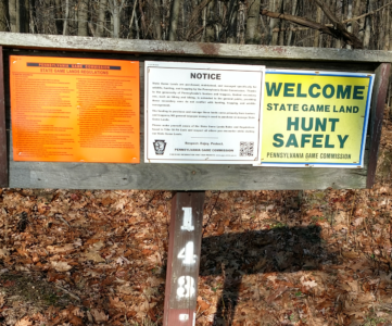
With the signage along the road, you’ll know the instant that you’re in the Pike National forest as every 20 feet you’re reminded that you’re on private property. Along the road are beaver ponds as you drive into the mountains you get closer to the source of the South Fork of the South Platte river. Once you’re in the National Forest there are dispersed camp sites abound along the road with various pull offs. If camping, June through early October are your best bets, and bring along the rod and reel to fish for native trout along the Rich Creek and South Fork of the South Platte.
Riding slowly along the dirt road I’d anticipated the weather being cooler in the mountains, loosing three degrees per thousand feet of elevation gained is the rule of thumb. I was breaking through thin ice on each mud puddle as I plugged along to the trail head. with windows cracked you could hear the glass like tinkle of ice being broken and tossed over the top of the fenders and hood.
Parking at the trail head it was a balmy 39 degrees, but knowing it was going to warm up to 70 made me believe that the trails were likely quite clear. What I’d done was scouted several trails on AllTrails.com and picked a nice 6 mile out and back to break myself in for the season and perhaps do a little scouting for critters.
This time of year trails are more or less clear of snow, but with the mountains being at 240% of normal snow pack I knew this year would be anything but normal. The trail I’d chosen was the Rich Creek Trail, the trail head just outside the boundaries of the National Forest to the point where there were private property markers on one side of the lot, profusely advertising that the trout stream was a ranch’s and not yours.
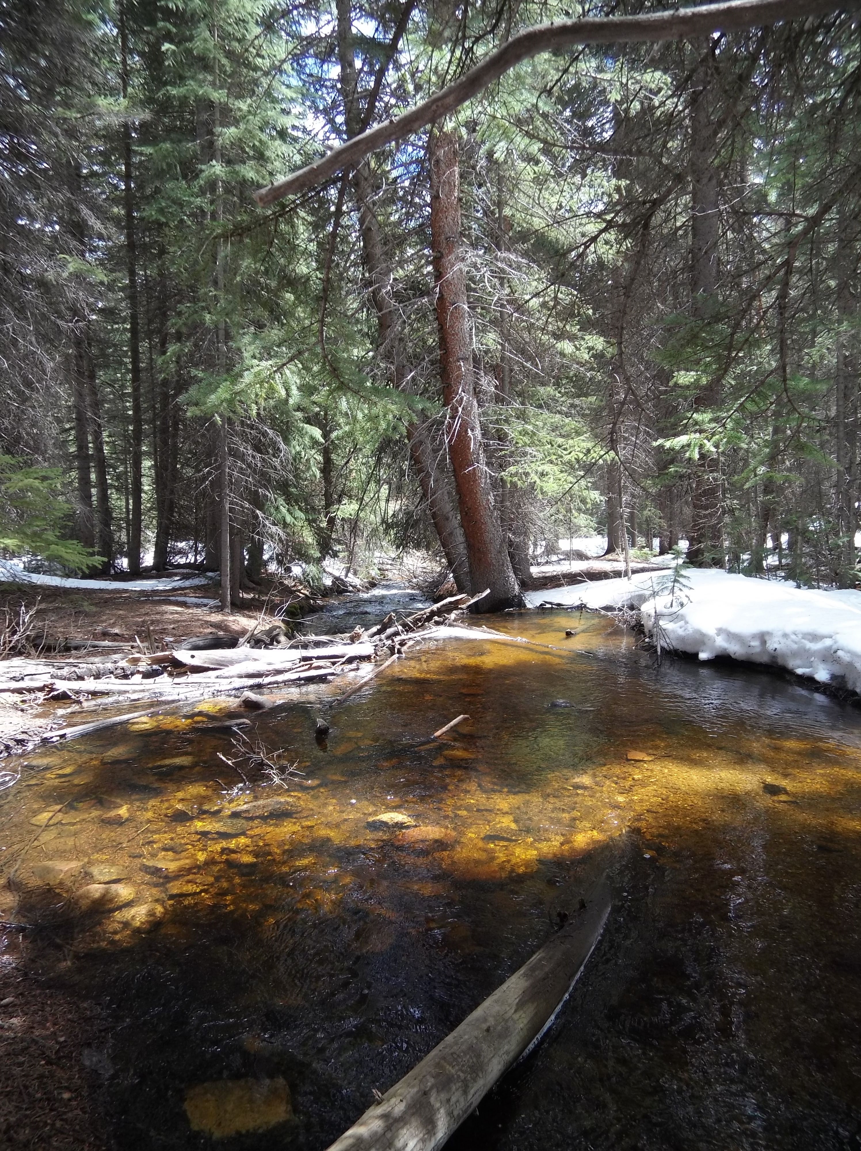
I threw my rain jacket into my pack as I geared up, having left my snow shoes at home and not even thinking to bring microspikes. It was almost June! Setting out on the trail the single track was well worn in the creek valley but it became obvious that snow was going to cause problems. At not quite a mile the trail all but disappeared as it snaked beside the creek and snow came down to meet it over a foot deep, clogging viable foot falls and rendering rocks icy.
Taking the High Road
There were three choices I could make, cross the icy cold creek, double back and climb the steep hillside until I found a ridge to bypass, or cling for dear life and use the 8 inch gap between roots and ice covered rocks to go the twelve or so feet required to bypass the obstacle. I looked at the hillside further up, and it would be several hundred feet before I could get good enough purchase, crossing the creek was a non-starter this early in the day. I wouldn’t get hyporthermic, I just didn’t want to soak my feet this early on.
So I took the least sensible of the options, pressing myself against the side of the hill and gripping tree root after tree root and moving myself across the hillside until… Well, I suppose you can guess. I ended up in the creek. At some point my right foot lost its hold and I slid on my stomach down the hill stopping briefly on a large rock before being dumped feet first into the creek below. Had it been higher than perhaps 12 feet in the air I would have hurt more than just my pride. I got out of the creek, located the nearest segment of the trail and did a gear check and made sure I wasn’t hurt. I was really hoping this wasn’t going to be a common theme on my adventures.
Now soaked from the shins down I had to make the decision, was it safe to continue? Was I on a fool’s errand to start my New Year’s Resolution after nearly half a year was already behind us? I was two hours from home and 9/10ths of a mile down the trail. I wasn’t going to quit just yet. The mountains take their toll, and this was just one way they extract it.
Onward and Upward
Meandering through the woods it became obvious that the trail was going to be snowed in for some spots. Paralleling the creek I cursed that I’d left my fly rod in the truck opting instead to hike with less things to break in my fervor to see what was at the top of the mountain. The woods began to close in again after the briefest walks in the warm morning sun, and the snow piled up in the shadows. The snow was in bulbous mounds between lodgepole pines piled from knee to waist high. With the melting and freezing cycles that occurred each day and night there was a hard crust on top that you could almost walk on. Almost.
I was postholing in order to stay on the trail and follow the yellow blazes. I had the GPS track on my phone for the trail, but I’d long since lost cell signal and the track was on the AllTrails app. Soon enough the trail became faint after dodging some waist deep snow drifts and I was off. I bushwhacked for a half of a mile, realizing that the AllTrails app had failed me, pointing all the time towards the trailhead rather than the terminus. I hadn’t turned around but it was difficult to get a read on where it was trying to take me.
Then the altitude hit. I was just below 10,000 feet and beginning to feel it. I could feel my heartbeat in my ears. Exacerbated by the tumble into the cool creek my socks squished with every step. I had fresh socks, dry and safe in the truck. Sitting down and looking at the GPS track I switched back and forth between AllTrails and OnX where I had an offline Topo. The offline topo lacked the resolution required and the track, but it seemed I’d missed something.
It looks like I was supposed to get wet today regardless. The trail had likely crossed the creek at some point, and I was paralleling it on the shady side of the valley punching through the snow and wasting vital energy. It was a work out, but not the one I’d planned.
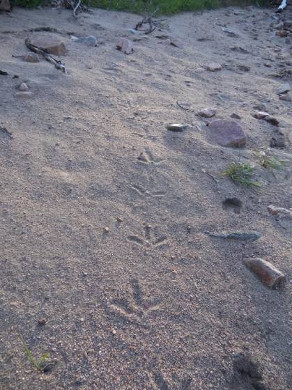
A quick course correction and I was back on the trail within ten minutes, beginning a slow ascent into the drainage. Now I’d be lying if I said I didn’t have ulterior motives when I planned hiking all of the wilderness areas in Colorado. With the Game Management Units largely being broken down by means of drainages and mountain ranges it made sense to keep my eyes peeled for sign. This was also shed hunting season and morel season, so bonus points for me if I found more than a sprained ankle on this trip.
At nearly 10,000 feet though, I was betting I wouldn’t find either of those. What I did see was scads of fresh moose sign. I’m not shy to say it either. With the average wait for a moose tag in Colorado being something like 18 years, and me sitting on one single preference point my unborn child will be able to serve in the military by the time that I’m likely drawn. The moose habitat here was stellar, swampy, and just a little spooky.
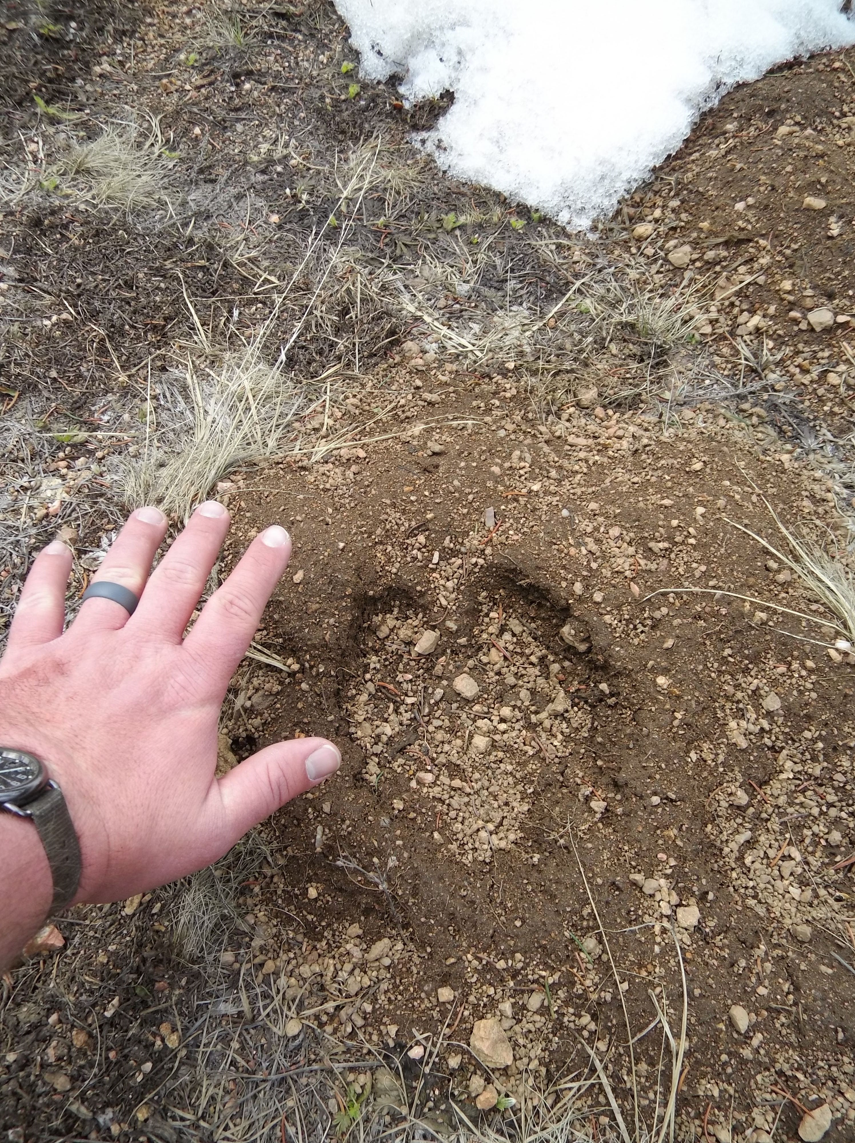
The trail began to close in on me, and moose sign was both heavy and fresh. Most of the tracks I was seeing were right on the trail, animals will use beaten trails and forest roads when the alternative is a nasty tangle, especially when they feel safe and in the wilderness, why wouldn’t they?
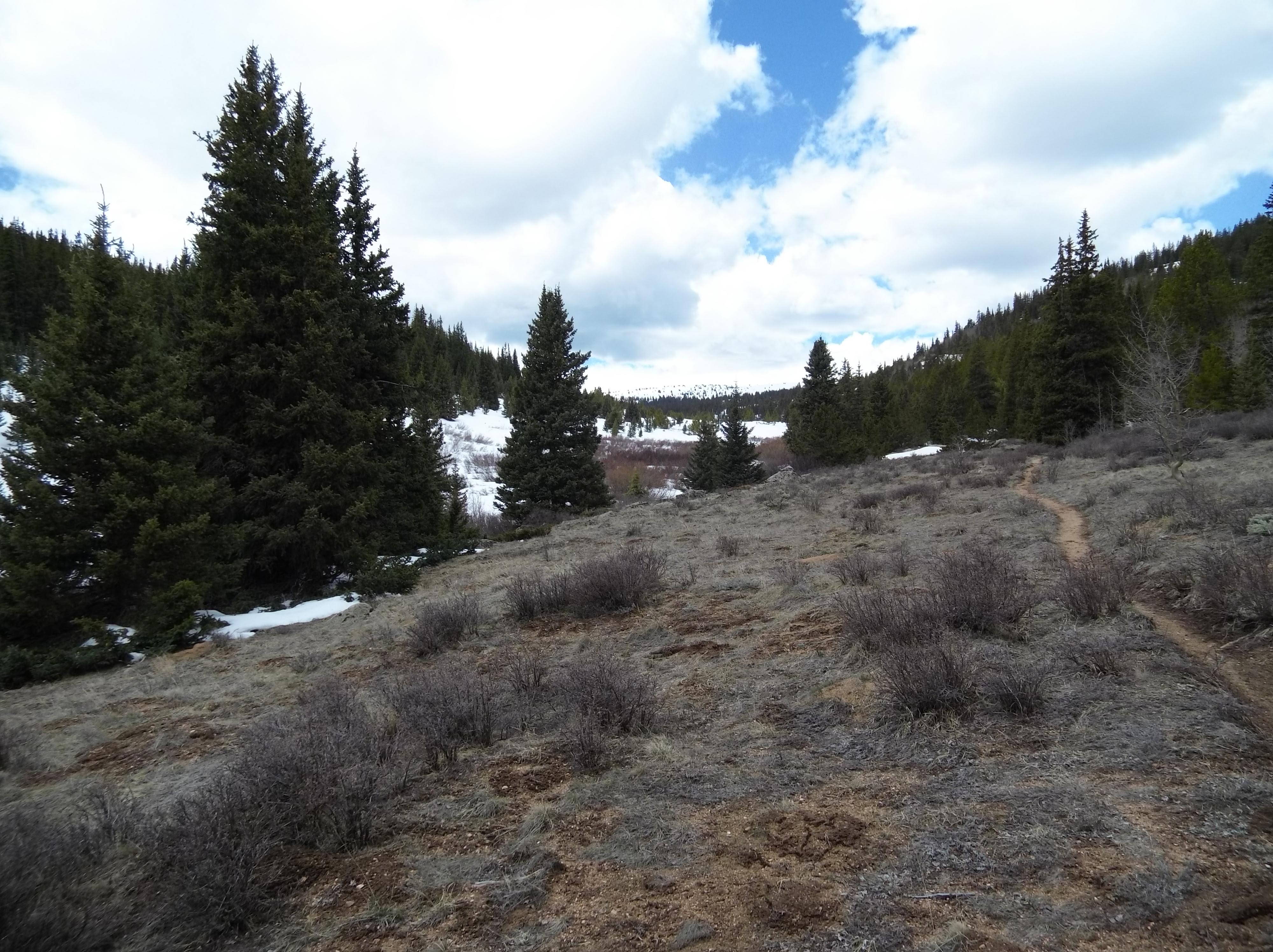
The pussy willows crowded the trail, and it became questionable whether the trail was for walking or white water rafting as it fresh snow melt trickled down in rivulets from the surrounding hillsides. I broke out of the willows as the trail began a sharp ascent up the mountain. I was finally peeling away from the creek side, but it was not going to be gradual.
You can always tell people at my work that aren’t from around the Denver area here visiting for a conference or meetings. They’re generally winded immediately when walking our stairs in our little building. While running up and down the stairs all day doesn’t bother me, a sharp elevation gain on rocky soil in the high country socks me right in the lungs every time. My heartbeat was measured in my ears and around my neck again as I took it dead slow up the hill.
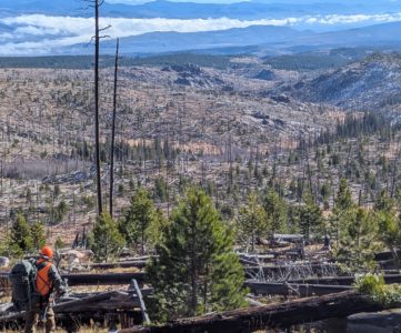
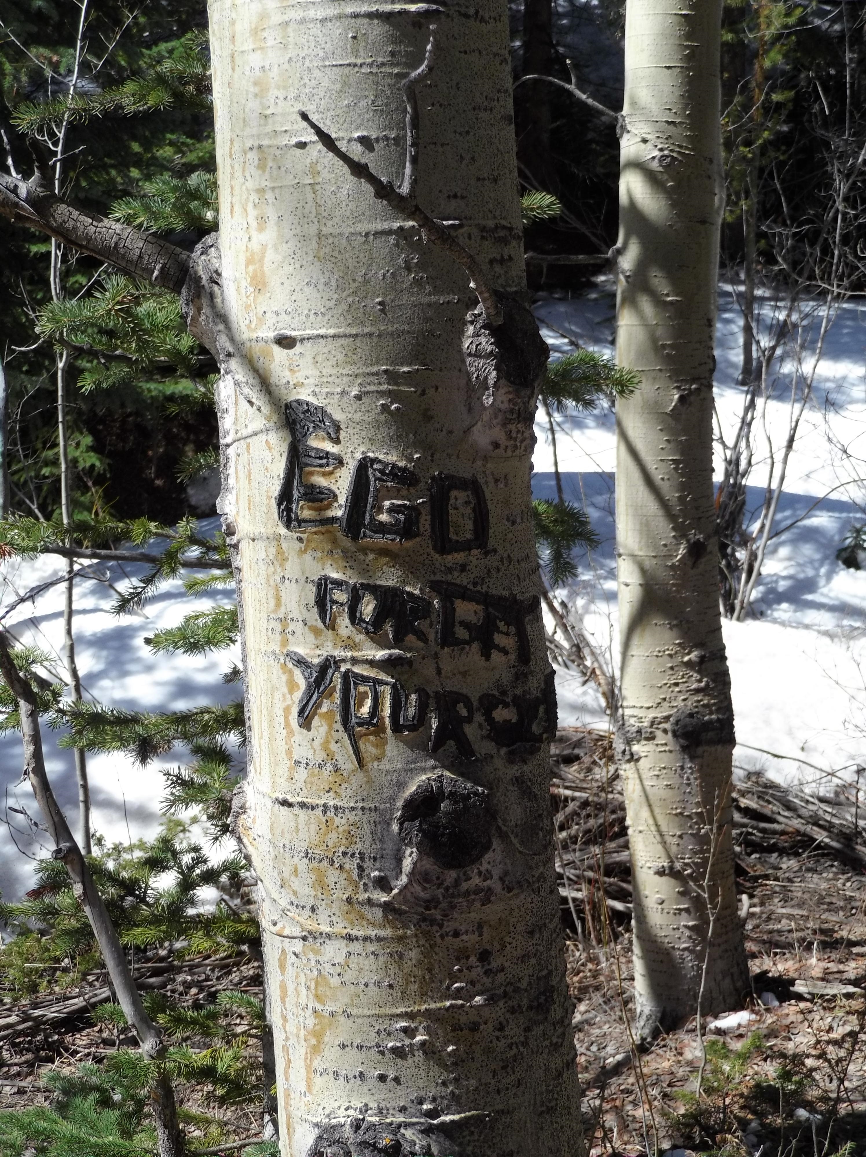
The terrain began to change from a lodgepole pine forest to mixed Aspen and various conifers. It was looking a little grousey, though I saw no sign. Then as suddenly as a flat tire the terrain opened and there I was in a mountain bowl with glorious alpine views. It was clear people had camped up here before, but had taken care not to let campfires get out of hand. I spotted two or three fire rings just as or slightly after I thought to myself “This would be a neat campsite!” While I knew I wasn’t the first person here, maybe not even this hiking season based on other postholes and some fresh trail blazes, it was the first time for me.
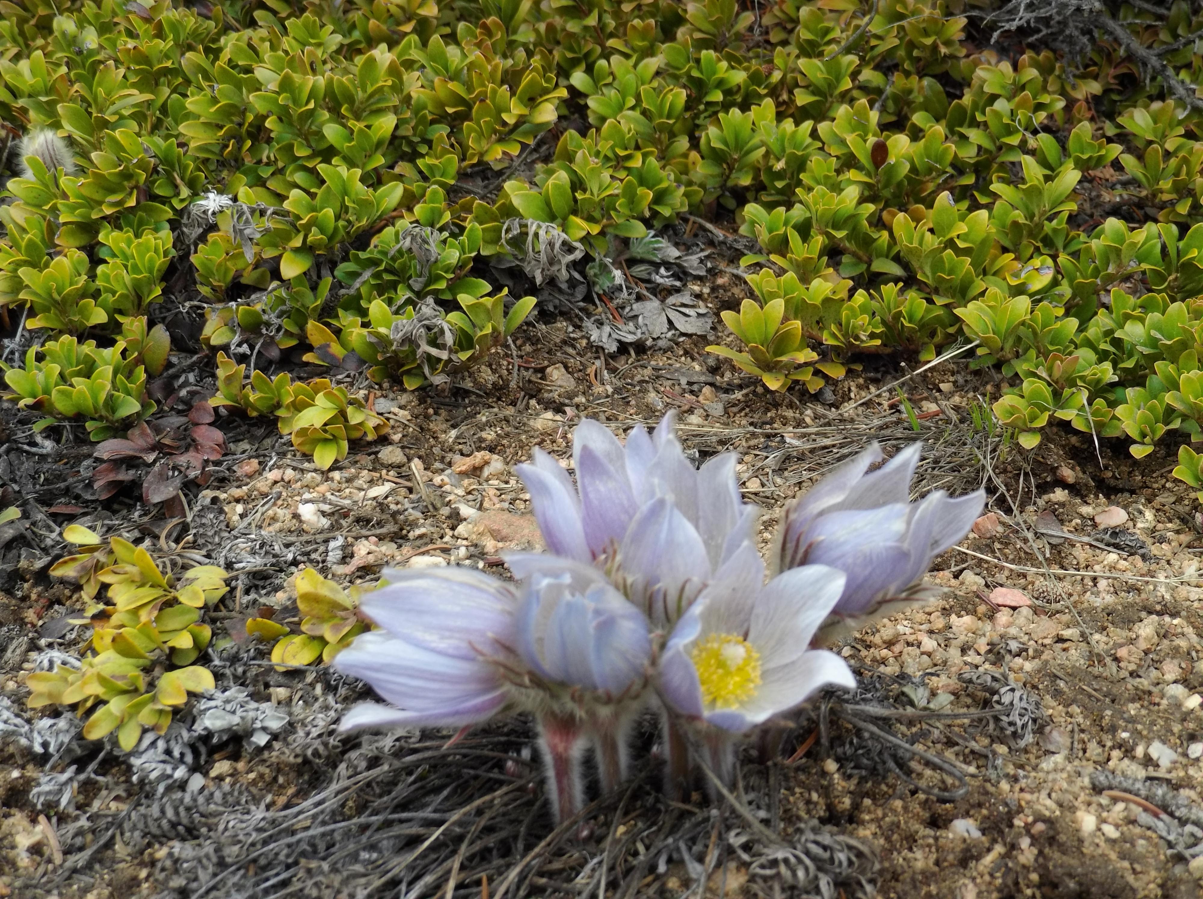
I soaked in the sun in the open field and I’d be lying if I wasn’t tempted to do a snow angel in one of the large drifts but I instead took the time to do a little glassing for game. Finding nothing but deep snow and some mountain flowers I began to get ready for my descent. Once more into the breach. I’d survived Buffalo Peaks, but the mountains had extracted their toll in exchange for amazing views.
Resources
USDA Link on Buffalo Peaks Wilderness
Wilderness.net Link on Buffalo Peaks Wilderness