A Day of Aggro-Rest
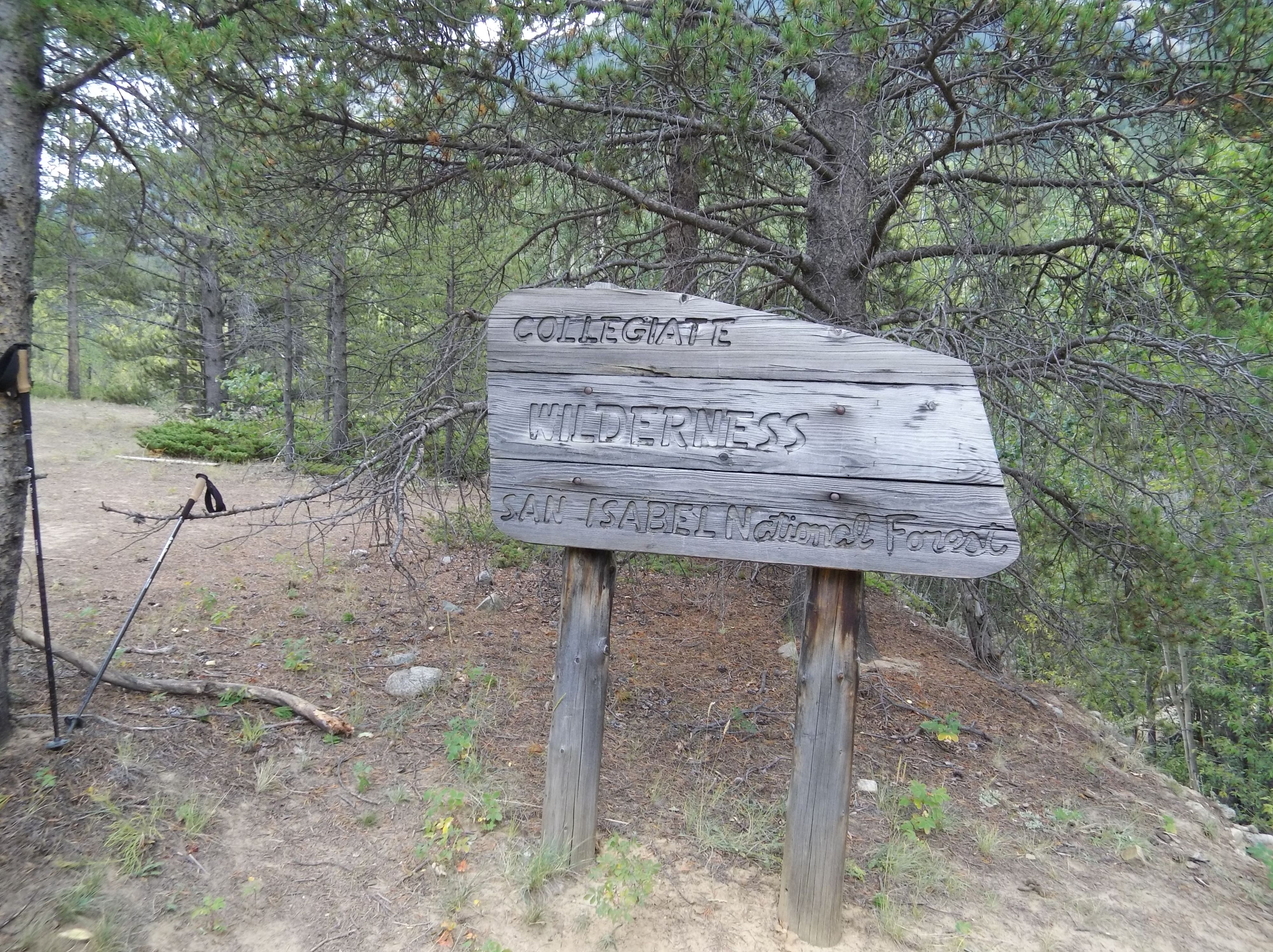
While out in the Collegiate Peaks area hiking, camping, and bird hunting I took an additional rest day from our party to do something a little more aggressive. I’d tweaked my knee during the descent with a full pack down the Belford Mountain trail and Missouri Gulch and wanted to test it a little. This would ensure I wouldn’t put a damper on anyone’s ptarmigan hunting up on a steep hill.
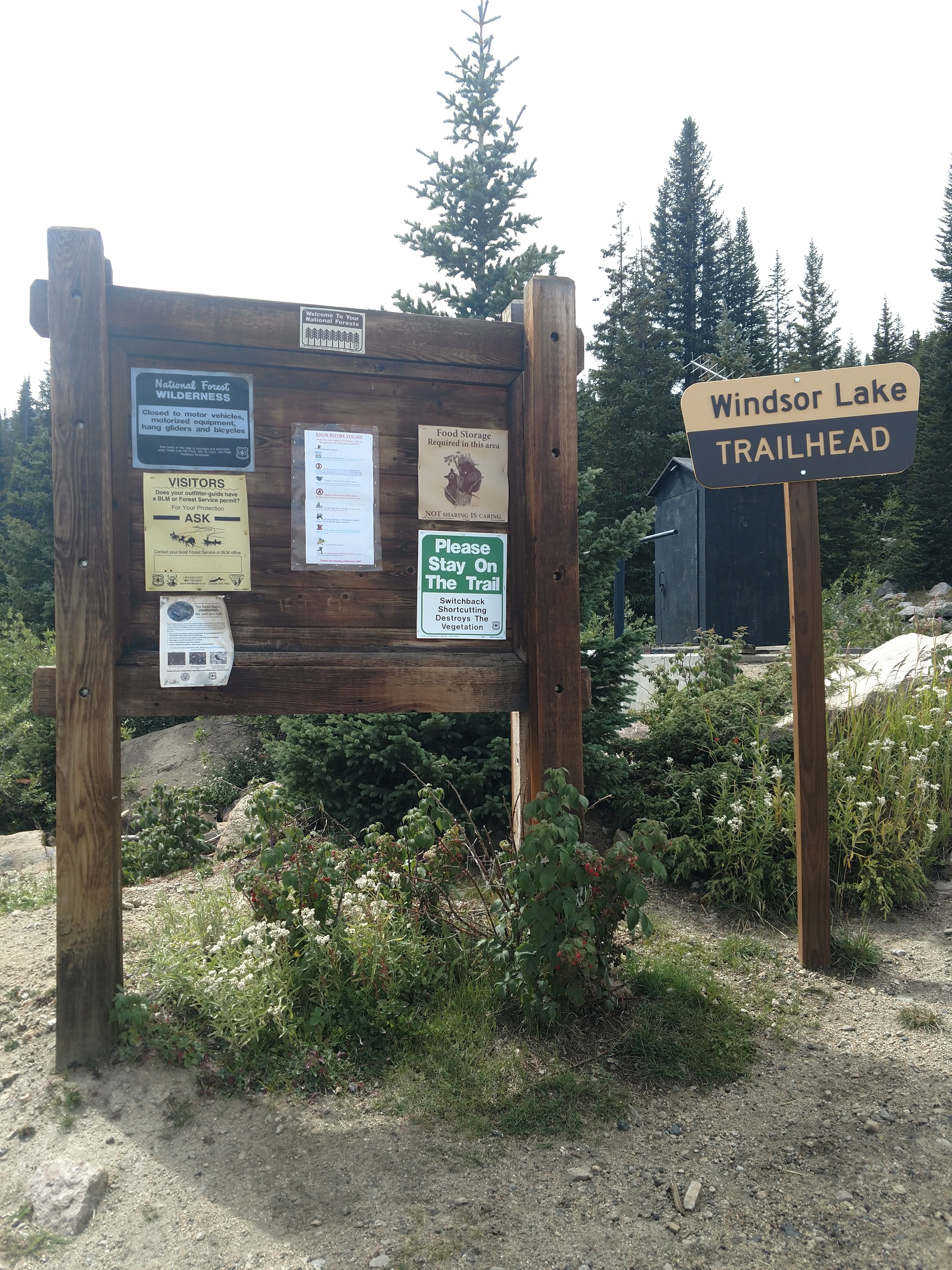
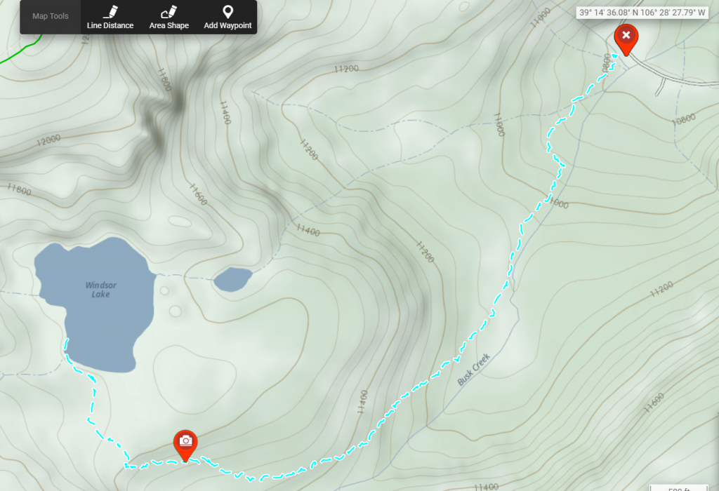
The Mount Massive Wilderness was nearby, and with the Weston Pass road potentially closing in the next month or so with the weather I wanted to get to it while the access allowed for it. I settled on the Windsor Lake Trail, with 885 ft of elevation over a 2.8 mile round trip. The trail is rated as Hard on AllTrails, but it’s difficult to compare the route we’d just taken up a fourteener to a small hill with a lake at the top of it.
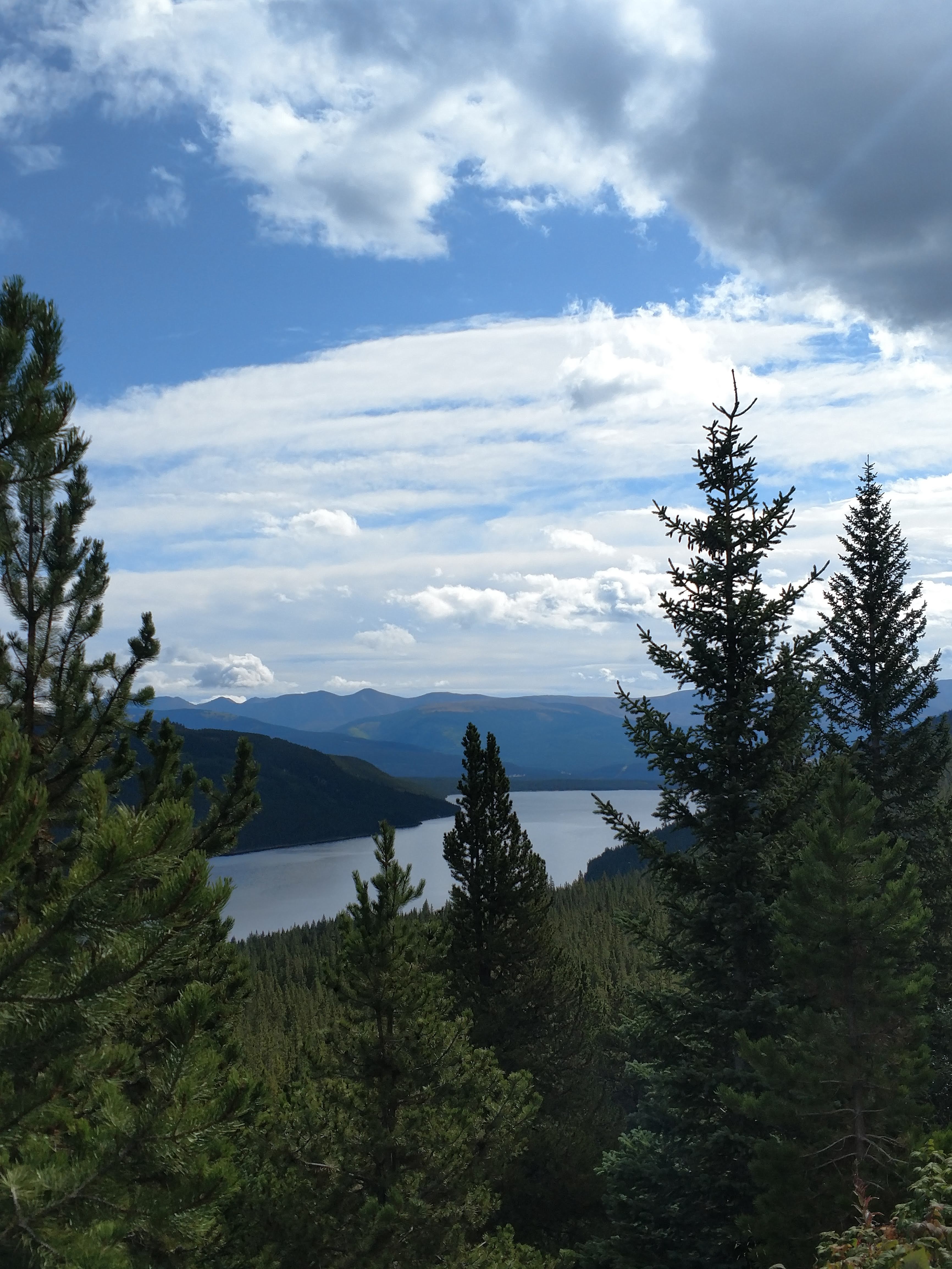
The trail began at a dirt road that would go all the way up to Hagerman Pass, while it was well maintained it was also quite narrow, with the road dropping to Turquoise Lake below.
Up Up and Away… from the Lake!
Parking for the trailhead was adjacent to what appeared to be an old mine or some water diversion that was boarded up sited directly next to a USGS well or weather station. There was only one other car at the parking area, but it appeared as though they might be with the herd of side-by-sides unloading and getting ready to race up the mountain on the OHV trail.
Picking up the trail from the trailhead was easy, two wooden “Trail” pointers marked the way to the worn-to-dirt footpaths that snaked the hillside.
The faint trail up led me to some beautiful vistas but also seemed to veer way off from my map. I kept an eye on my GPS and kept hearing falling water all around me, I figured I’d be into the lake in due time.
Off Trail
The trail also didn’t seem particularly steep by the estimation of the distance calculated on all the reference material I’d seen. It was well worn, but some bushwhacking was required in areas that had grown up a little bit. At this point I’m used to single track trails being covered by local flora to the point where you have to somewhat guestimate where your footing needs to be.
It was at a point where I saw several strips of pink surveyors tape that I noticed that perhaps the trail had been edited by some well meaning hikers looking for a less difficult route. At first I thought it might be from some hunters, but in the peak of elk season I saw no muzzleloader elk hunters in the area. Curious.
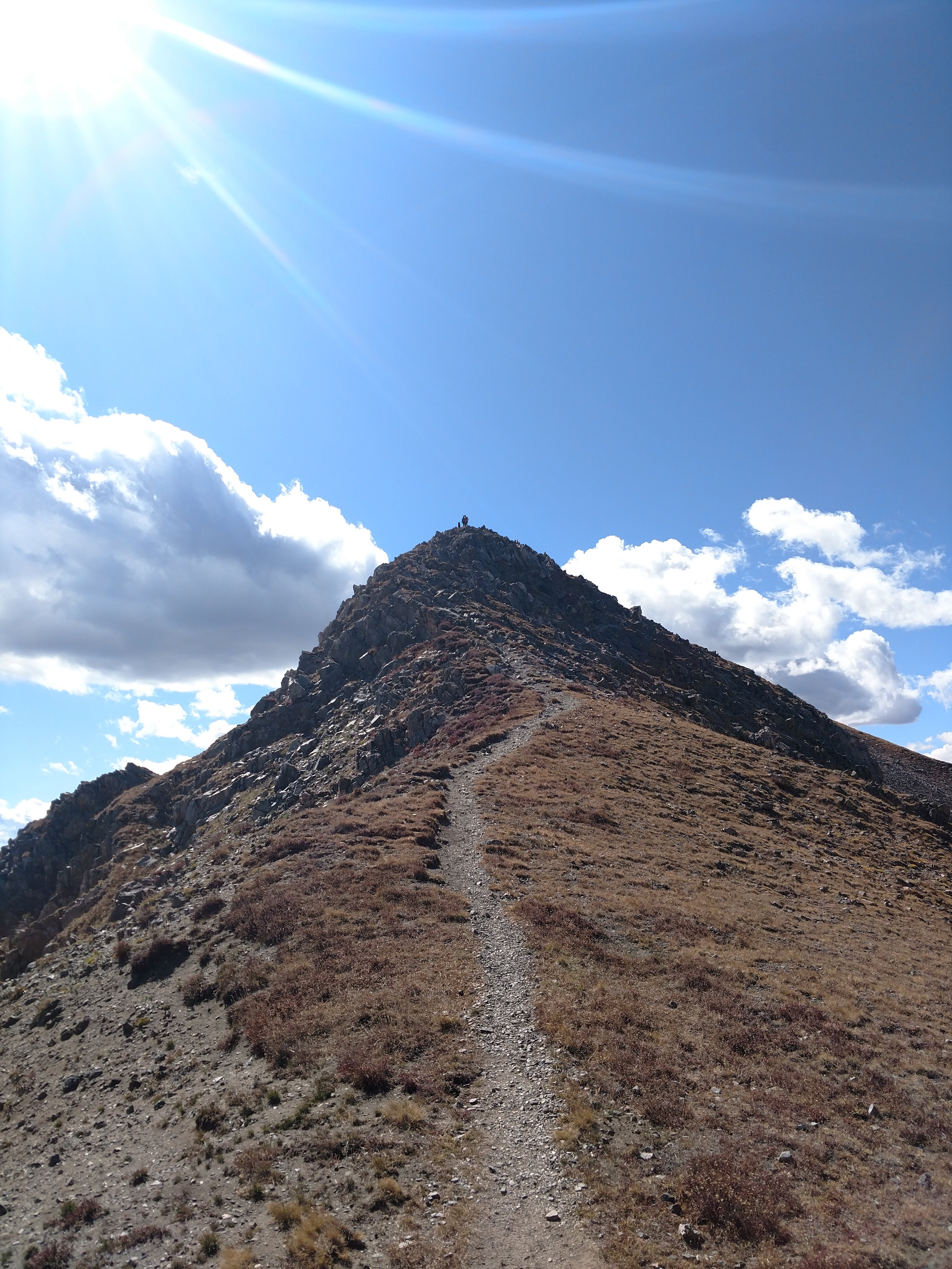
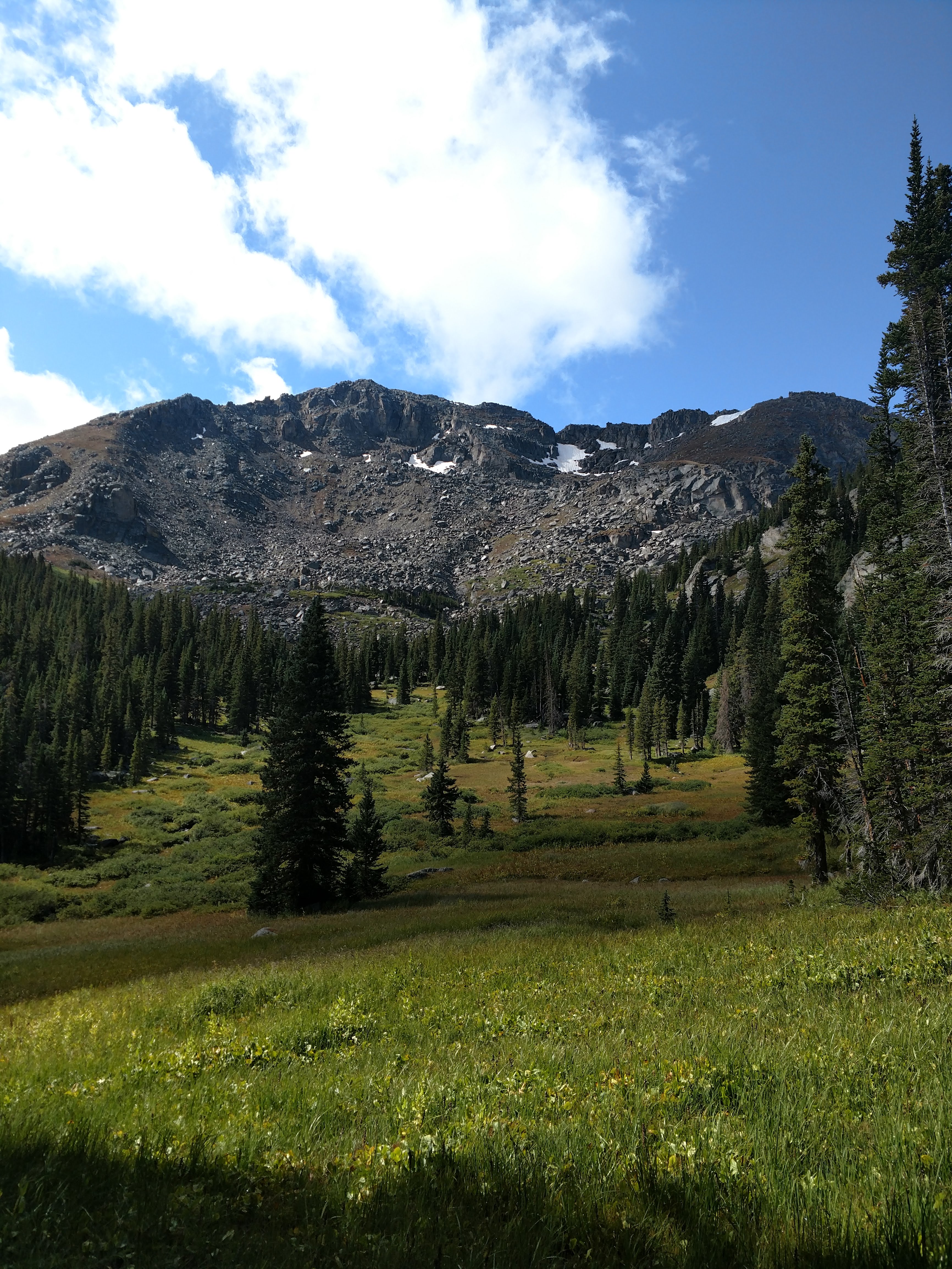
Bushwhacking a little more and suddenly the whole area opened up from forest to meadow, and the high mountains revealed themselves. The treeline was quite close here, and though I didn’t climb the ridges I’ve made a point of coming back to do some camping.
Back on (single)Track
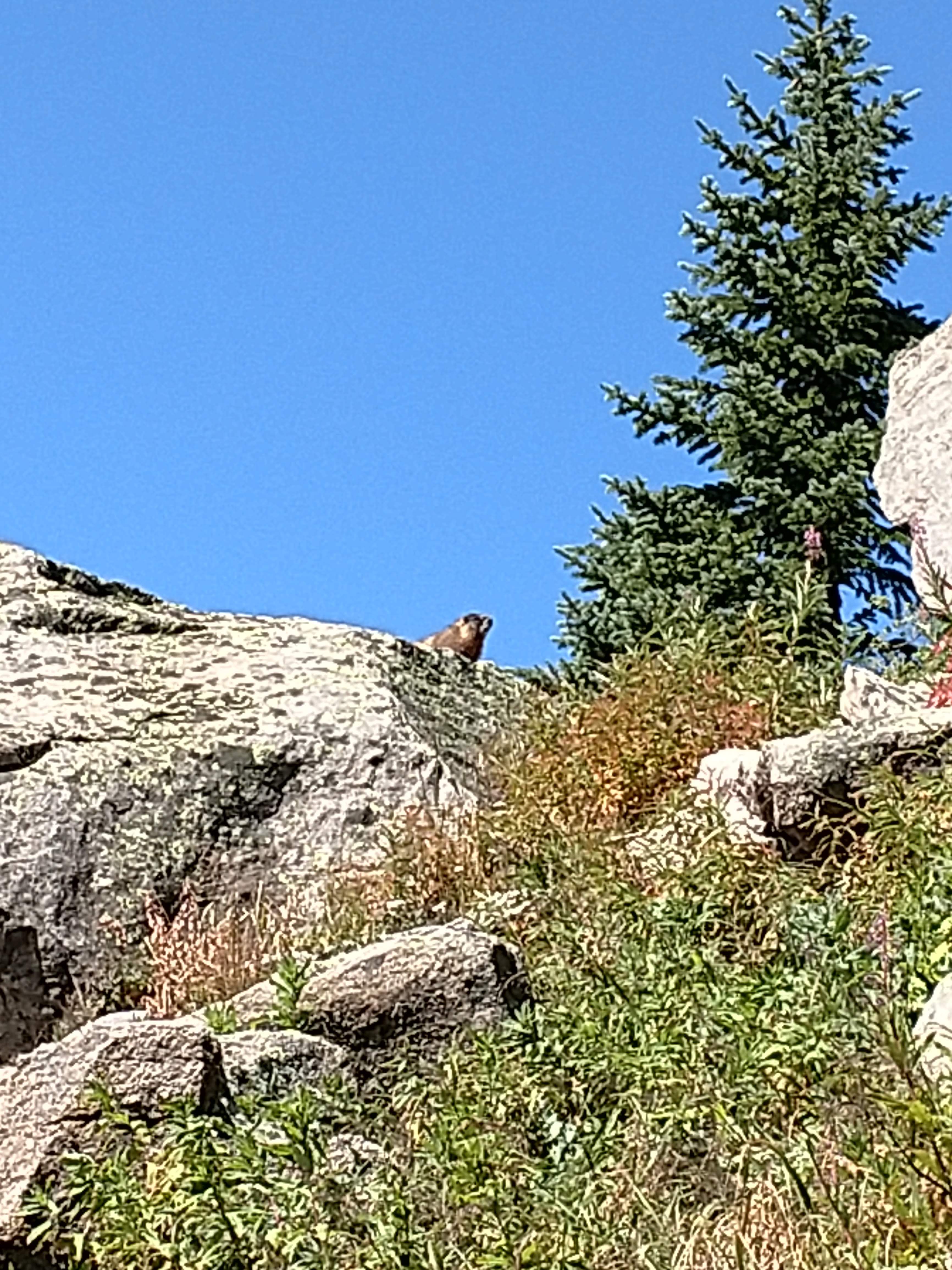
Interestingly, despite water being all around me, there was no lake yet to be found. I’d gone 2.02 miles by my GPS, but there was still a largeish hill with no trees on top of it to both my north and to my east. I headed east to find another higher clearing — and what appeared to be a ring of trees. Ascending the rocky ridge I realized that there were a plethora of wild currants around me, as did a plump marmot sunning himself on a large rock outcropping. Marmots are in season until October, but I was unarmed and I don’t need marmot gloves that badly.
Passing the guardian marmot the top of the rise had a bench of soupy marsh, the tufts of grass making it hard to cross. Progress was slower since I was solo on this trip, and didn’t want to sink to my hips in muck, but after realizing it was merely ankle deep I soldiered to the next tree line. Lo and behold, my destination of Windsor Lake in all it’s glory!
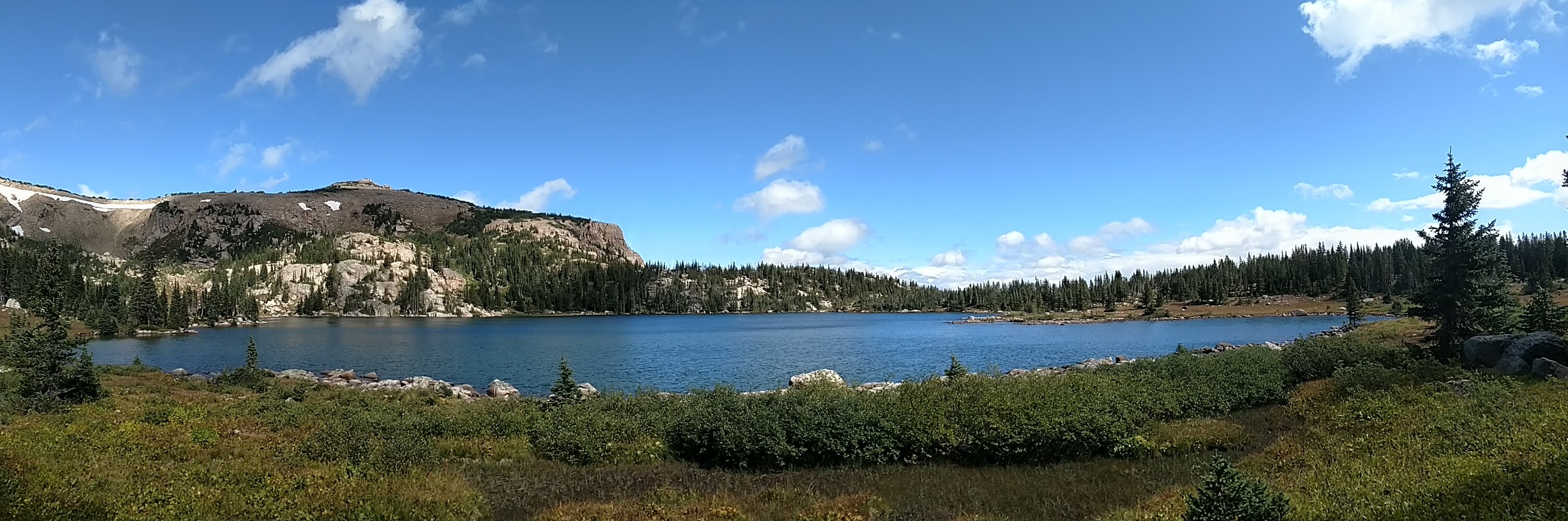
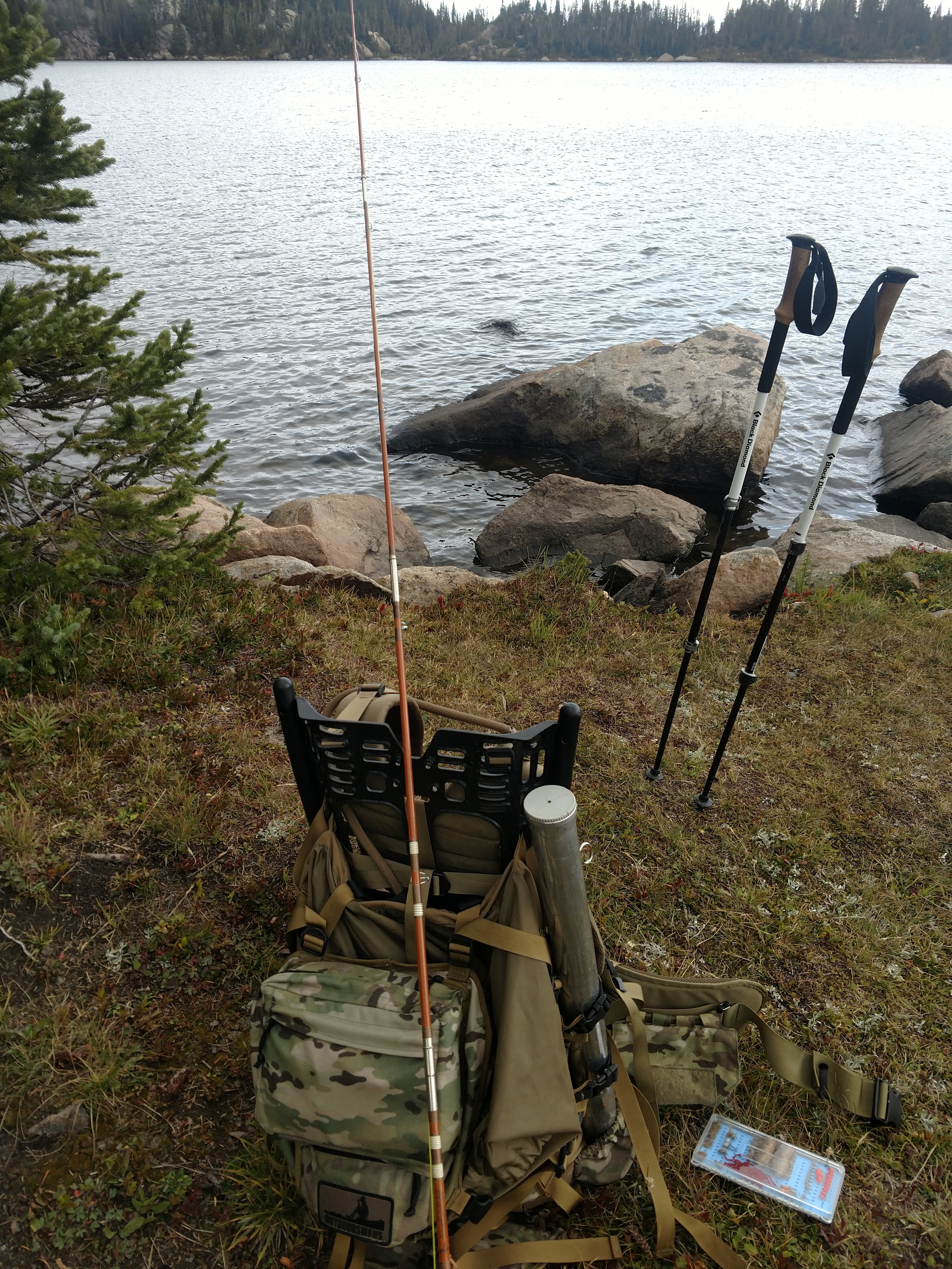
I sat lakeside and munched on some jerky before eyeing the crystal clear and ice cold water looking for potential cover. Like most lakes there’s a fair amount of silt around the edges. I was looking for cruising trout that I might be able to entice with an elk hair caddis or a panty dropper hopper. With all the grashoppers still around surely some would meet their demise to a hungry trout!
Whether Weather
No sooner than I began to make some casts to the water but the sky began to turn again. It’d spit rain at me off and on during the trip, so my merino base layers already had some moisture of sweat mixed with some cool fall rain. But now the clouds darkened and I worried about the rest of our party up on the mountain hunting ptarmigan. What was the weather like well above treeline?
I got a taste of it soon enough. The clouds darkened as if Poseidon himself was angered that I’d found this lake and was attempting to take trout from it. Then came the hail. Throwing on my raincoat as quick as I could I hunkered down in the small pines ringing the lake, but after 30 minutes passed it seemed like it was just going to sit on top of me. In the face of mother nature I flinched first. I was staying in a two man tent at basecamp, and only had the layers that I’d thrown in my truck. With another hunting day ahead of me I figured I didn’t want to try to dry out all of my stuff MacGuyver style.
I took one more look at my GPS and decided to swing around the trail-side of the lake to see where the original trail came in.
It was on the trail now several hours after I’d started my journey that I finally saw two other humans. I met a woman who’d asked if I had seen her surveyors tape. She and some locals had edited the trail so as to not make it so steep. I wonder what the Forest Service would think about that? We talked for a bit as the rain subsided somewhat but with the mixed weather and the seemingly dropping temperatures I decided to call it a day without any fish. Walking out past the previously unseen smaller and unnamed lake I saw smallish fish feeding at the surface. No matter, my trail rod was stowed at this point and I wanted a real meal back in town.
Stay the Course
I determined I wanted to take the un-edited trail back down to the trailhead as the rain storm continued to lash. It was nothing much, but based on the forecast, it was here to stay and I wasn’t looking to be cold and atop a mountain road as conditions deteriorated. I found the path just where my GPS said it should have been the whole time from the lake and set off.
No wonder the locals didn’t enjoy the path. Most of the elevation gain to the Windsor Lake was in the end of the trail, essentially a bulbous cliff face daring hikers to ascend it. My knee was still throbbing somewhat from the trek down Mount Belfort two days prior but I managed just fine as the rain began to subside.

The Road Home
Making my way downhill shuffling in my boots, realizing that perhaps the Vibrams on my Danners were about ready to give way again. I noticed as I passed by a hillside there appeared to be a small keyhole cave into the redish rock. Glancing over curiously, and by the light cast by the improving weather noticed the outline of a black bear. Plain as day, four legs, barrel chest, and ears at 45 degree angles from it’s head. I didn’t stick around to provoke it, or see whether it was even not an archery target a cheeky local schlepped up into the cave.
I wasn’t overly concerned, it was probably just as upset with the hailstorm as I was. The trail began leveling out and soon I was again at my truck. Somehow the dirt road I’d driven in on was hardly even muddy. Away I went, ready for a ptarmigan hunt the next day now that I knew my knee could handle a mountain again.
| Why am I doing this? I’m on a quest to hike, camp, hunt, or fish on all of Colorado’s federally designated Wilderness Areas. Check out all the articles here! |