An Outdoors Obsession
I’ll have to get it right out there, I’m obsessed. Ever since I learned that Colorado has a small population of White-Tailed Ptarmigan that are both huntable by CPW regulations and only located in the high mountains, I’ve been more than a little curious.
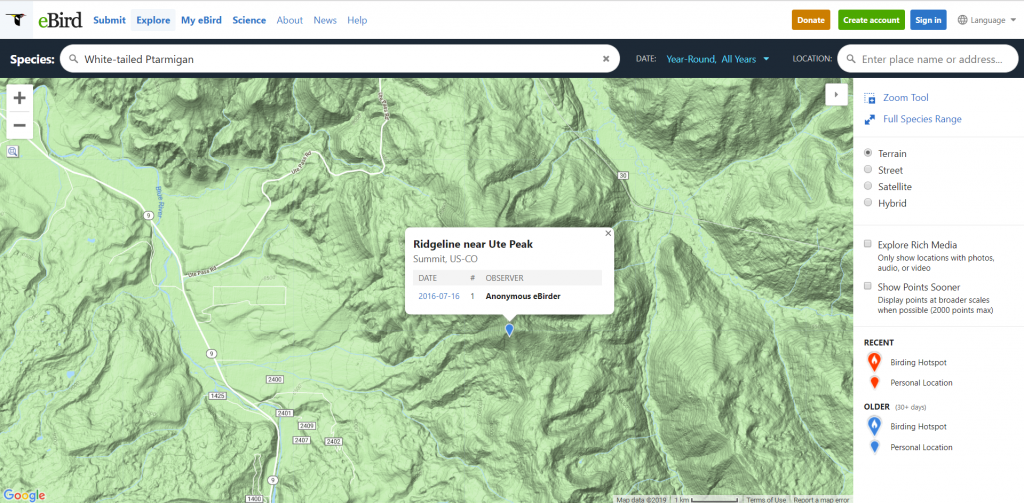
Whether it was the name itself while I was doing map study, or whether it was actual data from eBirds I’ve studied before I was intrigued by a nearby piece of Wilderness named Ptarmigan Peak. Rising just outside of Dillon, one of my favorite stopping points before going deeper into the state on CO-9 or I-70 Ptarmigan Peak offers the foil to the Gore Range on the opposite side of the valley.
Now, another confession. I went on this hike on blind faith that someone didn’t Greenland-Iceland me. You know, where Greenland is mostly ice and Iceland is mostly green to throw off visitors? With a peak in the area named Ptarmigan Peak, and the Wilderness area named the same, I figured there’d have to be Whitetailed Ptarmigan around. After my trek, having only seen droppings from a blue grouse and some other critter related signs I went on a self-confirmation quest and ended up at eBird. There, a lone birder from 2016 confirmed that yes, there were ptarmigan in the area, at least at some point in the past.
A Beautiful Ride
My Jeep labored up the hill towards the mountains. I’ve disconnected the battery, cleaned the air filter, and done all number of other odds and ends but the Wrangler just continues to huff and puff when we leave the elevation of Denver to venture higher.
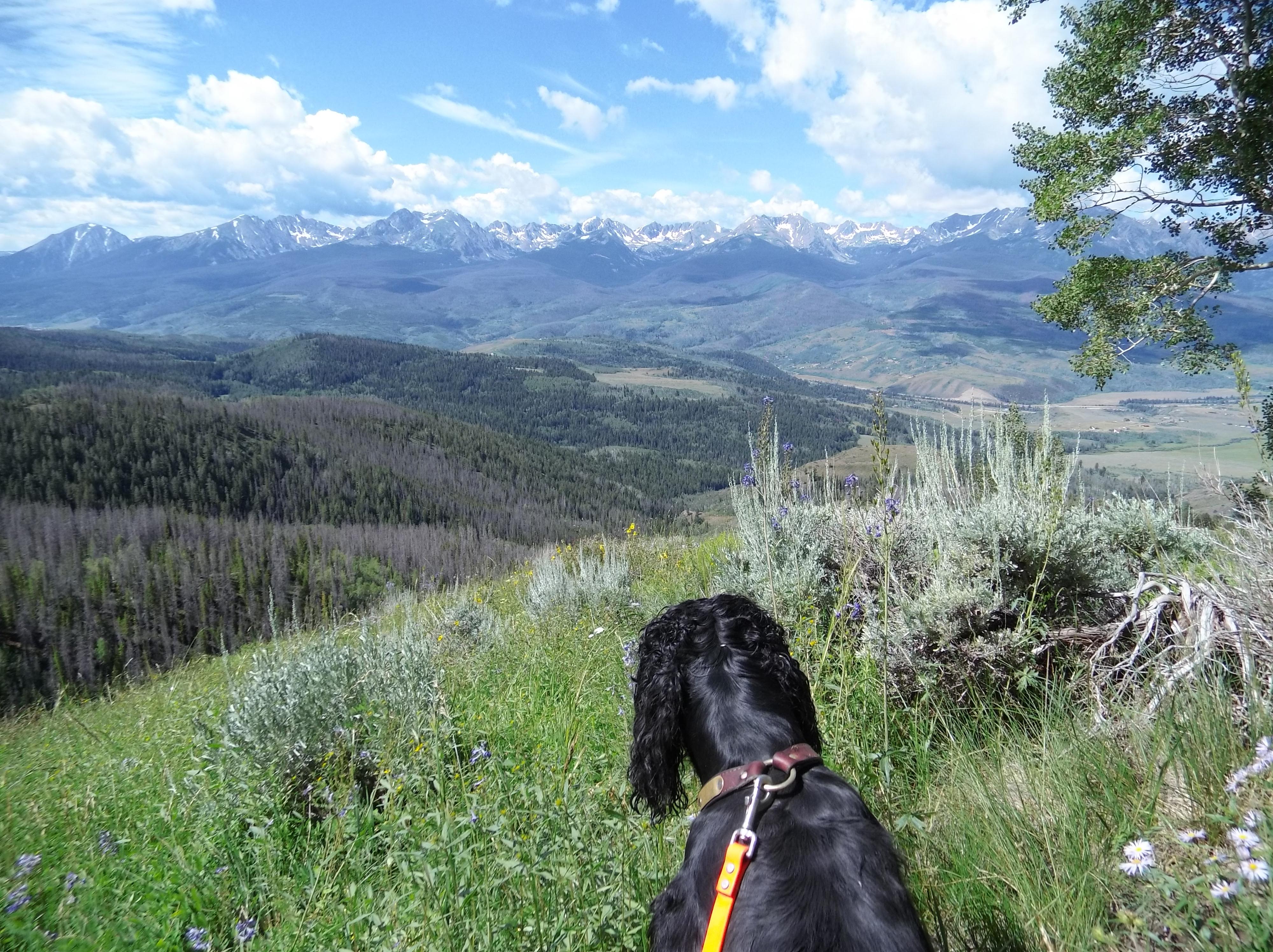
With the city falling behind me and the mountains laying in front of me, you can feel the stress of work and home just melting away. My Gordon Setter, Abbey, was riding shotgun, albeit she was giving me the stink eye after realizing the car ride would be more than the fifteen minutes from the house to the dog park. She’d not been allowed to get out much since the birth of our son. I’ve done my best to get out on neighborhood pack walks as I train for some of this fall’s hunting outings dotting my calendar, but I hadn’t made enough of an effort. Her copper eyebrows shifted as she looked at me and then back at the window, watching the terrain pass by.
It’s hard to tell what a dog is thinking, but this is her sixth season. Surely her large muzzle can tell that the air temperature has reached it’s hottest, and we’re entering a glide path towards warm sage, yellowing aspens, and with any luck grouse and quail on the wing.
Turning onto CO-9 from Dillon took us away from the vacation town in a heartbeat, though cabins along the road were ostentatious even if they were in traditional mountain log cabin style, there was still clearly ski-town money around.
Which Wilderness?
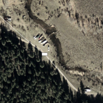
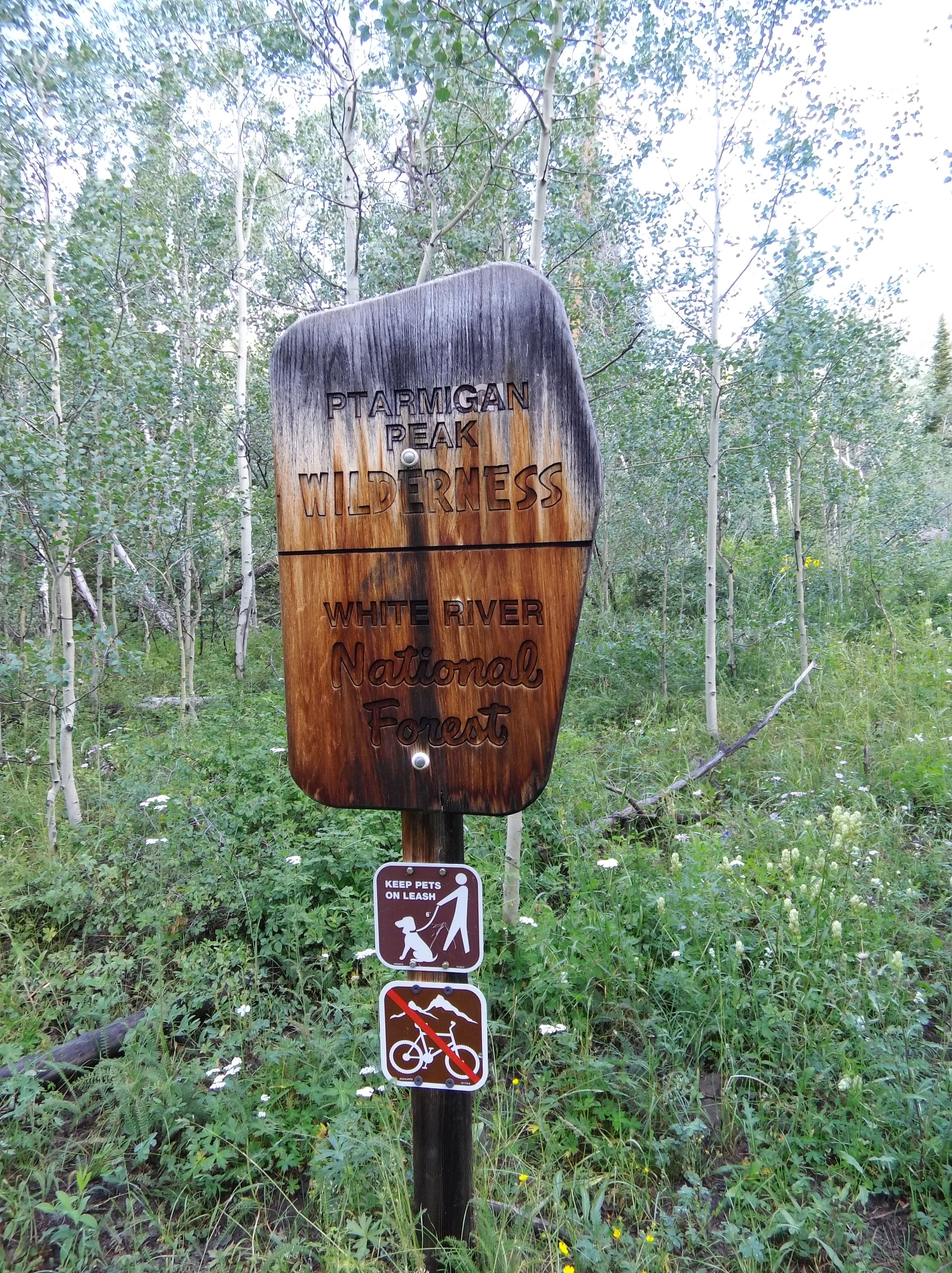
We pulled into the trailhead just off of Ute Pass Road, a narrow dirt road that appears seemingly out of nowhere 16 some odd miles along the Blue River outside of Dillon. There was only one other car in the parking lot which was seemingly in the middle of a private ranch-cum-subdivision as many luxury homes dotted the sage. Snow capped mountains rose on either side of me as I checked out the signage. In Wilderness areas dogs need to be on a leash per the signs, but per the actual regulations for the USDA Forest Service dogs may be kept under voice control.
Where the signage for bringing Abbey along didn’t deviate, something else was curious. A couple of the sign holders proclaimed I was in the Eagle’s Nest Wilderness as opposed to the Ptarmigan Peak Wilderness. I knew I was technically in neither given the geography. It would be two miles before I entered a Wilderness area, and Eagle’s Nest was across the entire valley at the foothills of the Gore range. I shrugged it off to perhaps a forgetful Forest Service summer intern and we loaded up our gear.
This Wilderness Area, Ptarmigan Peak, was designated by an act of Congress in 1993 cradled in the White River National forest who’s boundary is formed generally by the Western side of the Continental Divide. The 12,615 acres of the Wilderness area are sleepy compared to the developed ski areas of Arapaho Basin, Copper, and Breckenridge all very close by during the winter allowing for some solitude. The area is in many places truly wild, with few trails cutting through the riparian meadows of the South and Middle forks of the South Williams River and the parklands above on the way to the twelve and a half thousand foot peaks inside the Wilderness boundaries. Just the place for a boy and his dog to scout some birds and enjoy a conditioning hike.
Goal Oriented
Hunting season is quickly approaching, and the September 1 Upland and Dove opener will be here before you know it. My hikes are thinly veiled at best — they’re scouting trips where I tend to stay mostly to the trail in order to complete my objective, but I’m hardly staring at my feet. I use this as an excuse to mark down previously used camp sites, berry bushes, water sources, and a number of things. Yes, that means sometimes I bury my head in my GPS and review different points, and yes, that does mean that my GPS points can get awfully cluttered. But, I’m one of those gosh-darn technology obsessed millennials. I enjoy bringing some modest amount of technology to the woods, not to escape an otherwise peaceful existence but to enhance it.
Being armed with this information allows me to enjoy a more rich outdoor experience. Learning about things like wild mushrooms and why grouse eat a particular plant. It wasn’t until I recorded the Pika’s mountain alarm system “Meep meep!” that I realized it was a small rodent and not a bird that might be worth chasing up in the hard scrabble mountains.
Onward and Upward
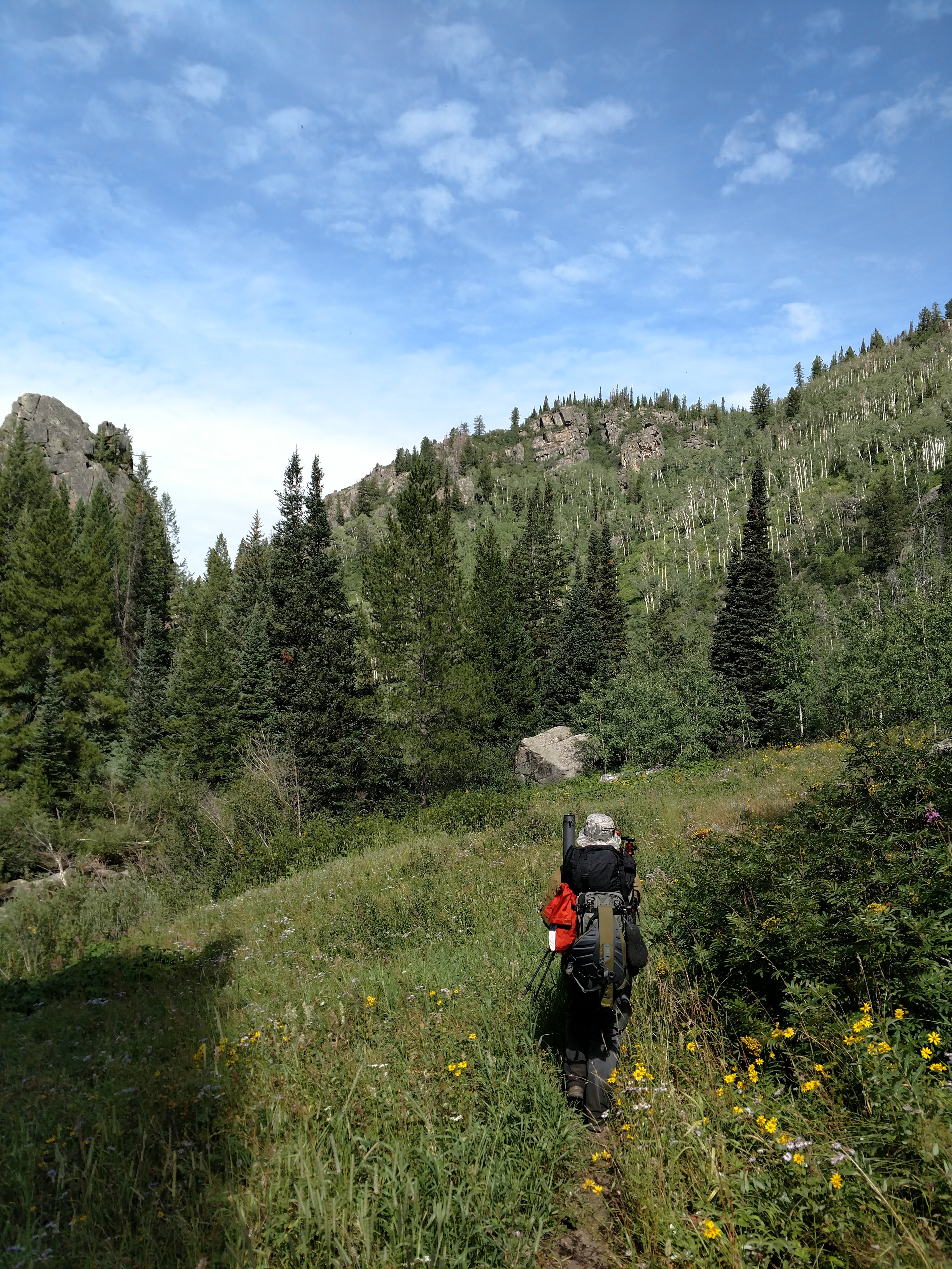
The hike itself started on the flat in a curiously suburban atmosphere amongst vacation homes and large ritzier homes you’d expect local doctors and lawyers to own. The dirt road on the way in changed from Ute Pass road to Rodeo, and Google even announced the transition with a California-esque “Ro-day-oh Drive” enunciation. Well then, pinkies out and backpacks on!
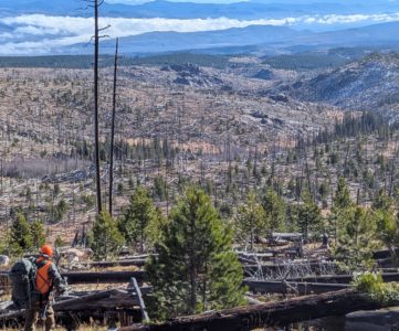
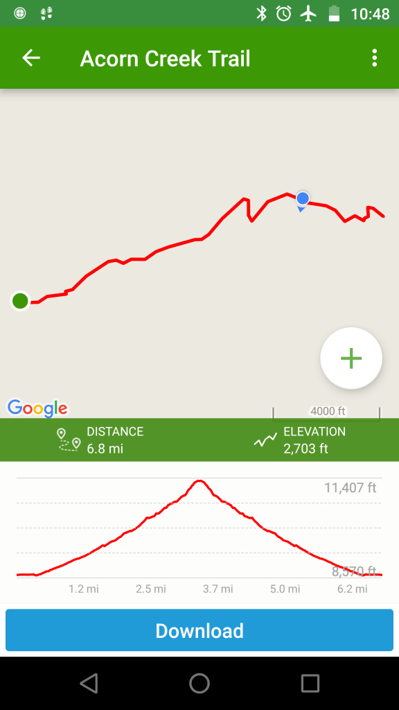
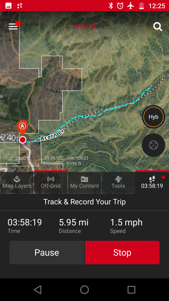
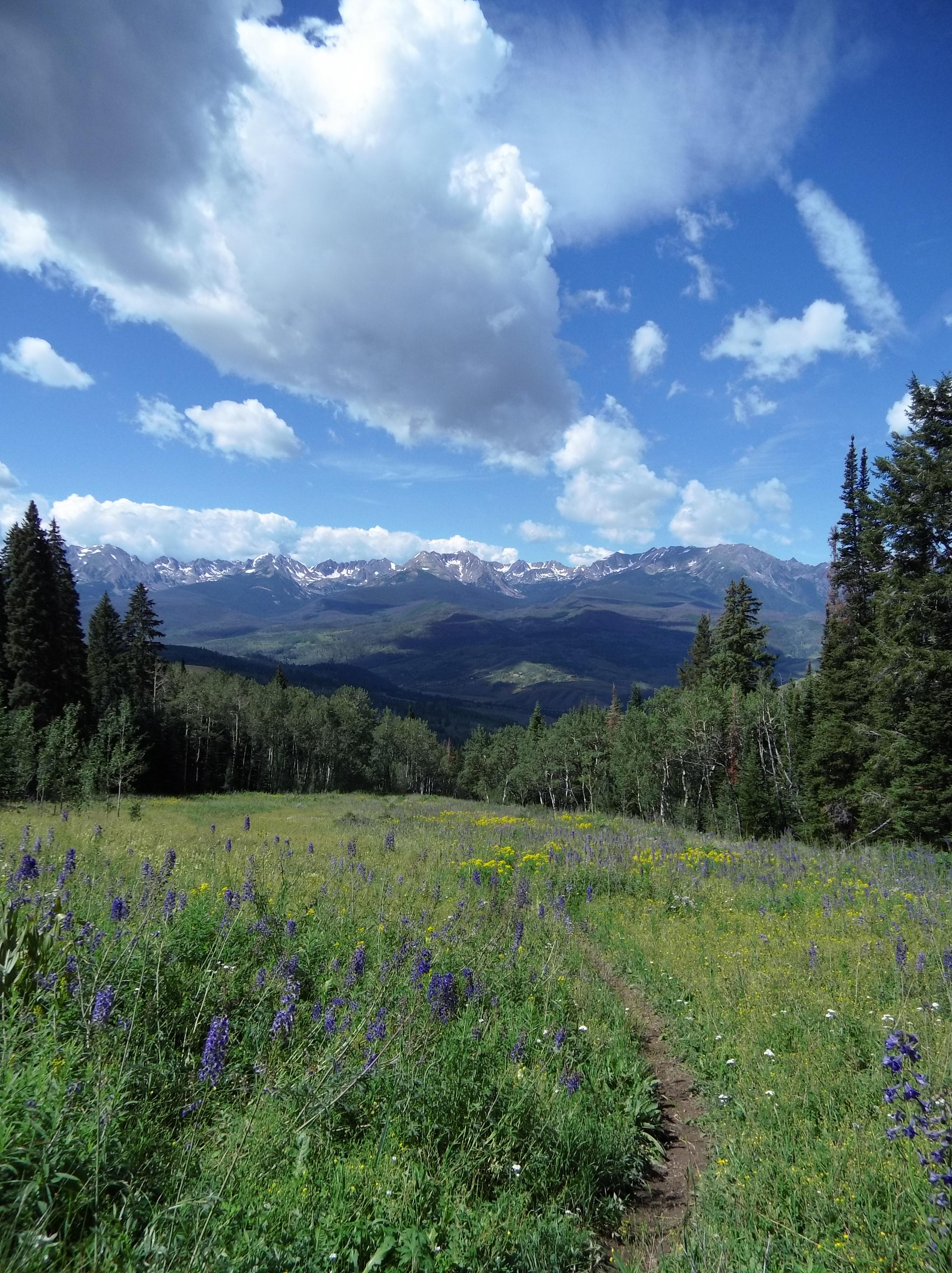
If I hadn’t mentioned before, we were ascending the Acorn Creek trail, which starts off fairly exposed in the sagebrush sea of the lowlands and snakes it’s way upward. I’ve included the elevation curve below, but suffice it to say it was nearly a 3000ft round trip change in elevation over not-quite 7 miles total. This hike is no slouch, much like the first hike of the season I tricked myself into thinking would be easy.
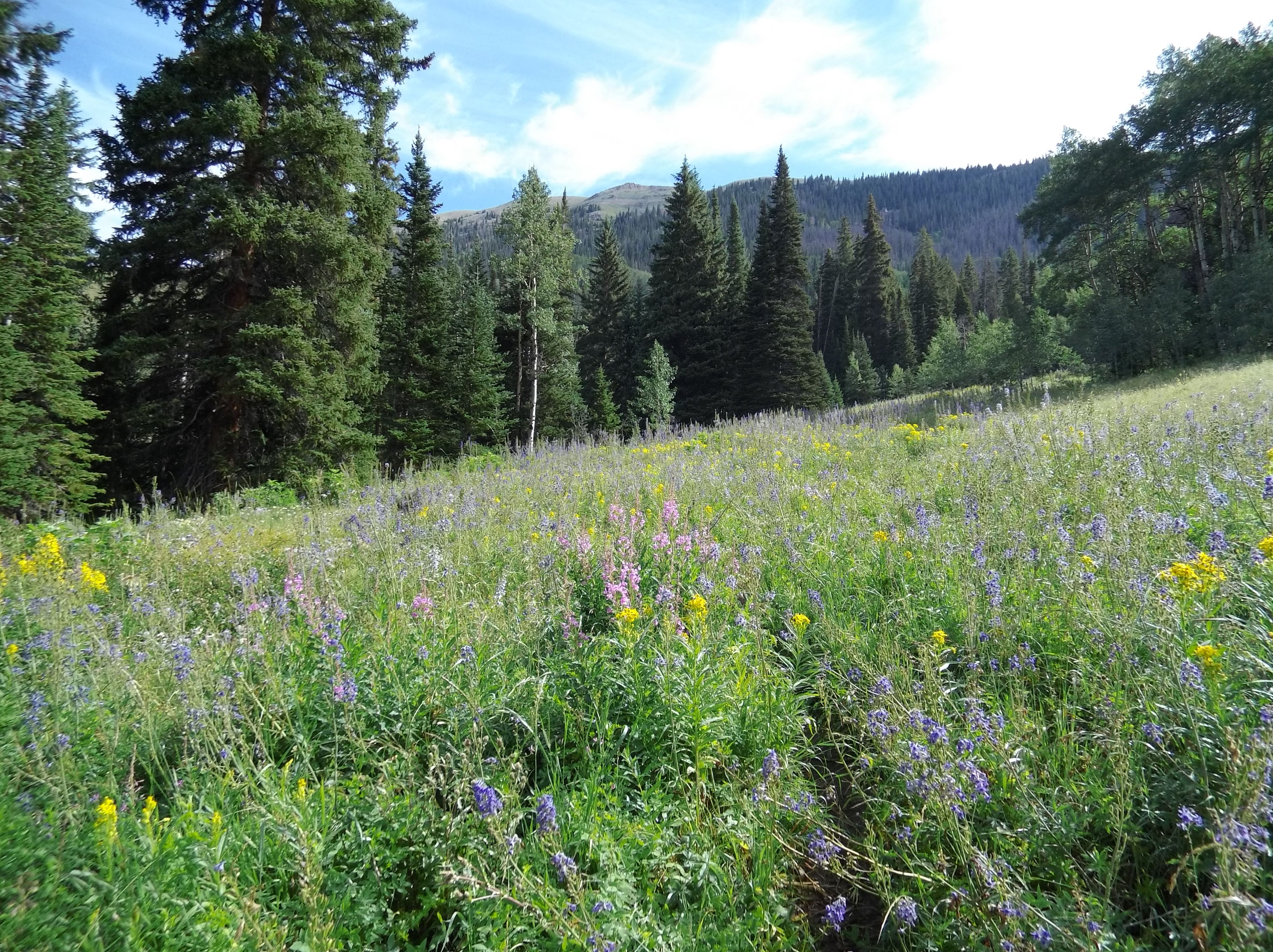
Despite the weather being largely temperate, the sun was beating down on us, exposed on the single track for some time before beginning to plunge into islands of aspens. After what seemed like a while we descended into a creek valley where we crossed the creek and the trail became overgrown with tubers that sop up the water at the creek edge. Beyond the single track snaked into meadows filled with sage bushes warming in the morning sun — thankfully no cold blooded rattlers warming with them.
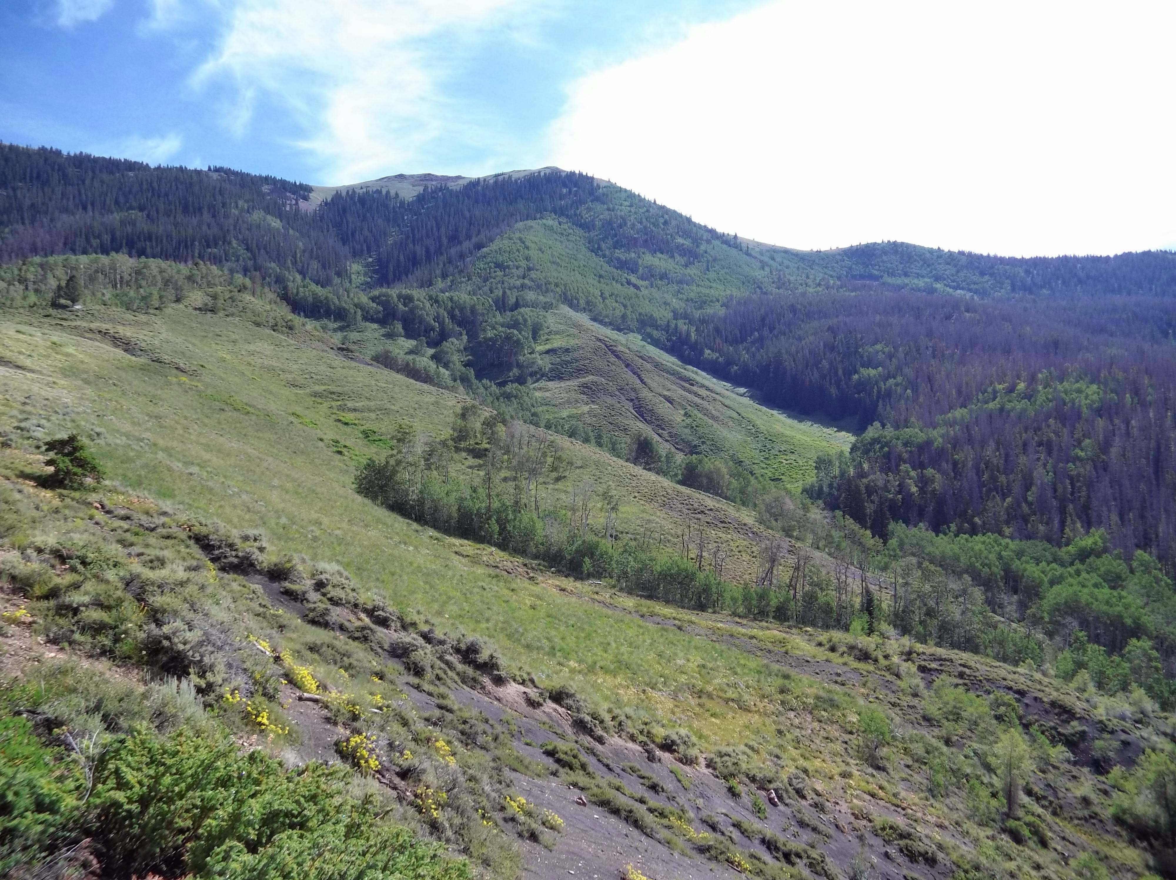
Soon enough the aspens mixed with pines as we trudged, clearly gaining elevation with every step along the gently rolling hills. However, I was already feeling the burning in the back of my thighs, I’d summited Mt. Evans with my office just a few days prior and the soreness still lingered.
Our suffering was soon rewarded by plunging into a dense pine forest where the line to the Wilderness lay. The rounded off Forest Service trapezoid greeted us to the Ptarmigan Peak Wilderness. From here on out there would be no more amenities other than the trail we already existed on.
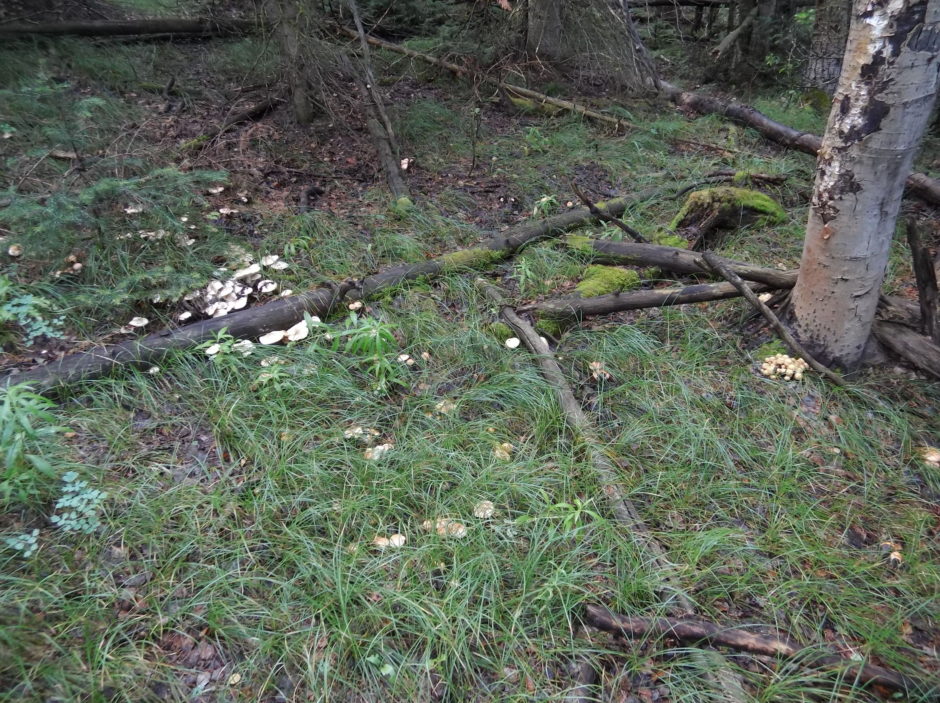
It had rained earlier in the week and the talk among the folks in my office was that the weather would be poor to summit a fourteener this weekend. I had the jump on the weekend though, having Friday off. As we turned the corner on the trail we saw the forest had begun to make the most of the moisture earlier on in the week as well. There were mushrooms abound of all shapes and sizes. They all survived some minor poking and prodding from me, as I don’t know enough about the western varietals and they weren’t morels so they stayed happy in their woodland home.
We meandered through more wildflower covered parklands as the elevation kept climbing. The hike mixed full exposure with full cover in dense forests for a nice mix throughout the day.
Finally though the terrain got steeper as we moved out of the pines to the side of a mountain. We took an early lunch and admired the Gore Range from beneath a pine tree where others had camped and perhaps glassed elk seasons ago. In another week I’ll be heading to the Gore Range in order to scout for mule deer and elk, so in the half hour we rested and hydrated my mind wandered not to the immediacy of scaling the mountain but to the future and whether I’d fill my freezer this season.
Progress after our lunch was slow. Abbey and I were slaked from our fuel-up of water and food but it was clear both she and I were feeling it. However, the top was within sight, and it just didn’t look that far! Legs and lungs were burning though, and time was running out. I wanted to make sure that I gave my wife some respite from watching the little one. She’d already gracefully allowed me to do some hiking in order to condition for hunting season and enjoy some relaxation from long work days going immediately into cooking for the family and playing dad.
Know Your Limits
We made a mistake. In continuing on up the mountain we were running low on water, for both me and Abbey this meant summiting and likely running out of water in the midday heat. My legs were burning at this point, still tired from earlier in the week and the mountain scoffed us, rising as an imposing obelisk.
I looked to my GPS and again ran a direct line to the summit of Ute Peak, .5 miles in the end, but after my last hike at James Peak, where 453 yards gained several hundred feet of elevation I knew even OnX could be somewhat deceiving. Without an elevation curve it was hard to tell, but having eyes on, I knew today it was insurmountable.
Turning around was surprisingly rewarding. While my knees felt it, and Abbey wanted to go off trail several times to find a “quicker” route down the mountain we had the unbelievable views of the mountains in the distance all of the way down.
It’s the Journey, not the Destination
While we turned around without summitting it didn’t make much difference to me. We hiked, we saw new Colorado flora, we encountered a new huckleberry patch that’s now marked for later, and I got Abbey out of the house where she’d been frazzled with a baby interrupting her life as a spoiled dog.
Getting There
From Denver hop on I-70 West towards the mountains and don’t stop until you’re careening downhill towards the Dillon/Silverthorne exit. Hop on CO 9 North for 16 miles until you reach a right hand turn on Ute Park Rd. Ute Park becomes Rodeo Dr as you bear left and follow the road around. It pops out into what looks like developed ranch land dotted with houses. The trailhead has two entrances in sort of a loop off to the left. Park and enjoy the Acorn Creek Trail which feeds the Ute Pass and Ptarmigan Creek trails on top of the mountain, if you get there.