While I might be APTOutdoors, it’s nice to have signal when we’re out at camp. So I’ve been investigating solutions to get rural internet and cell service to our camp in the mountains. Being in a metal building it’s a little like being in a faraday cage, so I’ve been looking at signal boosters.
WeBoost / Wilson Amplifiers is pretty much the gold standard you see on just about very #vanlife rig on the road. They offer solutions from mobile antennas to keep fleets in contact to bigger enterprise scale equipment for large industrial applications. Since we have a metal building and we’re tucked in the head of a valley we’re somewhere in the middle for what we need.
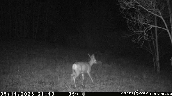
You can’t boost signal if you don’t have signal. My Spypoint cellular trail cameras are able to send out pictures of skunks, neighbor dogs, and mule deer — so they get at least enough signal for MMS.
However, even if my cellular trail cams can get out, my Verizon phone has difficulty sending and receiving messages. My inReach has great access, but I want something that is a little more instantaneous and allows for more dynamic communications. So boosting cell signal is a must.
Finding and Boosting Cell Signal
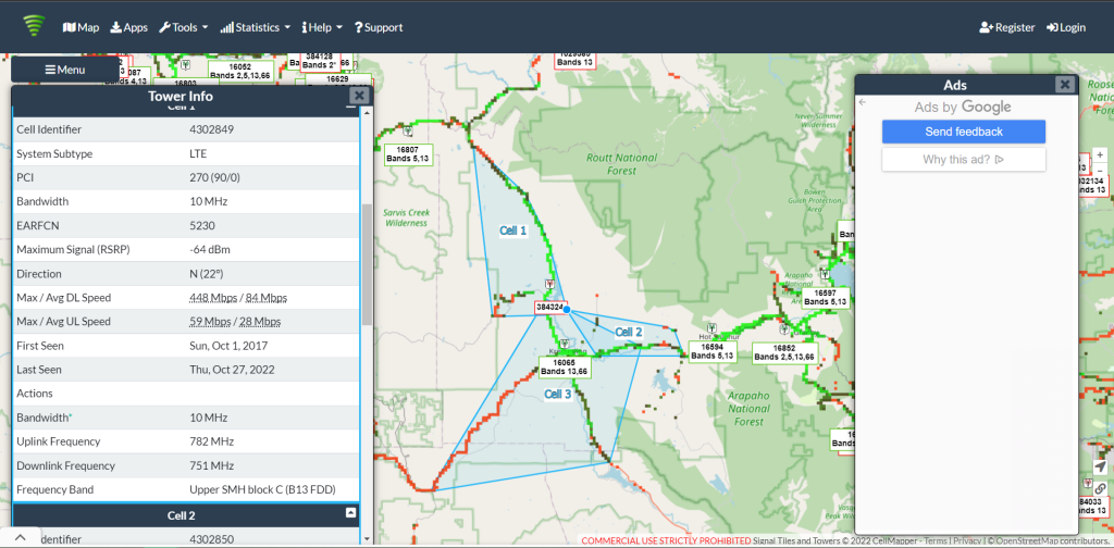
First, while I knew that I had signal, I wasn’t exactly sure where it was coming from. CellMapper to the rescue! CellMapper is a community driven site that takes data from cellular tower leases and plots it on the map. I was able to determine that there were two nearby towers. Okay, I’m in the head of a valley with no line of site. How is this going to work? I know what direction I need to face for both the near and far antenna masts down valley from us. Additionally a neighbor on the other side of the highway also has a large tower. I’ve yet to put binoculars on it to see what he has mounted, but my bet is either a television antenna or something for cell signal.
Can’t see none, Won’t be none
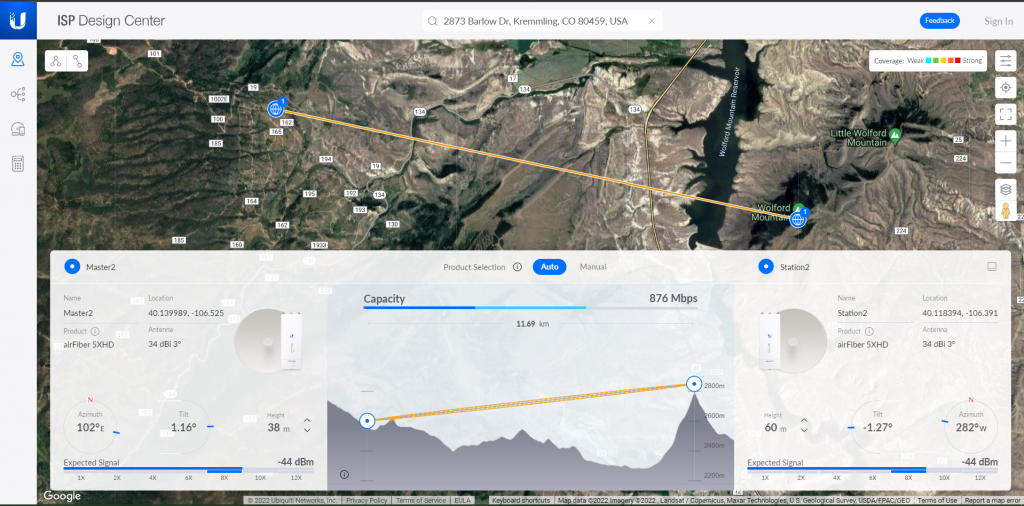
Ubiquiti happens to have a link quality and hardware configurator my friends had mentioned when I was originally talking about boosting my cell signal. Some of my friends are deeper into the RF world than I could ever hope to be, but I was familiar with the Ubiquiti brand. So off I went. This tool allows me to take two points on the map, it loads DEM (digital elevation mapping) and then you give it variables like the tower height. CellMapper can provide you with the tower height on the cellular tower, so one variable is taken care of.
From there the website is able to tell you how tall your tower would need to be to get line of sight link. The configurator gives you azimuth and tilt of your antenna in order to get maximum link between the two points you select on the map. Unfortunately at an ideal tower height on my end of 38 meters, it’s infeasible to get line of sight. You need a permit in our county for anything over 35 feet tall, and the likelihood of me installing a tower 98.5 feet in the air seems unlikely.
Back to the drawing board? Well, not quite. Maybe I look to pivot for a moment and see if there’s really no signal available, or if Verizon service is just terrible.
Internet for the Quonset
Outside of boosting signal I wanted to get Internet via 4G LTE. Rural internet is tricky. Some locations providers don’t officially support their mobile internet plans because they can’t guarantee the level of service their contract states you’ll get. But honestly where I am I can barely guarantee a webpage to load. So we need something. Why would I be looking to get rural internet if I’m looking to boost mostly my phone’s cell phone service?
Simple, I’m a bit of a geek. I want some cameras at the place so I know when the snow is melting. This year I had up to four feet of snow in my driveway, and even into April I still couldn’t get in. I’m also interested in a weather station or data logger. I read numerous studies conducted in the area that it gets down to -40F, so I’m interested in knowing when that happens. Future plans include a small apple orchard, so monitoring how often temperatures dip that low would be key.
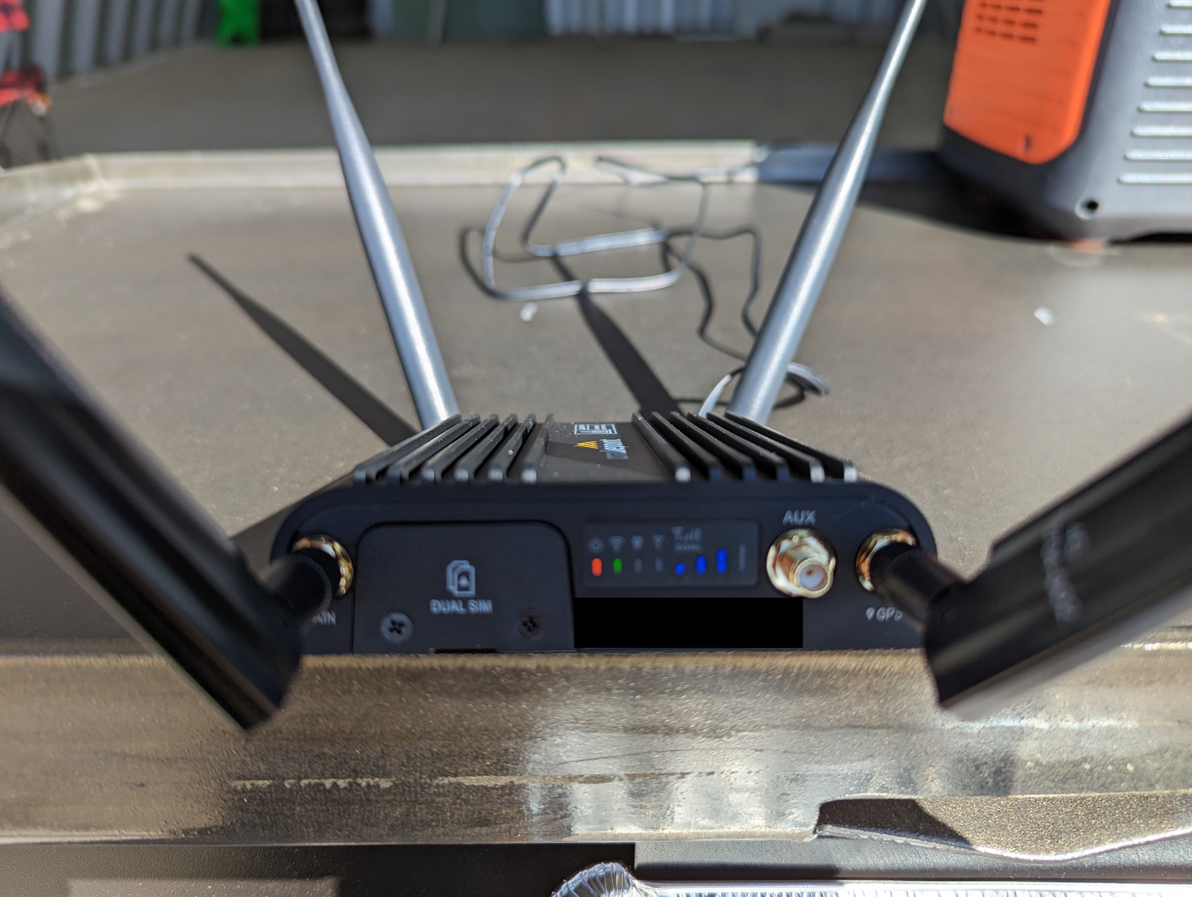
So I chose a carrier with two SIM card options, that rides both of the major networks, Verizon and ATT/T-Mobile. From there, I bought a dual SIM LTE router.
Terms of Service and Novellas of Support
Okay, I’m not mentioning what carrier I chose in this post. Mostly because they don’t technically allow you to use a router using their cheap unlimited data dual SIM plans. They will allow hotspot access for $5 more a month allegedly. However, I’ve yet to find that option on my web portal.
Anyhow. I bought a Cradlepoint dual SIM router for $45 on eBay. Unused, unopened fresh kit. Awww yeah. Further, I got the hardware because it was rugged, had a wide range of operating temperatures, and was recommended by someone on an Off-Grid Hackers group I enjoy. What’s the bad news?
Cradlepoint has gone to a platform as a service, or PaaS model. Your router barely has any functionality at all without paying for a license. Thankfully their IoT tier is $50 a year, but it was a bit of a pain to realize I couldn’t use most of the features on my router without it. Hidden cost.
Fast forward reading through 100+ pages of contracts and documentation and I took the router up to camp and lo and behold! I have service, but to see on which carrier I’d have to either go to the web console with a computer or swap SIMs out and independently power it up. But for now, it’s enough of a proof of concept. I can get signal at camp, activate the SIMs, and get Wi-Fi calling on my phone. Not bad.