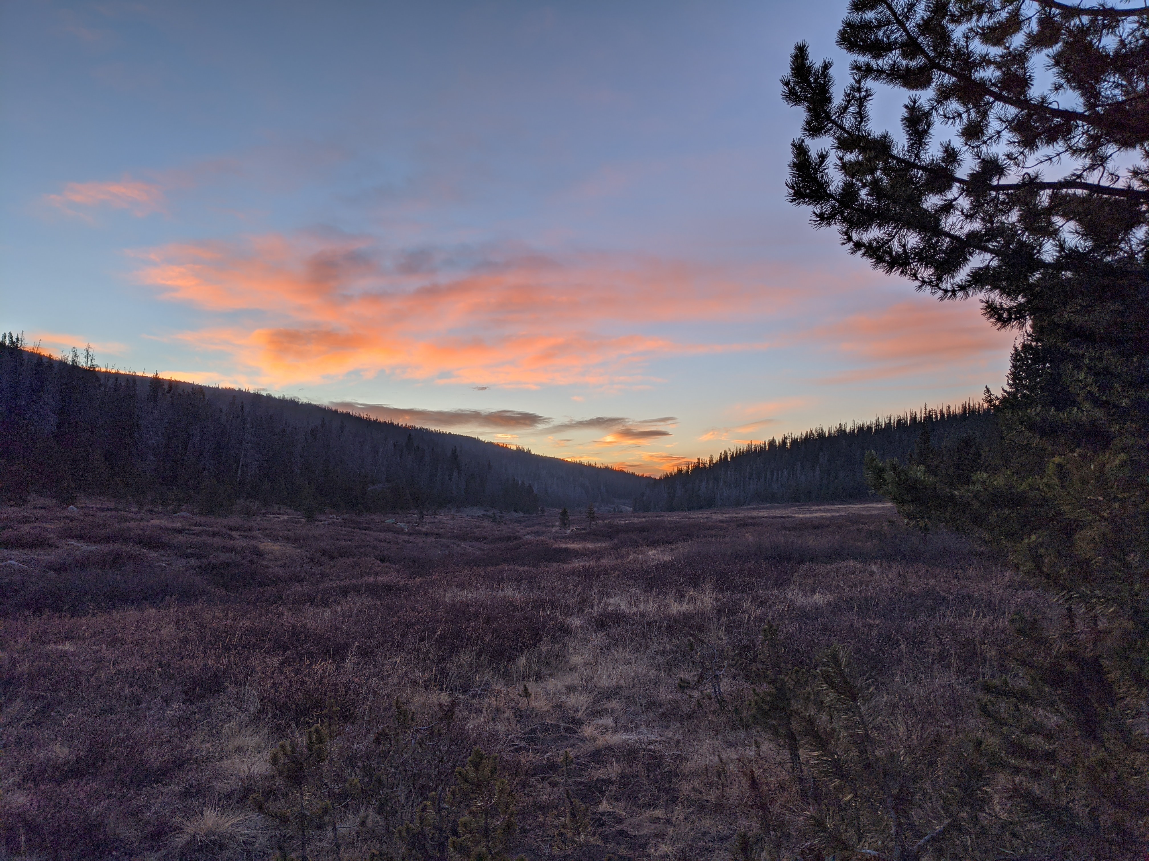
This year has already been rough on Colorado. First the Coronavirus pandemic shutting everything down, and now a the summer wildfire season. The Colorado wildfire season is always something to keep in mind, but this season seems to be especially brutal. With more time off than usual Coloradans took to the mountains in record numbers to recreate, with hunting and fishing license sales up across the nation. As of this writing, the over the counter elk archery season is already underway. Unfortunately, so are five large scale forest fires that have burned over 200 acres in the state.
With a state that is more than 40% of it’s land mass public land, it should be easy for elk hunters to just, go somewhere else right? It’s not so simple when you’ve scouted areas or when you’re coming from out of state. Road and National Forest closures can be unpredictable and enforced with unpredictable vigor. Smoke plumes change daily, restricting visibility in some areas but not others.
Resources and Research
If you don’t live in the immediate area of where you’ll be hunting it’s hard to put together all of the research required to make sure you can still go. Below are some resources to help you in your planning of your hunt, or your backup plan in case you need to change units for some over the counter options.
Fire
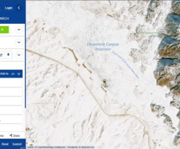
For up to date incident reporting on fires nearby check out InciWeb‘s Incident Information Center. It provides incident overviews, fire perimeter maps and approximations, and provides information on potential forest closures. Fireweatheravalanche.org has slightly more robust information sourcing the same InciWeb database but also includes other weather hazards as well as predicts fire growth potential based on prevailing conditions.
Fire Bans and Restrictions
At the time of this writing Colorado is under a Statewide Fire Ban until October 9th mandated by Governor Polis. However, during normal times you can look up the fire restrictions for counties as well as federal lands by going to the Colorado Emergency Management website.
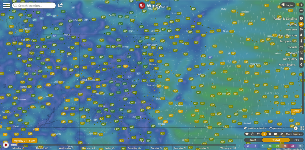
Wind
For localized prevailing wind conditions for regular hunt scouting I like to use Windy, a website (and app!) that uses local weather stations to source a global wind direction map. This will help you get an idea as to how air quality from local fires might affect your visibility in the field.
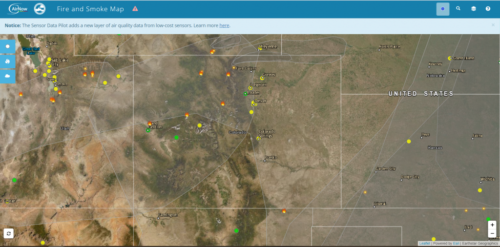
Smoke Plumes
Smoke will directly impact your visibility for long distance glassing, and will likely cause a low haze or fog for your morning hunts. Not only that but greatly reduced air quality and strenuous activity such as hiking with a full pack at elevation rarely mix well. AirNow.gov has a great map that shows the fires as well as smoke plumes detected via satellite as well as ground sensors. It uses NASA data that’s not super easy to interpret to get their shapefiles. Using this map will help you understand the broader impact of the Colorado wildfire season as well as greater impact from the other wildfires in the West.
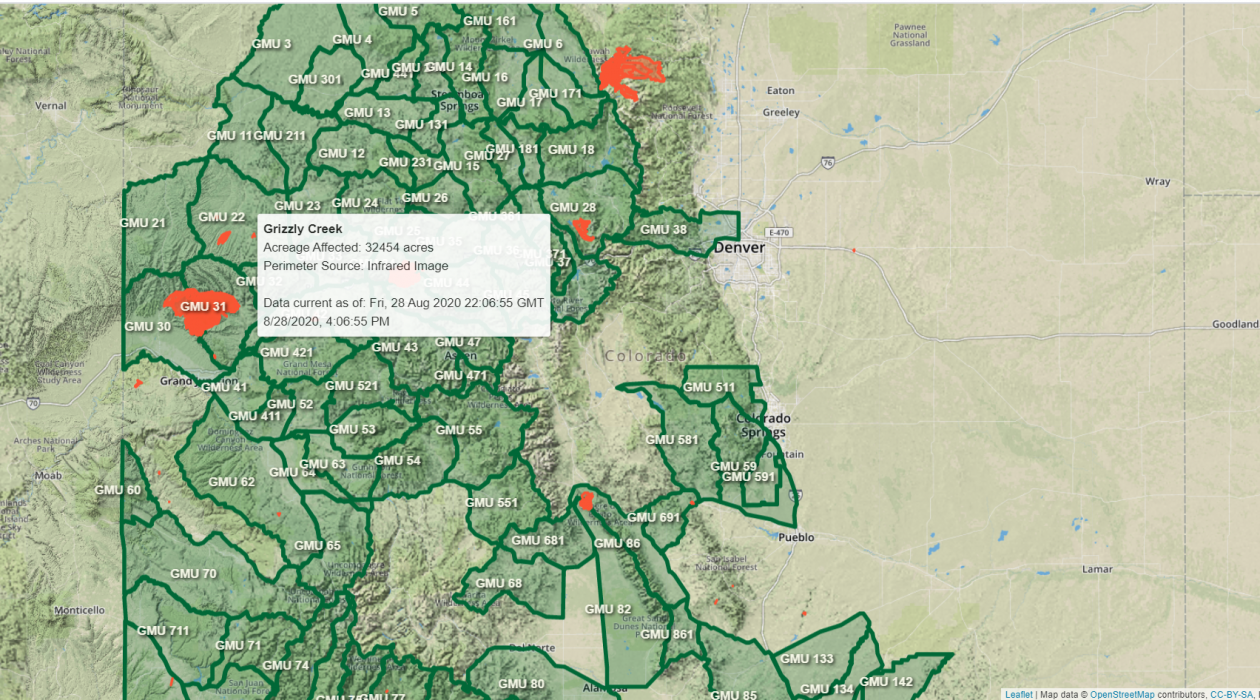
Our Maps
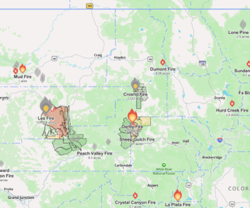
To help plan or pivot your adventure we put together a map that brings in live data from the National Incident Feature Service to include daily updates of wildfire perimeters. It’s hard to judge whether a fire will affect your planned hunt, so we also provided Colorado Elk Archery and Rifle over the counter (OTC) GMUs as a selectable layer. Change the layers and edit capacities to see if your scouted locations have been burned, or if it’s time to develop an alternative plan for the season.
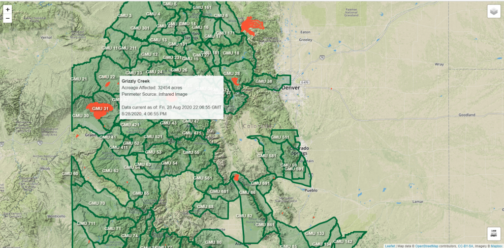
As of right now the map includes fire perimeters as well as some basic incident information. Archery and Rifle Elk GMUs are selectable overlay layers so you can see if your unit has been affected by the ongoing fires. This will also help you understand where in the unit you might have to go to avoid the fire.
Coming soon to the map: wind data, smoke plume data, and additional fire data.
If You Can’t Go
Colorado Parks and Wildlife understands that this is not a normal Colorado wildfire season and as such they’ve put together a number of refund options for hunters impacted by wildfires. You can see the full release here but here’s some highlights:
- You may qualify for reinstatement of preference points used towards your license. Hunters must have a license valid for one of the GMUs actually affected by the fires to qualify.
- If you have tags valid for other zones you should likely pivot plans to hunt in those zones. A refund is not your only option here.
- If the season has started the tags are no longer eligible for refund.
- The release includes specific tags pre-approved for refund. Those tags are directly impacted by the Colorado wildfire season this year.
- There is a $15 processing fee for refunds, qualifying licenses (fishing, small game, etc) are non-refundable.