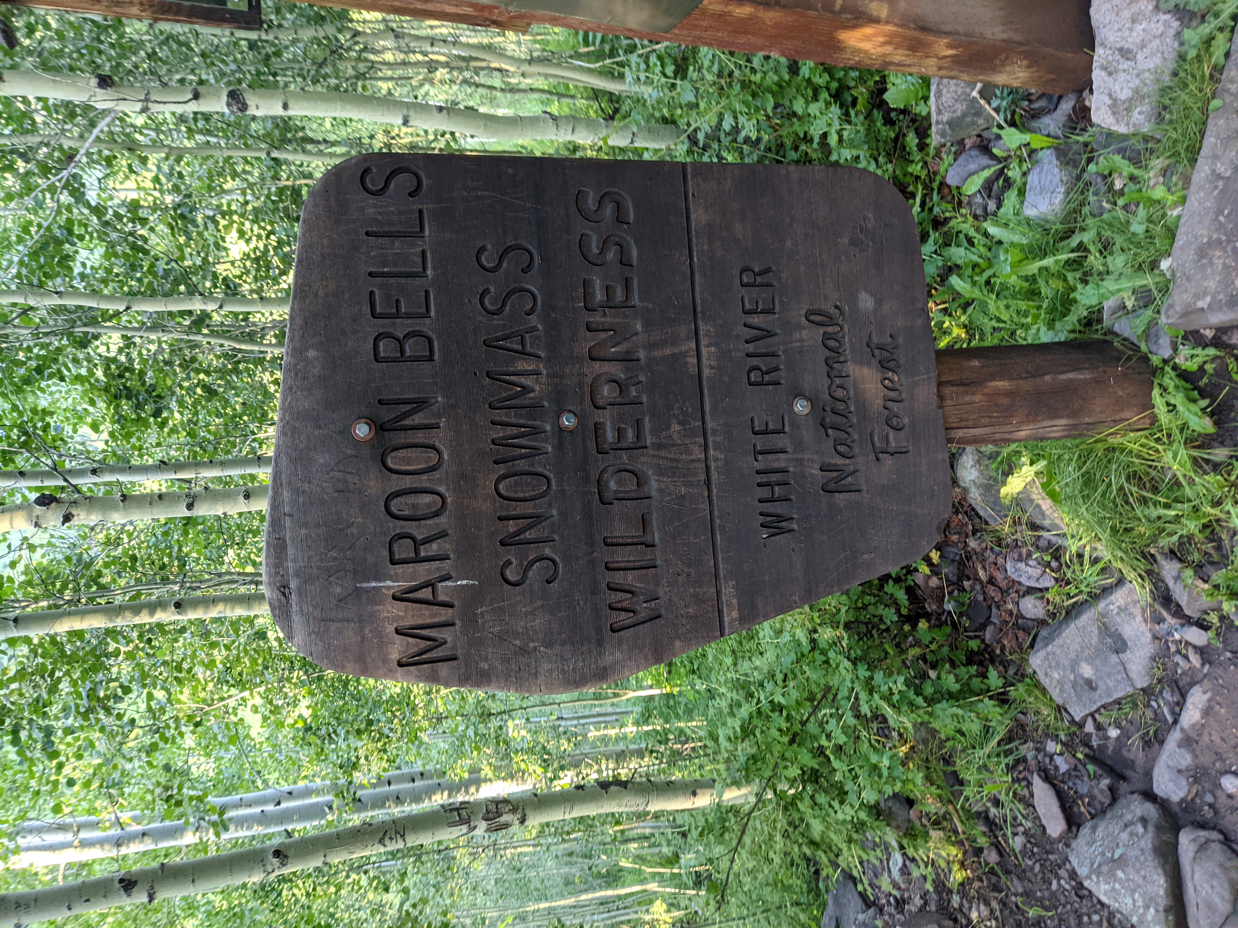
Research and Preparation
Despite being one of the most iconic locations in Colorado, getting there, and backpacking the Maroon Bells Wilderness seems to be one of the more poorly documented things I’ve ever researched. I don’t know whether it’s the free spirited nature of backpackers more experienced than I, or if it is really just that hard to nail down logistics of basing a hike out of Aspen. Actually hiking the Four Pass Loop should be the hardest part of the adventure, and it seems like it’s the least painful.

I intend on covering in agonizing detail the logistics in another post to be released shortly after this one. Below is my trip report on our Four Pass Loop hike, and my experience in the Maroon Bells Wilderness, my 14th wilderness to date!
Day 1
My alarm went off at one in the morning. I’d gone to bed at 9:30 Wednesday night after having a ridiculously full work week. Back to back twelve and a half hour days had already left me wiped out. So of course the next logical thing to do would be to drive four hours to the Maroon Bells Wilderness outside of Aspen with two of my friends and coworkers and backpack the 27 miles up and over four passes.
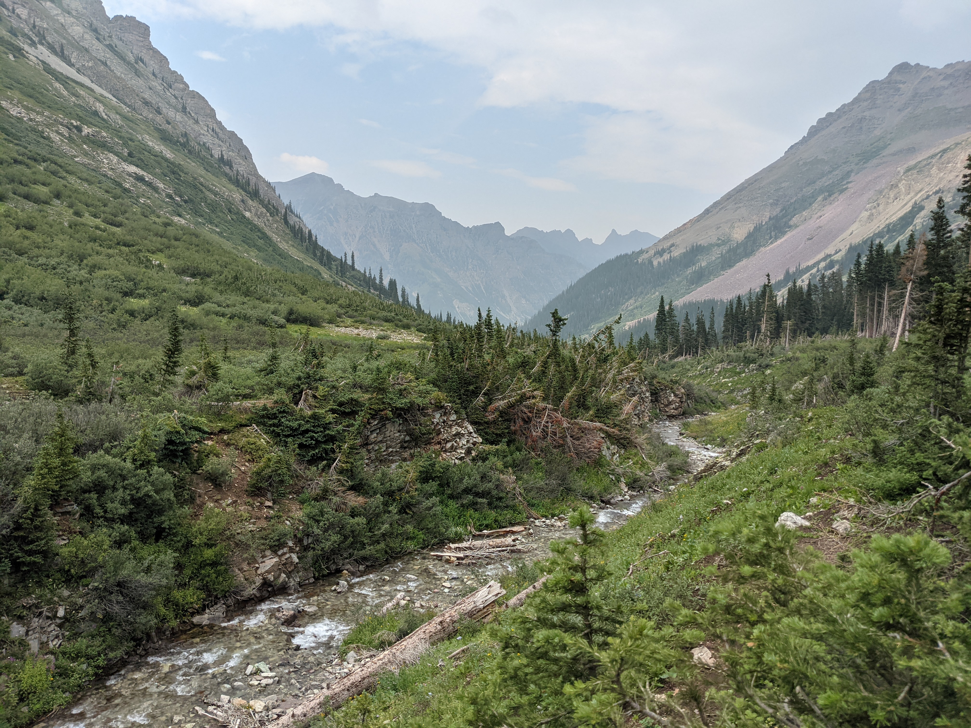
The Four Pass Loop consists of Buckskin, Trail Rider, Frigid Air, and West Maroon passes and is one of the most popular hikes in Colorado. The Maroon Bells themselves are the single most photographed object in Colorado. It stands to reason the rest of the surrounding area is equally gorgeous.
Like most of my other adventures this was not without it’s fair share of drama related to mother nature. Flash flooding and mudslides had off and on closed the exits to Glenwood Springs off I-70, despite weeks of perfect weather rain was now being threatened for the next eleven days, and people were anxious about it. I understand, but so long as rain forecasts are generally under 30% I usually carry on with my adventure. They were closer to 50% with the worst rain being forecast on our initial hike.
An Uneventful Drive
The drive was not particularly difficult, but I spent most of it on auto-pilot. I picked up my buddy Andrew where I asked him a couple questions about his gear, and off we went into the foothills. While the drive would be a little longer, we chose to do 285 and go up and over Independence Pass in between Buena Vista and Aspen.
That pass is like a wealth demarcation line, with mansions and sports cars on one side, and modest cabins and beat up utes on the other. As we tore up the pass I warned about the critters and my previous experiences seeing a Porsche almost plow into a moose. Not 10 minutes later, there was a bull elk attempting to cross the road, but my high beams and fog lights never caught it until it was in line with my head. A near miss, and enough to make me slow down my ascent up and over the pass.
We arrived at the overnight parking at Buttermilk ski resort around 6 in the morning Thursday. One of my friends was able to shuttle us to the trailhead. In case you’re military disabled, an access pass allows you to park at the overnight trail parking. Good to know. So a quick car ride up Maroon Creek road and we were on our way.
Stepping Off
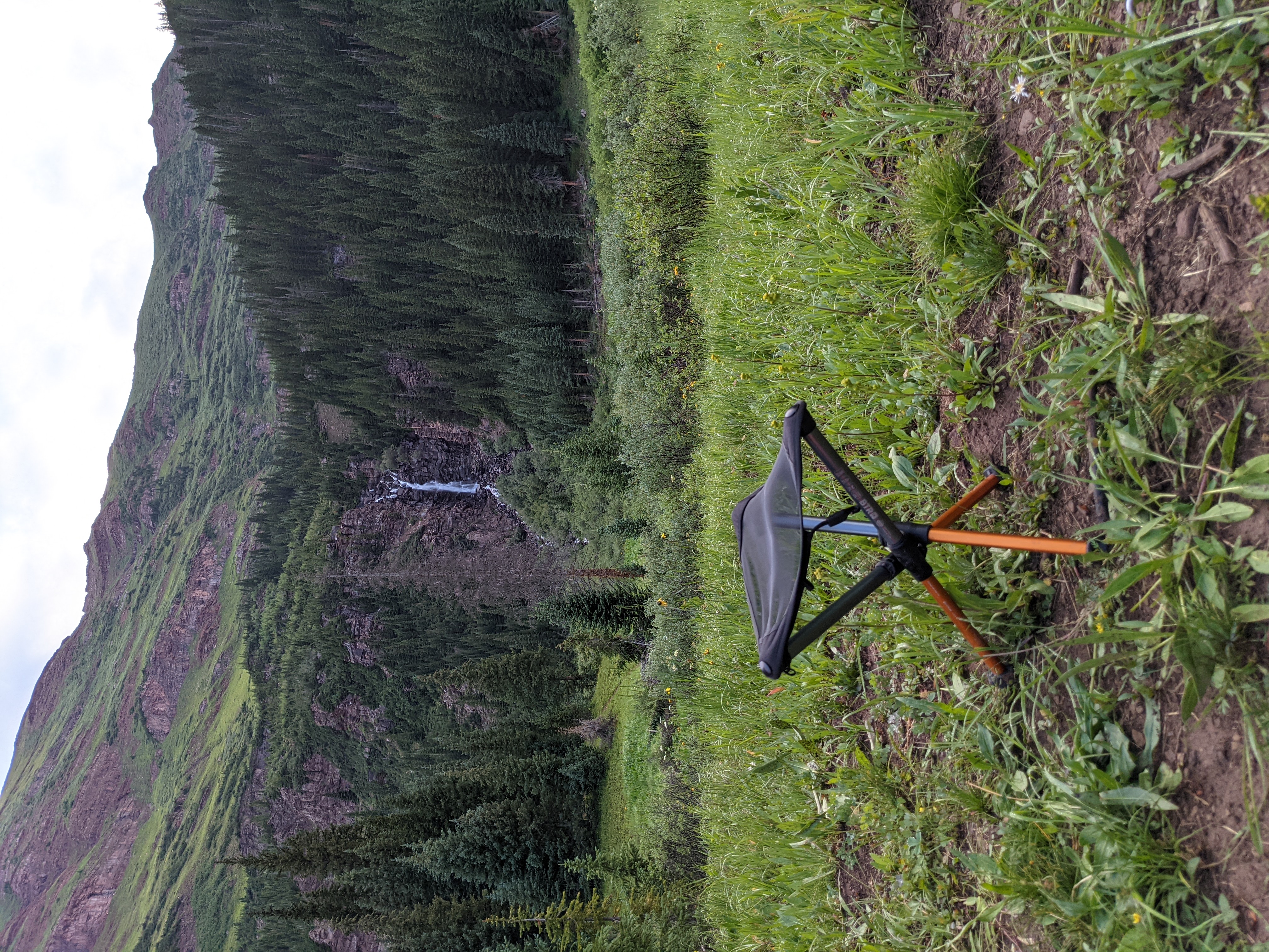
I had decided that we should hike the loop counter clockwise. Less traffic and it was allegedly less steep. So starting with Buckskin pass. We detoured just a little bit to Crater lake just to see what all the fuss was about and saw it silted up from recent rain but still very popular with hikers. We doubled back onto Trail 1975 and began our ascent. It would be several days before we were back at Crater Lake, maybe it would be a fun little camp site where I could try out my fishing rod if we needed a rest before we drove home on day 4.
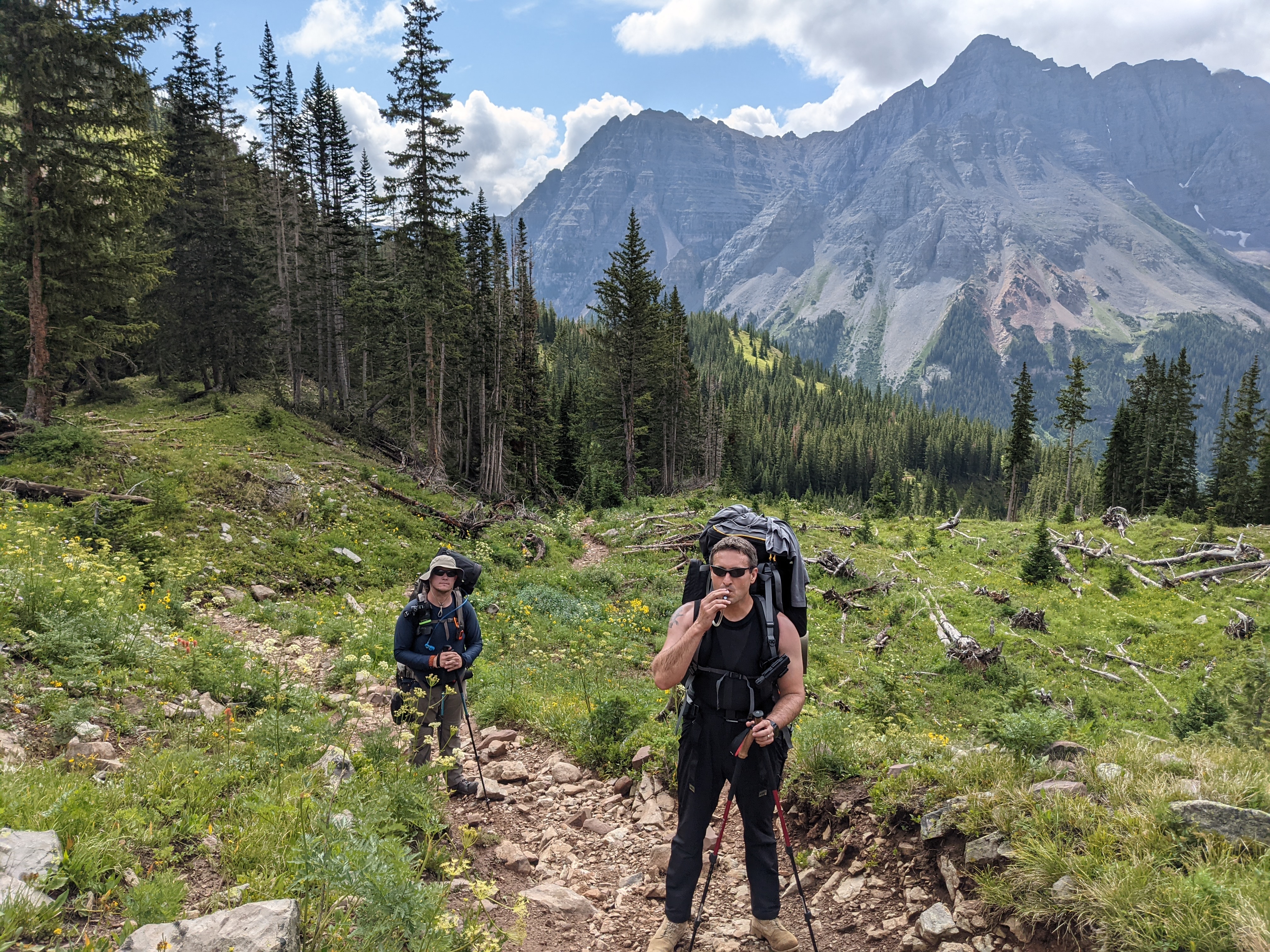
One of the problems with going counter clockwise during this loop is that you are immediately smacked in the face with elevation gain. The hike to Crater Lake from the parking lot is relatively free of large amounts of elevation gain, although the trail is rocky it’s not particularly difficult. Once you get to the Y in the trail however, the ascent to Buckskin pass all uphill less some straightaways in the trees. From the trailhead at 9580ft you’re heading to the pass at 12,462ft, gaining 2,882ft your first day. That’s a sizable chunk of Four Pass Loop’s advertised 7752 total feet of elevation gain. If AllTrails‘ maps are to be believed.

Descent into the Storm
Once we reached the top of Buckskin Pass it was evident that weather was going to chase us down the hill. As with most of my Colorado experience these last few years, you agonize over weather forecasts more in the mountains. How will it affect your hike, will there be lightning? It was after noon by now, so we had to start our descent and get into tree line if we wanted to be safe from lightning strikes. All of us in the group had some form of rain gear, and we knew it was going to at least spit on us this trip. So down we went, into the valley below.
As much as I wanted to make camp at Snowmass Lake, I’m just not sure we had enough gas left in the tank that day. I was underslept and likely getting cranky — though I’m not sure the group could really tell the difference. Rain was rolling in, and it was clear that all GPS devices were reporting different distances, and the map seemed overly optimistic as to how far we had yet to go.
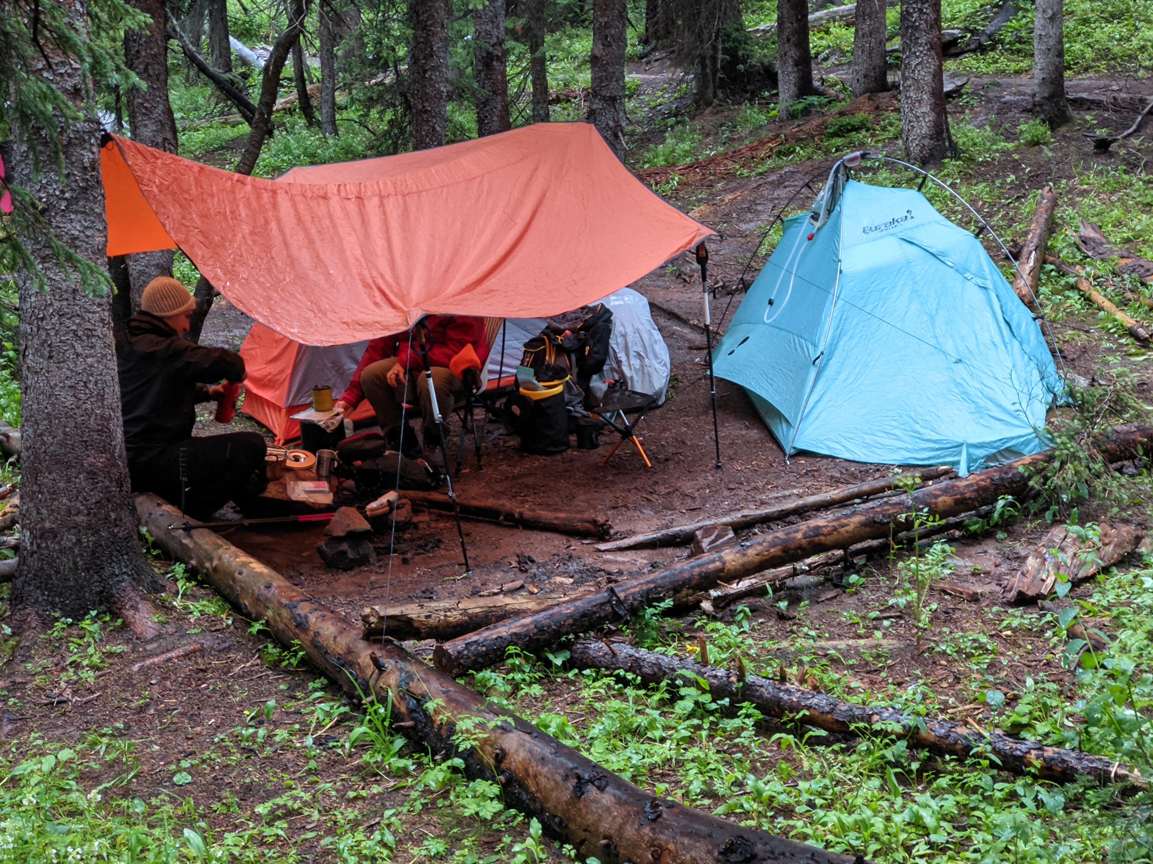
Then, at around three in the afternoon the rain started coming down. We found a spot just off trail, and perhaps too close, but one we could hunker down in and keep out of the rain. Our speed pitching skills were generally rewarded, unfortunately once our tents were pitched we had a new enemy. The runoff from the hummock next to us. Small streams diverted under and next to tents and through our eating area. Leo fixed his tarp to some 550 cord and trees to give us a slightly larger dry area. We dug trenches with our trowels to divert water away from our tents, trying not to start a four day adventure soaking wet.
People marched on past us, looking awfully depressed and wet, commenting at our dry camp. We very likely had one of the first camps off the pass for people doing the route counter-clockwise. A large group passed us on the way to the lake — we had shorted ourselves probably two, two and a half miles. But it was time well spent when lightning struck and sounded like we were in the midst of an air raid. The time from lightning to thunder was, for some, less than 5 seconds. It was close.
We filled and treated water from the growing flow of it through our campsite. I was able to quickly fill a bag from runoff from the tarp. 2 liters in under a minute. We tucked into warm beverages and the first of our dehydrated meals and turned in early. As usual, my snoring caught my camp mates off guard thinking I was a bear.
Day 2
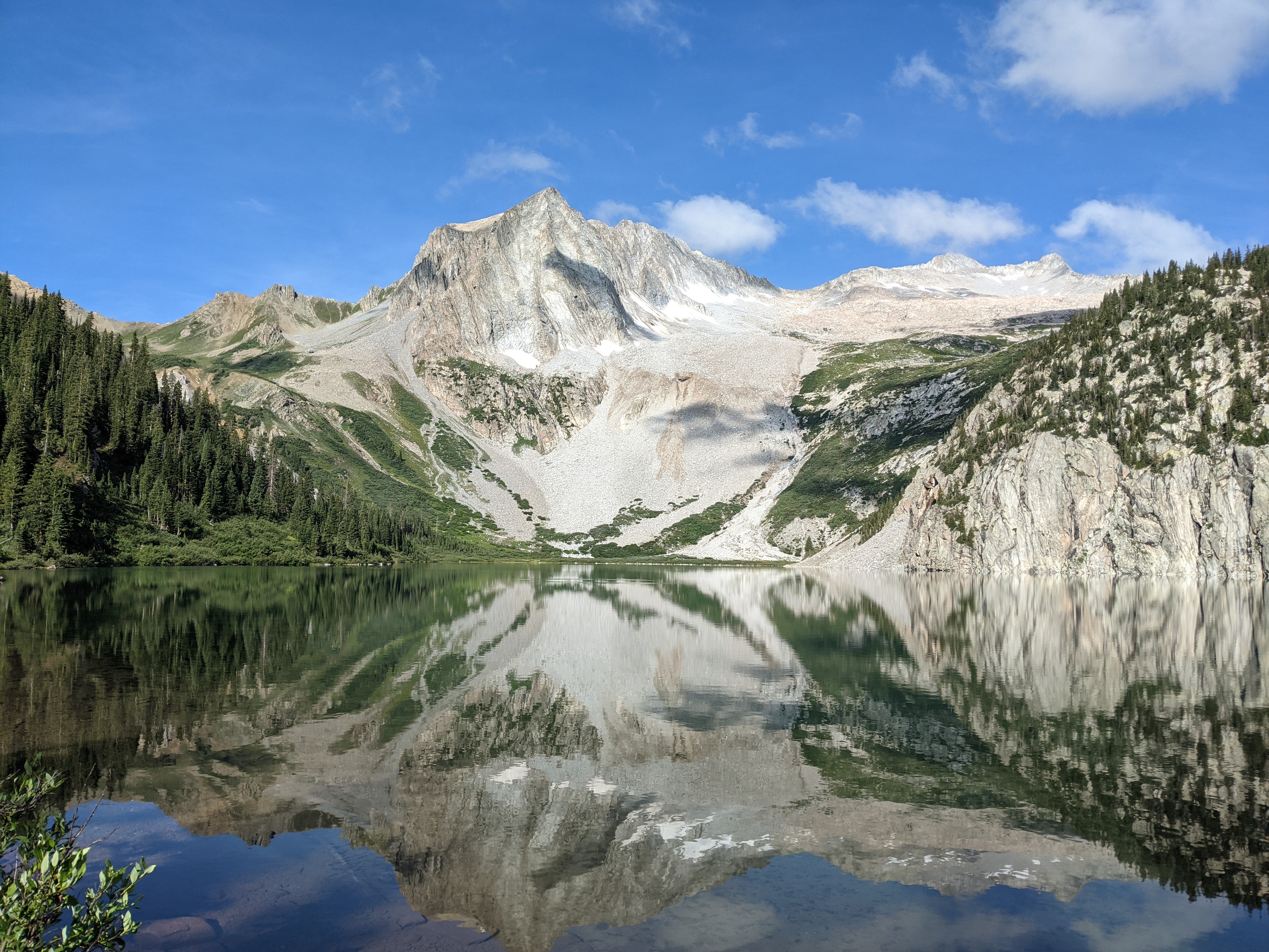
The next day I woke up at four in the morning, time for coffee! No one else was stirring in camp. I decided to hang out and get some more shuteye but that lasted a mere 30 minutes before I went to retrieve the bear kegs and spin up some coffee and breakfast. We’d shorted ourselves the view of Snowmass Lake during the hike. We wanted to make sure we got camp set before the weather came, and boy did it. So we decided before we really made an effort to ascend to Trail Rider Pass we wanted to check out the lake.
Even on sore legs it was a quick hike and the views were like something a National Geographic poster. Views like these are why we need to protect these places for the people willing to come here. Even when my legs can no longer carry me there, I’d like to have this place saved for those who can get there.
There are a lot of people, but other than in some campsites the trash and refuse you come to see on other pieces of public lands seem very minimal. In 2022 they’re looking at implementing an access fee to help clean up the areas hit hardest by humans. The comment period should be coming up soon so I encourage you all to write. If you love the place, and the fee is low, it shouldn’t be a barrier to entry. However it would be one of the very few places I’m aware of as wilderness that would require such a permit.
Trail Rider Pass you can essentially see from the lake. Unfortunately that does mean you see it the whole slog up the pass. From the lake (10986ft) to the pass (12424ft) itself you’re gaining 1483 feet of elevation. The climb is long and slow but not altogether that steep. There is a significant rocky traverse where you need to be careful picking your line — though cairns often exist along the path they’re not always the most helpful. Going counter clockwise afforded us a lot of elevation to lose on the descent but it was on long sweeping switchbacks down to the “river crossing”. It’s more like a creek at best, but with the previous night’s rain it was a raging torrent.
By this time in the day you could see the Bells getting socked in with weather. A grey haze set in on the horizon and we knew it was the evening thunderstorm. I didn’t want to put rain gear on quite yet, because I knew throwing on my heavy jacket would kill all will to hike it out further. We pushed quickly to the creek side and managed to make the crossing before the rain started in earnest. Unfortunately that also meant that we now had to push, in the rain, with tired legs to find a place to camp for the night. Nothing quite looked suitable as we passed multiple sites people had snapped up closer to the creek.
Sore Legs and Epic Campsites
Andrew and I were getting pretty tired but we pushed farther. I scouted forward a few sites but again, nothing suitable. We pushed through a bunch of huge fallen trees. Then I heard it. A glorious waterfall that filled the valley with an amazing sound. I posted up on what might be a nice site but was way too close to the trail. Finders keepers in case someone coming off the pass snapped it up before we could get something. Leo dropped his pack and went ahead. After a while he snuck back and motioned us on. I wasn’t keen to walk much farther but a meadow with a primo view of the waterfall awaited. A little exposed and windy but an amazing camp location in a special place.
For all the planning we’d done, maps I’d stared at, and then basically tossing that plan out the window at first light the first day — I’d say our team did pretty well. Despite shorting ourselves the first day, the second day we made up the distance. We stayed up late — or at least late for a camping trip, talking over our dinners the days ahead, distance we needed to make to be safe from the weather that loomed.
We’d made it to exactly where we’d hoped to camp for the evening. Unfortunately that meant immediately after breakfast the next day we’d begin our ascent on to the final two passes of our trip. A long and hopefully sunny day above tree line.
Day 3
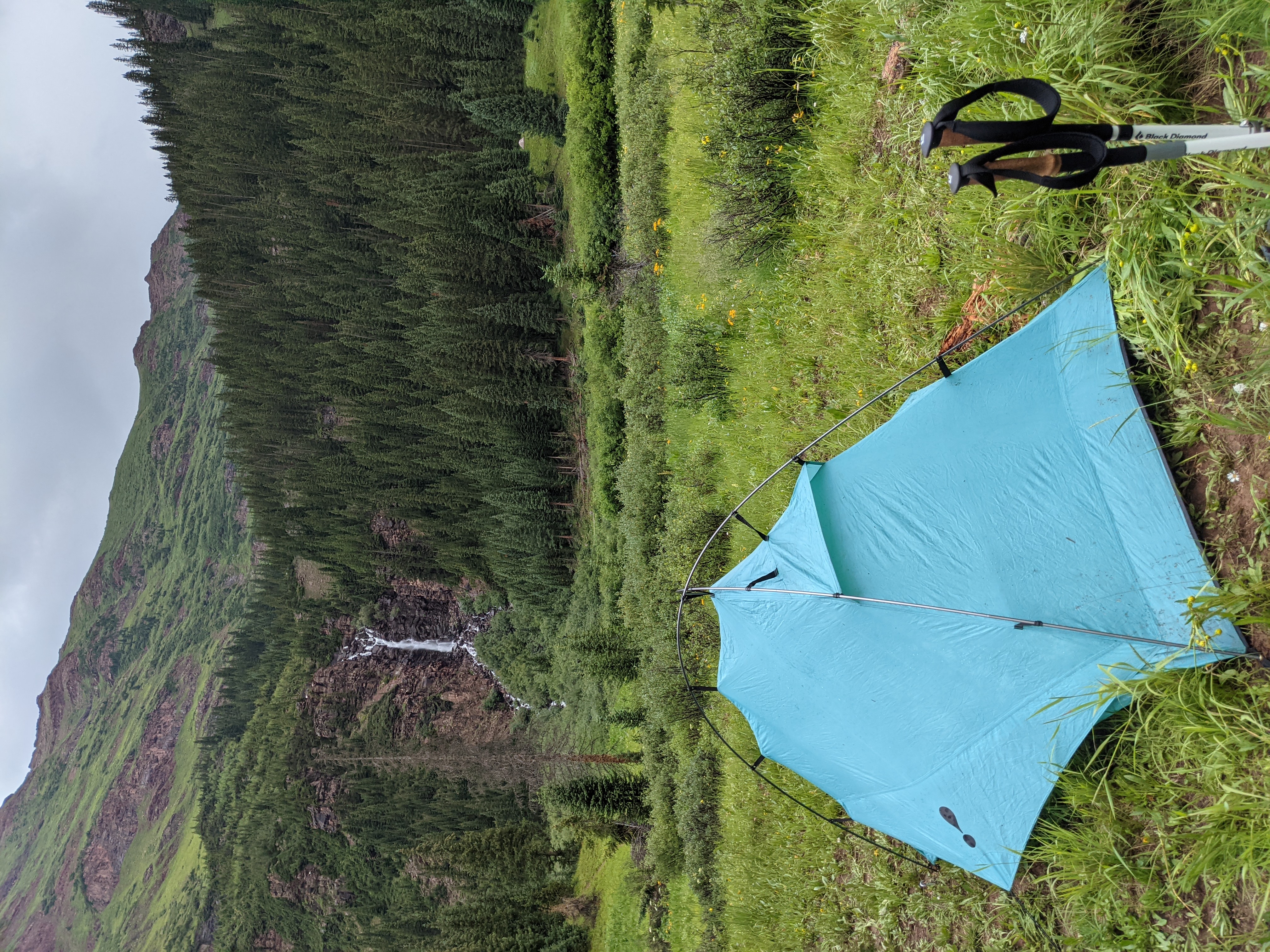
The next day we rose perhaps a little late for a two pass day, but it was nice to enjoy a little bit of time around camp. The burbling waterfall had indeed lulled me to sleep and was a fantastic backdrop to making my morning coffee and meal. A wake up below the waterfall, some coffee, and ibuprofen for my knees was just what the doctor ordered for our longest day yet. Even though it was likely only going to be something like 7.5 miles to where we could camp, it was going to be brutal. Two passes in one day, is something people far more fit than I can do without a second thought. Every day our packs got lighter but it just didn’t feel like it was enough.
Working our way out of the valley the roar of the waterfall let us know we hadn’t gone far. Once we gained altitude from switchbacks the hanging valley above opened up. Wide and steep sides painted with red rocks and clay, interspersed with patches of green grass. Willows clung close to the trail ensuring a wet sweep of our torsos and packs every time we tried to slip past. In the back of my head I wanted to see a moose, but I knew how dangerous they can be up close. If we saw one in the dense willow, it was going to be very close indeed.
Ascent to Frigid Air
Heading up to Frigid Air Pass from camp was a bit of a slog, once we made it up the steep switchbacks adjacent to the waterfall, we had the long climb through the hanging valley. Then we were able to see the pass. At this point there was actually quite a bit of foot traffic as we leap frogged some of the same groups every quarter mile or so. Each group had a sort of surge-stop hiking technique. Setting waypoints helped us make progress but at this point two days of hiking at elevation for some distance was beginning to set in. This wasn’t my first long distance trip, or even high elevation trip. But it was my first combination of both. Clouds rolled in, intercepting our path at a 45 degree angle we thought the thunderheads might sweep just past us, raining on the descent on the other side.
Our tiredness began to show as we strung out, first me, then Leo, then Andrew. We watched the clouds darken, but I knew that if I donned my rain gear it would be a death sentence for my productivity for hiking that day. I don’t own lightweight rain gear. I have a fishing tournament rain jacket, and basically it’s clone for hunting. Both are heavy duty with pit zippers, but both wear a little like trash bags.
As I got closer to the top of the pass we strung out to the points of switchbacks, one or two apart. I finally made it to the top to see a veritable gaggle of people taking pictures. One guy was in blue jeans and a cotton T-Shirt. I have literally no idea how that person was surviving, but I was envious. The sky opened, it began spitting rain as I regaled the clockwise hikers with the area next to the waterfall and they exchanged intel about the trail yet to come.
Rain turned to hail and I reluctantly put on my rain gear and stowed my cell phone as Leo and Andrew summited the pass. We were now three for four on Four Pass Loop, with one massive pass left to go. The hail though dampened the mood, and with hoods up, we made our descent into the saddle between Frigid Air and West Maroon Pass. The descent was the steepest we’d encountered yet.
Unfortunately with the hail, rain, and the red clay that made up the single track — we were in for it. I did my best clawing my boots into the steep sides, and using my trekking poles to dig in. I had to side hill on more than one occasion. Andrew was close behind me and at one point lost balance, with an inadvertent mud glissade sending him 10 or so feet down the mountain. Just enough to color his pants and take some dignity. However we’d so far made it further than any of our friends, so there was nothing really lost. We soldiered on.
On to West Maroon Pass
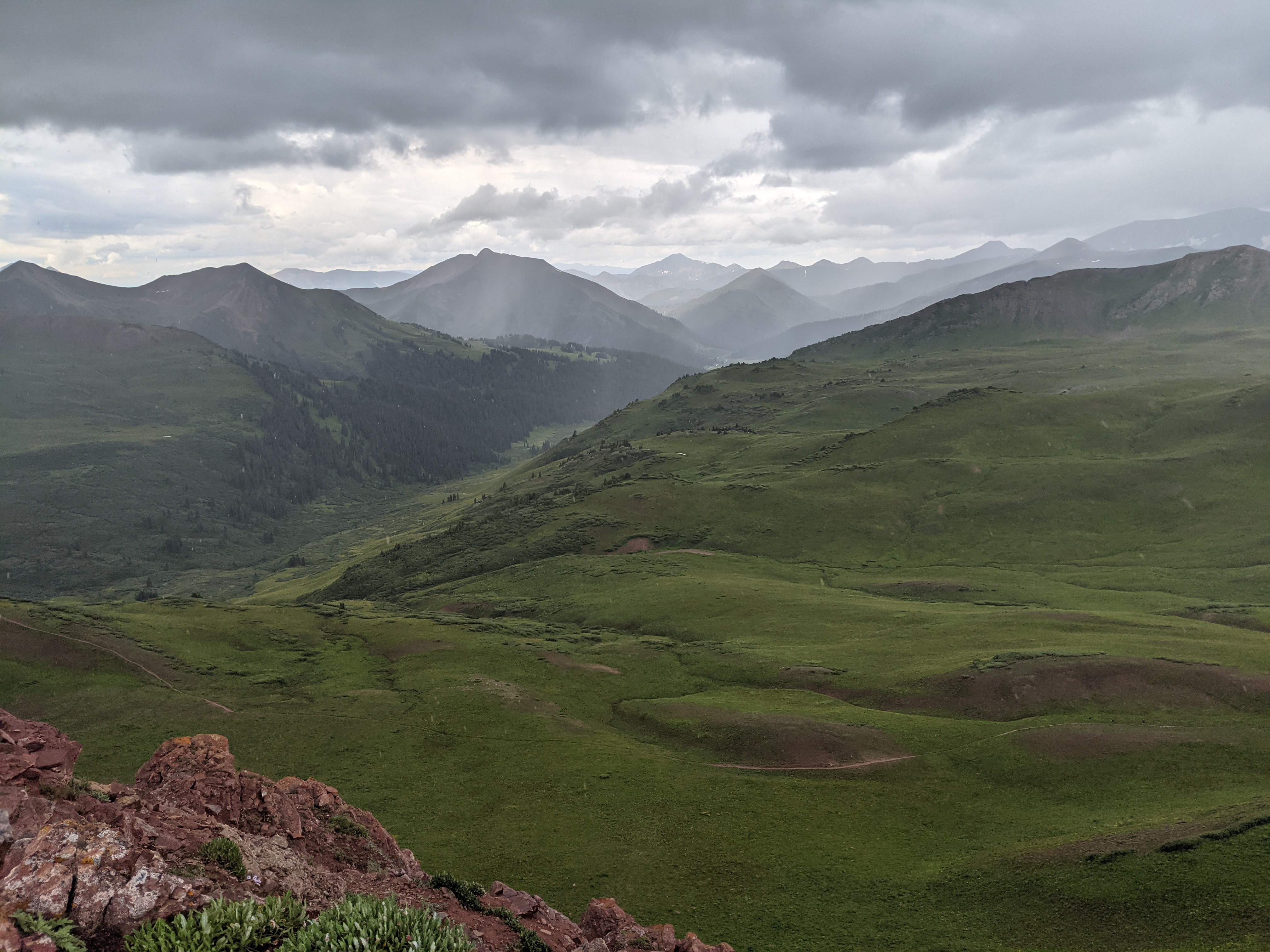
In the saddle eventually the weather broke, as it often does, as quickly as it came on. We could see the trail into Crested Butte coming in from our right off in the distance. Here the wildflowers were the most amazing I think I’d ever seen them in Colorado. While I’d worried about water availability, the weather, and the health of the flora during planning — none of those things were even an issue with our August hiking window.
A note on shelter: If you get weather between West Maroon Pass and Frigid Air your only real option is a clump of mature pines roughly centered between the passes. Otherwise you’re hunkered in the bushes off trail. Not so great for a lightning storm.
We rounded the bend on a glorious field of wildflowers and saw some camp sites up on a hill face. Practically at the bottom of West Maroon Pass I have to imagine that’s the first camp site for people really pushing starting the journey clockwise. Though looking back at the map I’m not sure I’d have had the energy for that the first day.
The ascent up West Maroon Pass was brutal, you could see the pass from almost a mile and a half off. Thankfully I didn’t have my binoculars with me, I wanted to save the weight. Had I brought them, I’d have had clarity to the flea circus of dancing hikers at the top, having completed the Four Pass Loop themselves. Passing old snow drifts and navigating wobbly legs around rocky paths we slowly but surely made it to the top. We saw some familiar faces of other counter clockwise hikers, and the refreshed plucky faces of those just starting their journey.
Getting off West Maroon I was feeling the high of having completed all four passes on the loop, but we still needed to boogey to tree line. It was getting late, and as should be obvious now, weather was heading our way. At this point my ankles and legs felt like a baby giraffe, but gravity was on my side. We picked our way down the mountain, and once inside of tree line we started looking for a place to make camp next to water. Getting into an avalanche scar we started seeing some spots, but few large enough to make camp. We heard the roar of a stream, and as we explored the sides of the trail, some ladies had taken one clearing but alerted us that about 100 yards upstream there was another clearing, so long as they could cut through camp for fresh water. Deal.
Day 4 and Out to the Trucks
The last day we woke up a little later than normal, and had a leisurely breakfast knowing it was all downhill from here. Tearing down the tents and the rest of camp was easy, but it also meant that the trip for all intents and purposes was over. We’d defeated Four Pass Loop, and had done it such that the last day was a 3 mile hike out to the cars, and a 4 hour drive home. It was still going to be a somewhat long day, but nowhere near as arduous as any of the previous.
The hike down from camp was extremely rocky. As Leo, Andrew, and I looked at each other, we were very glad that we hadn’t done the whole trip clockwise. The first day would have been a 4 hour drive, a long rocky uphill slog, and very likely two passes before we made it to a safe and weather worthy camp. I’m not saying that we did the trail the “easy way” but we certainly did it the way that worked the best for us, our fitness, our time table, and perhaps our sanity.
Wrapup and Recovery
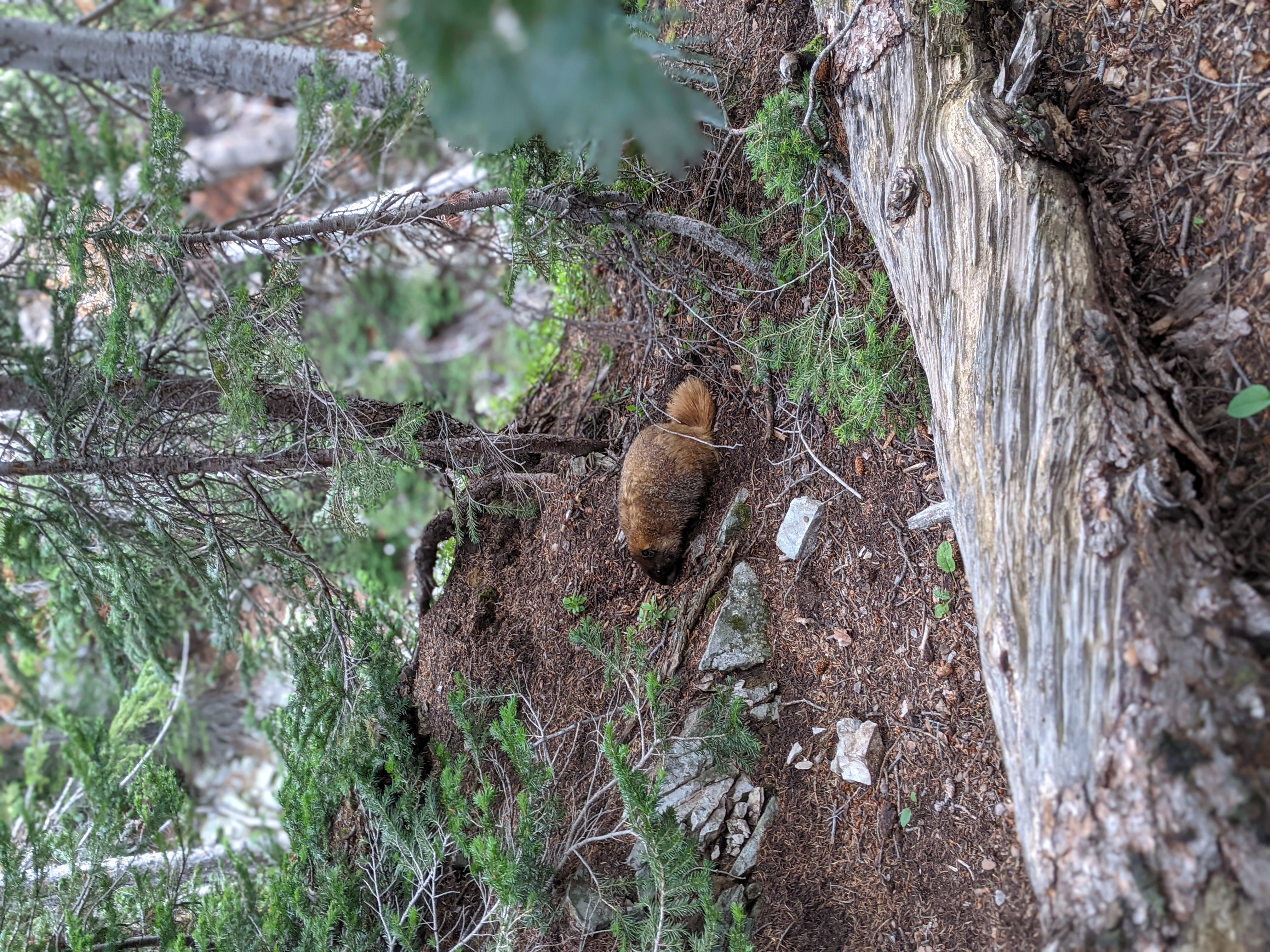
Funny thing, even though Four Pass is one of the most popular hikes in Colorado, if not the nation, the majority of the people that you see on the trail in this last few miles are day hikers. People who are seemingly amazed at your sunburned arms, chapped lips, and heavy packs. Why would anyone do this to themselves? When I realized I was among the white yoga pants clad Aspenites coming for their picture of the Bells I realized that while we both owned this land I was traipsing on, the interior of the Maroon Bells Wilderness felt even more my own. Those people would only ever see photos of Snowmass Lake, or what’s beyond West Maroon Pass. They’d never experience the hail at the top of Trail Rider, or a marmot trying to steal your camp food.
Just because of my intense feelings of place and ownership in the interior of the wilderness doesn’t make it any more mine. All Americans own this beautiful landscape, and I can hope that my pictures and stories are some reward for those who will never make it there.
Andrew and I drove back to the Denver area tired and stinky, and stopped off in Leadville for something to eat. He treated lunch where I ate more than my fair share of a High Mountain Pies Carnivore. They’ve got a great beer selection, and cater to the hiking, biking, and hunting crowd. It’s a known quantity to me, we destroyed four pies last time I was there for a hunting trip.
Of all my other trips planned this season that fell through, I’m so glad my friends and I were able to make this happen. For Leo it was likely one of his last major outings in Colorado, for me it was an important trip to help push myself to see what I was capable of. You get these images of wilderness trips built up in your head, and sometimes they live up to the hype manufactured in your mind’s eye — the Maroon Bells Wilderness and the Four Pass Loop exceeds all expectations, and you own just a tiny bit of it.
| Why am I doing this? I’m on a quest to hike, camp, hunt, or fish on all of Colorado’s federally designated Wilderness Areas. Check out all the articles here! |