Priorities Change
This week I was able to slip out for another hike, promising both to test some gear and keep it brief since my little boy has been awfully demanding of my wife’s time. I return to work next week from my lengthy paternity leave so this was likely my last chance this summer to do a weekday hike with little chance of being interrupted. For dedicated readers you might note that we’re getting a little late in the season for only being on the 2nd of 41 Wilderness areas (give or take, Colorado approved new ones!). With life changes comes a change in viewpoints. My New Years Resolution still stands, but with my little boy and everything that comes with being a father I’ve revised my deadline. I’ll try to do all 41 in 3 years, but I will do them before we take orders outside of Colorado. There’s so much beauty and well, wild in the places I’ve seen to date.
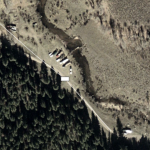
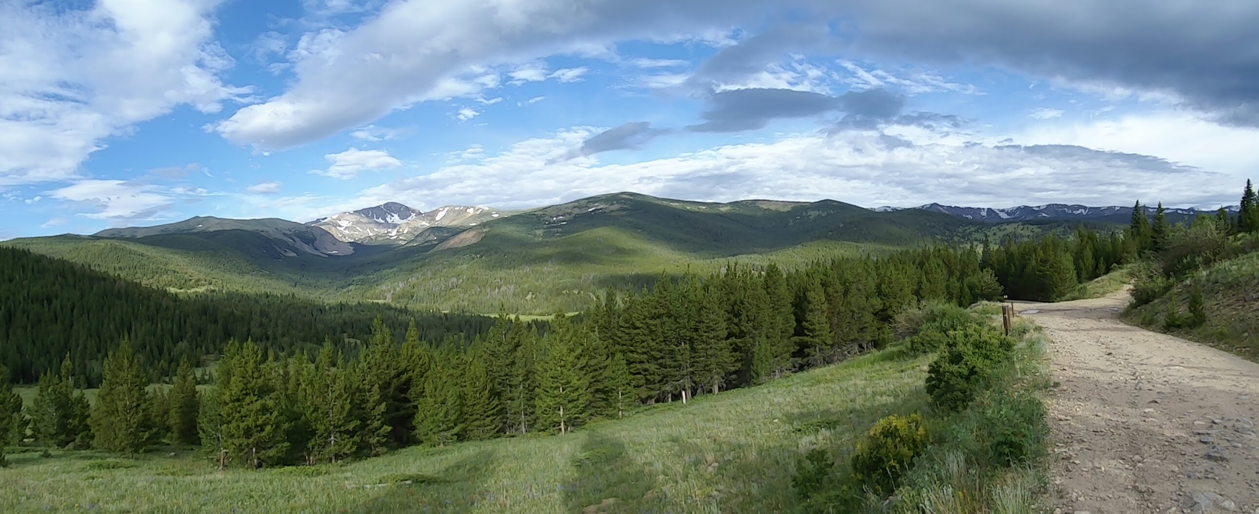
So where do you go when you don’t have much time? I promised to get back by mid-afternoon and didn’t want to go somewhere I’d already been before. I’m saving Indian Peaks Wilderness, one of the United State’s most visited Wilderness areas for when I can do the Arapahoe Glacier hike. Both time and weather will need to allow for that hike that spends hours above treeline. I settled on the James Peak Wilderness outside of Nederland, Colorado. It was well within striking distance from the house and combined off-roading in the Jeep with a short hike along with some mountain lakes, one of my favorite terrain features for a hike.
On the Road Again
I was able to gather nearly all of my gear, eat a quick breakfast and get out of the house around six AM, wanting to beat a majority of the rush hour traffic out of Denver and achieve escape velocity from the city’s orbit. Quickly I got to I-70 and began the climb through US Route 6, the Grand Army of the Republic highway, the very same highway I bebop from grouse covert to covert back in Pennsylvania! Passing through Central City and Blackhawk I wondered if people really loved gambling that much to have two whole historic cities dedicated to them. I motored on to something a little more my speed. The towns got smaller and the roads got dirtier as I worked my way through Rollinsville and then Tolland. Tolland, Colorado reminded my of the town where my family cabin is located in Western PA, small, sleepy, and mostly made up of seasonal homes around hunting and fishing. It’s so small it’s not tracked on the Census, but named for the Toll family, literally Toll-Land, it’s small enough that you’d have to believe everyone in the community is like one big family.
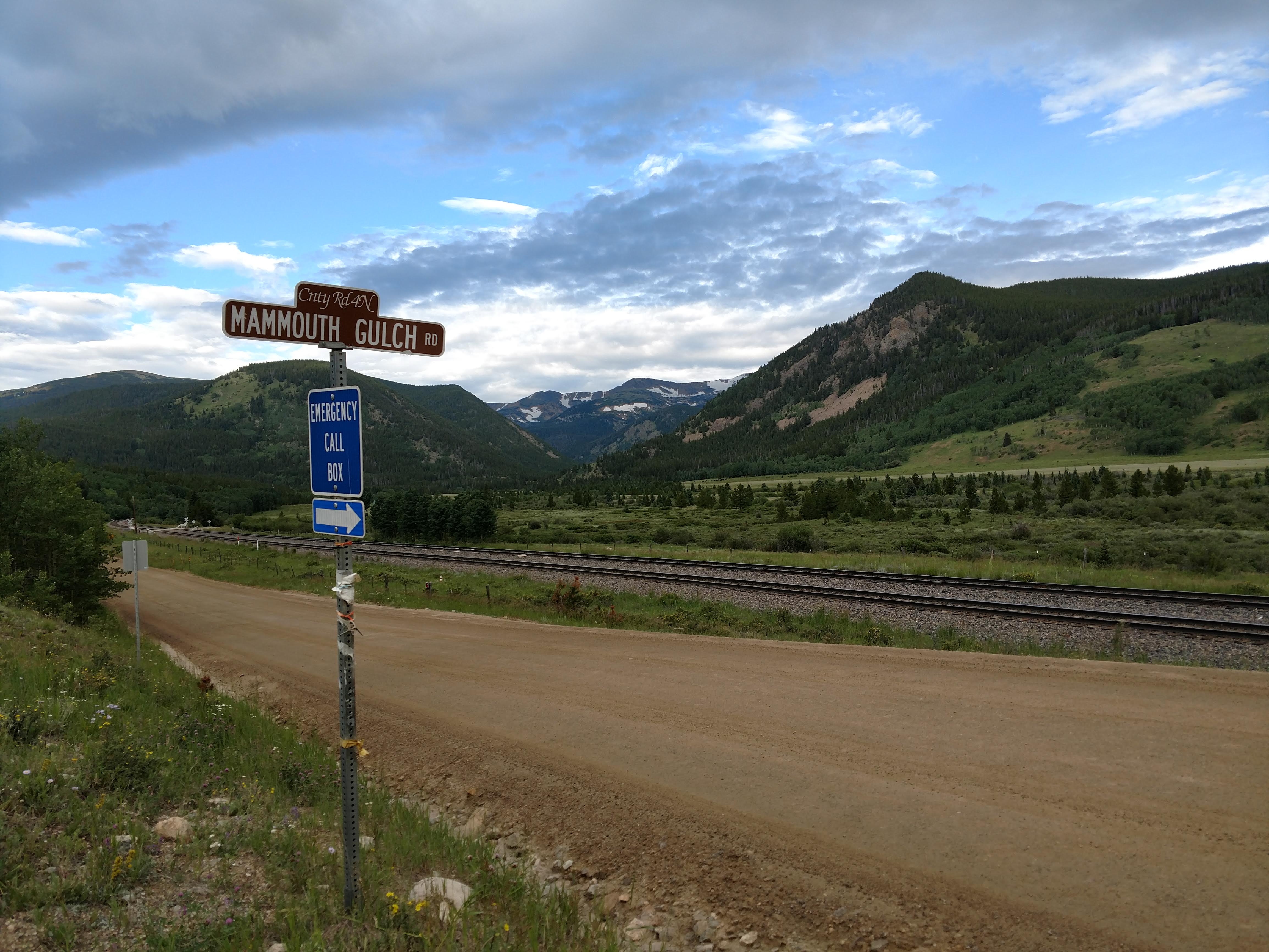
County Roads
The turn off of County Road 16 to get to the trail head takes the low maintenance albeit graded dirt road immediately to a no maintenance. Pictures hardly do it justice, but Mamoth Gulch Road (County Road 4N) honestly looked paved when I viewed it in Google Earth when I was doing research for what area I’d head to this day. I lived on a County Road in both New York and Pennsylvania growing up, one was paved and turned to dirt the other was tar and chipped seasonally. This road on the other hand was not for the feint of heart or the low of ground clearance.
Rocks the size of bowling balls poked out of the dirt and crushed stone that dreamt of some day becoming gravel. I fought with myself as I thought about airing down my tires. In hindsight I probably should have, I have speed bleeders in my truck that I can set the PSI on and screw them in to lower tire pressure on all four tires from the valve stem. When you do that your whole truck breathes a slow sigh until the pressure is released, and then you have to make sure you made a mental note of where the closest gas station is when you’re done with your trail — or have a compressor. I figured slow and steady would win the race, but perhaps airing down would have increased the ride comfort as I began to slowly make my way up Mammoth Gulch.
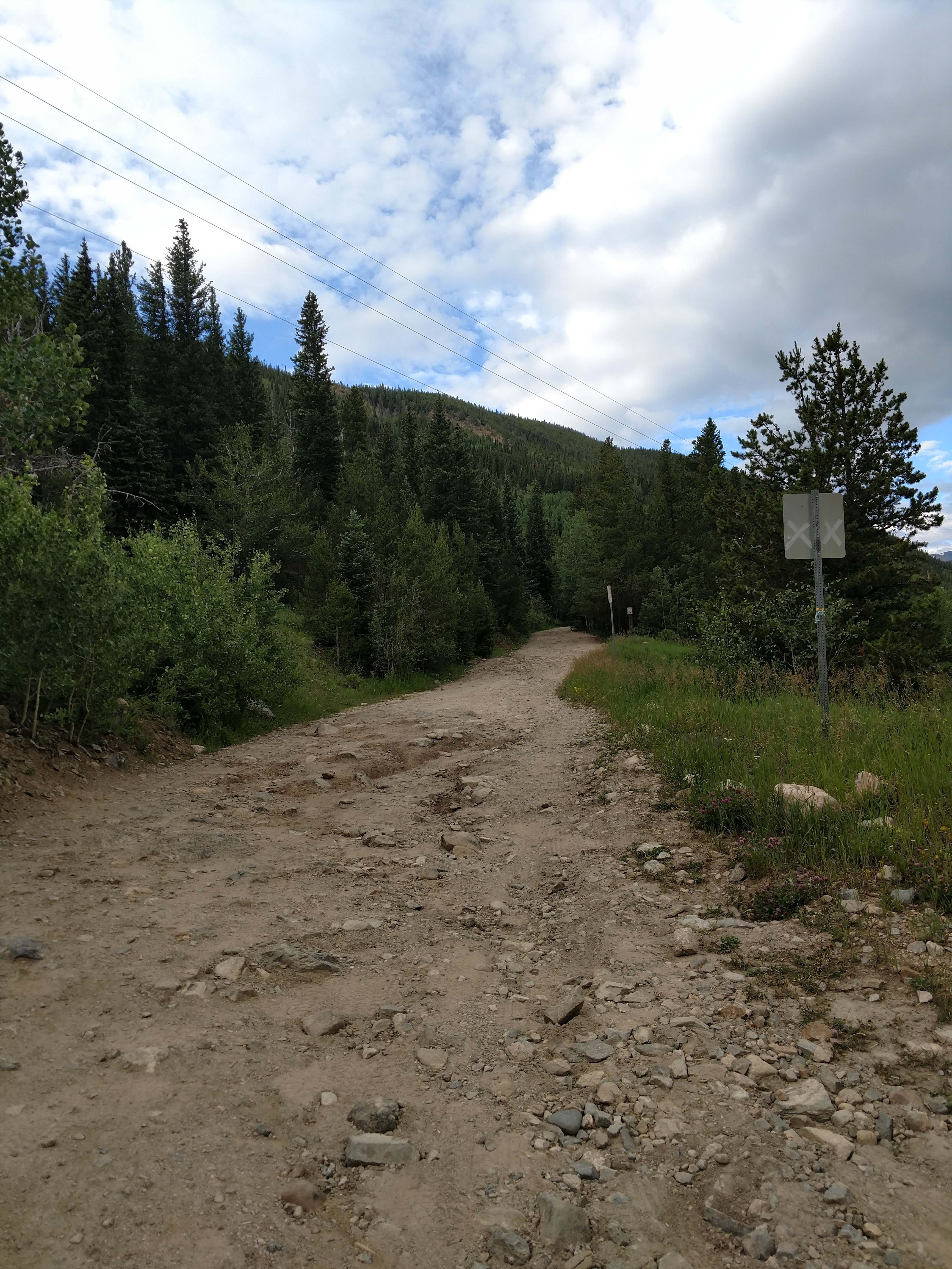
The road crept away from CR16 quickly and gained in elevation, soon I was able to see the tiny hamlet of Tolland below as the “road” which appeared in actuality to be an unimproved oxcart path or the out-and-back of an old Caterpillar D70. Trees lined the downslope portion of the road for several thousand yards as I crept along, the off-roading just technical enough for me to want to pick a line and be careful of larger rocks.
The trail was somewhat washed out but improved to what was simply a rough dirt road again. Unfortunately it was not to be, this road played with my emotions. Not that I was not confident in my driving abilities, I’d been running dirt roads a long time, but I preferred any technical off-roading to have a co-driver. Just when I thought things were getting a little worse for wear I saw out of the corner of my eye something big and white. A Chevy goddamn van was coming down the trail at me! A plaid-clad man with black rimmed glasses, thin mustache, and a brown mutt of a dog riding shotgun greeted me — and I didn’t think to ask how much further the trailhead was. At some moment wholly unknown to me the “County Road” that I was on turned into the National Forest System Road 353.
The Forest Roads now are marked with little brown plastic sticks, markers as to where to turn and what vehicles are allowed on the trail. I’d been measuring up until now time instead of distance. I looked down at my cell phone, there’d been no signal for almost an hour of driving, and I didn’t hope to get any even at the top of the mountain. I was in the National Forest and headed to the Wilderness, what hope could I realistically have to get a message out? I had a plan but wouldn’t use it until I needed to.
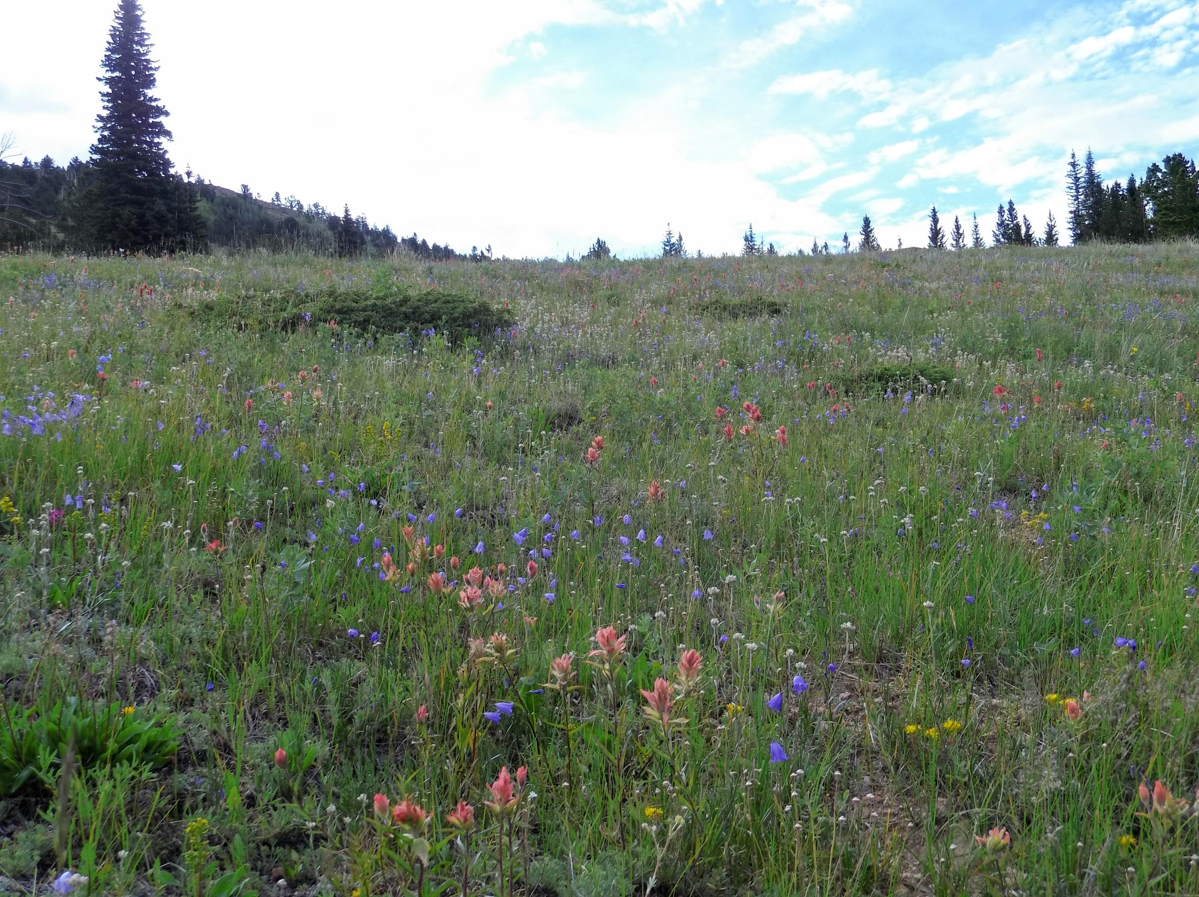
The forest gave way to open alpine meadows, and with the ferocious winter that Colorado experienced the wildflowers were taking full advantage of the summer sun. They dotted the meadow as far as you could see, providing color bursts to the sea of green.
Not Lost, Just Turned Around
After a short while of more bumpy driving I arrived at the Pisgah Lake trail head where a large dirt spot indicated an area that was likely meant to be used for trucks with trailers of ATVs, still in the National Forest, motorized transport was still allowed on marked trails. Unfortunately this threw me for a loop. I’d thought I’d arrived at my trail head only to realize the road went on still further.
Beyond this parking lot there is a seasonal gate, that during my research I learned was just opened a few weeks ago. It was here that I began to reconsider that I might not be heading the right direction. I got to the gate only to see that the road became narrower and appeared to thread it’s way through a meadow and over the ridge of the mountain I was looking at.
Turning around gingerly in the truck in an area just wide enough for two Amish buggies to pass I went back to the parking lot to check my offline OnX Maps. I’d marked the trail head parking lot beforehand and measured the distance… I’d been heading in the right direction. I gulped and turned around yet again. The road ascended and passed the only private residence I’d seen since I’d turned off the road in Tolland. The road rose imposingly, rutted with spring runoff and then cast around the side of the mountain. Several signs warned of foot traffic only on the adjacent areas, protecting the now alpine meadows from wayward offroaders.
From the vantage point of the cast of the road in front of me I had visions of the Discovery Channel specials on the Death Road in Bolivia. I knew it was my brain playing tricks on me, and my crummy 8 year old shocks providing a rougher ride than I’d have otherwise. The road was no joke, and unfortunately I don’t have a picture of it here. Upon making my way around the curve I finally arrived at the James Peak Lake Trail head.
Weathering the Weather
Wind rocked my truck at the parking lot. To my left the road ascended yet again to Kingston Peak and beyond, to my right a sheer drop off and two broken off telephone pole sized wooden sign posts. By the whitish hue to the one nearest me, I assumed that was the Wilderness sign I’d so wanted to take a picture of.
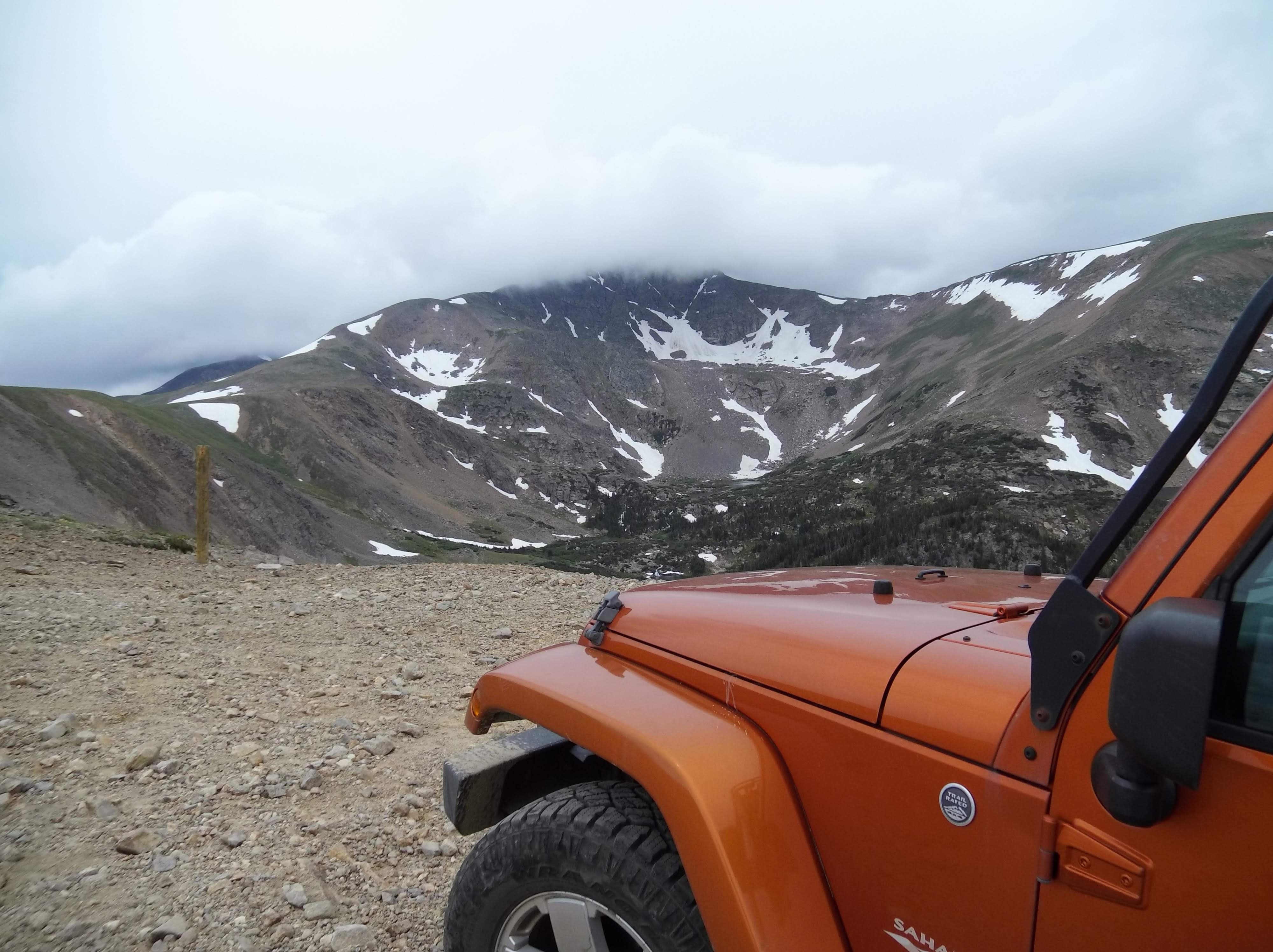
The wind in the parking area buffeted the Jeep, rocking it side to side. I hopped out to look over the side. Beyond the post the descent on the trail dropped 500ft in the first .5 mile of the trail. I psyched myself up that in this bowl I’d be protected by the mountain that was otherwise trying to throw my Jeep from it’s side. I threw on my parking brake, as if it would do much good, and fired up my Garmin InReach Mini to tell my wife I’d reached the trail head. I’d originally planned on packing in, doing a little fly fishing, eating lunch, and heading out. Unfortunately the trail ride took a little longer than I wanted, and I had little time and unfavorable conditions to wet a line.
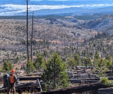
I began my descent onto the trail and immediately began to see that the first little bit of the trail was steep, real steep. I’d forgotten my trecking poles at home in favor of a tripod — something I won’t be likely to do again. Looking out into the landscape I was about to descend into though, I found the kidney jostling ride to the trailhead extremely worth it, and an adventure unto itself.
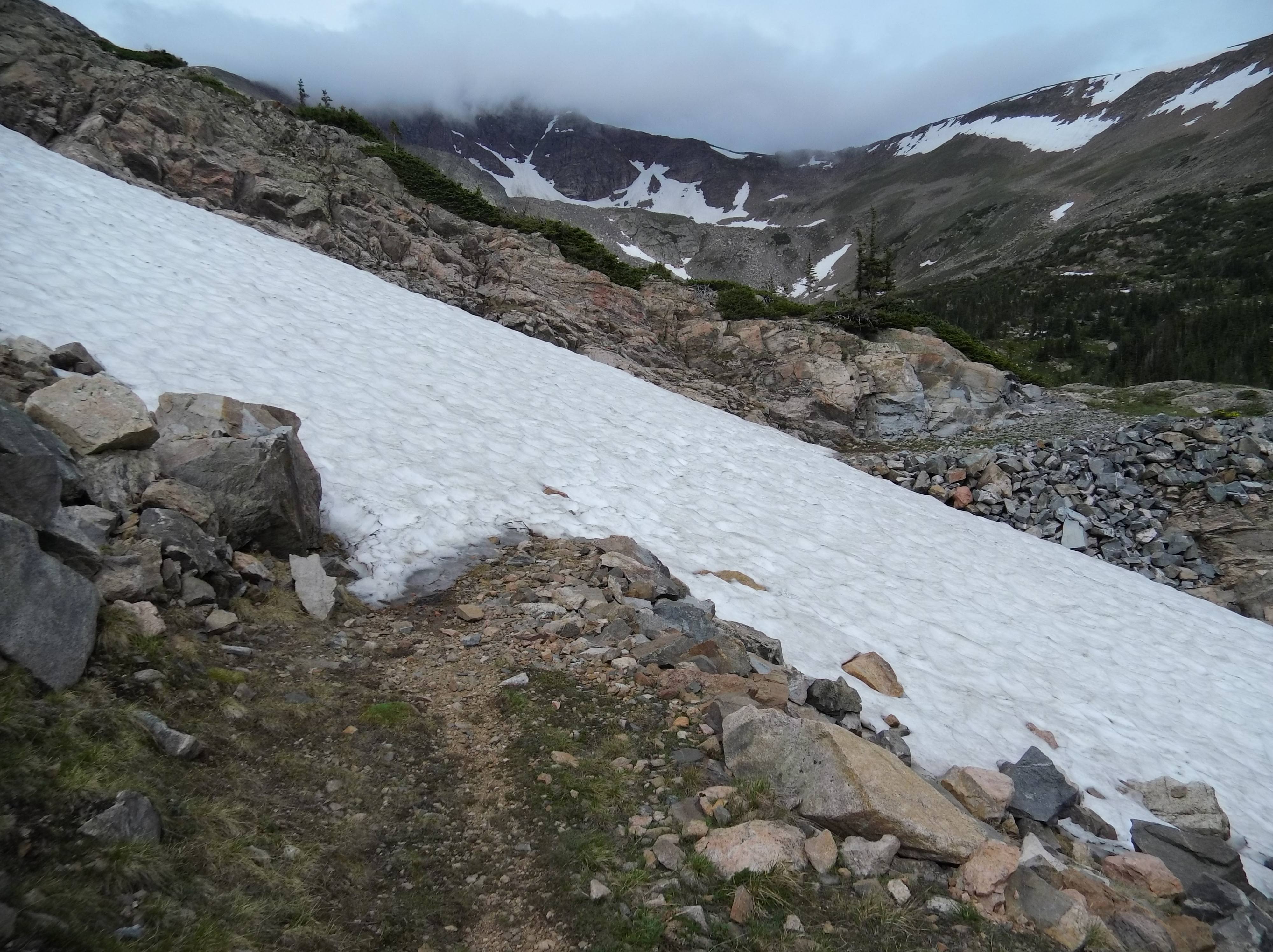
On the trip to the lake the single track trail began above the treeline and sunk quickly, plunging into small pines, creeping juniper, and Vaccinum with grasses and wildflowers mixed in for good measure. In the shadows of the valley creases snow still clung to the hill blocking the trail on four separate occasions. Not wanting to glissade into the valley below I had to pick a line where the snow was flat and solid enough. No microspikes and no trekking poles meant slow and steady steps to cross the snow fields.
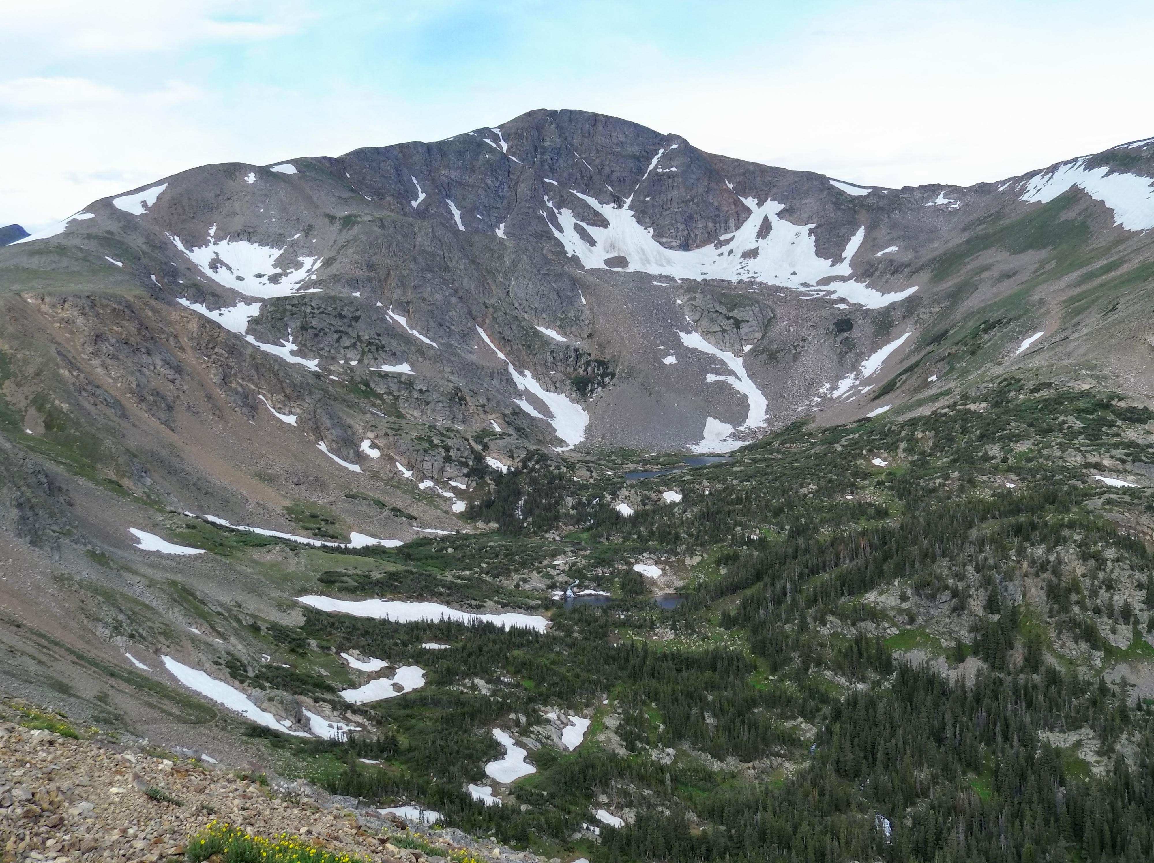
Half way through the trail splits to the valley floor below and several more lakes, but my eye was on the prize to scope out where the largest trout have historically been pulled. It wasn’t much farther, but I couldn’t get the scope of the lake until I was practically on top of it.
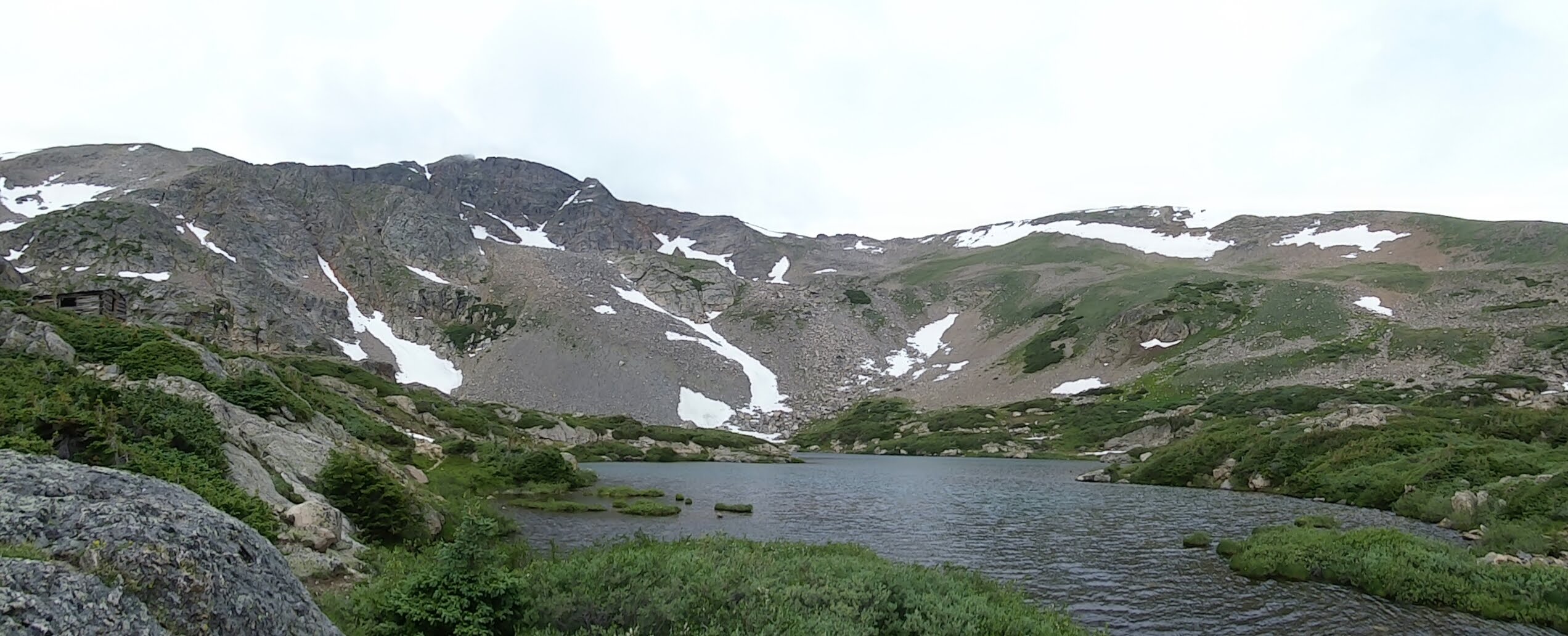
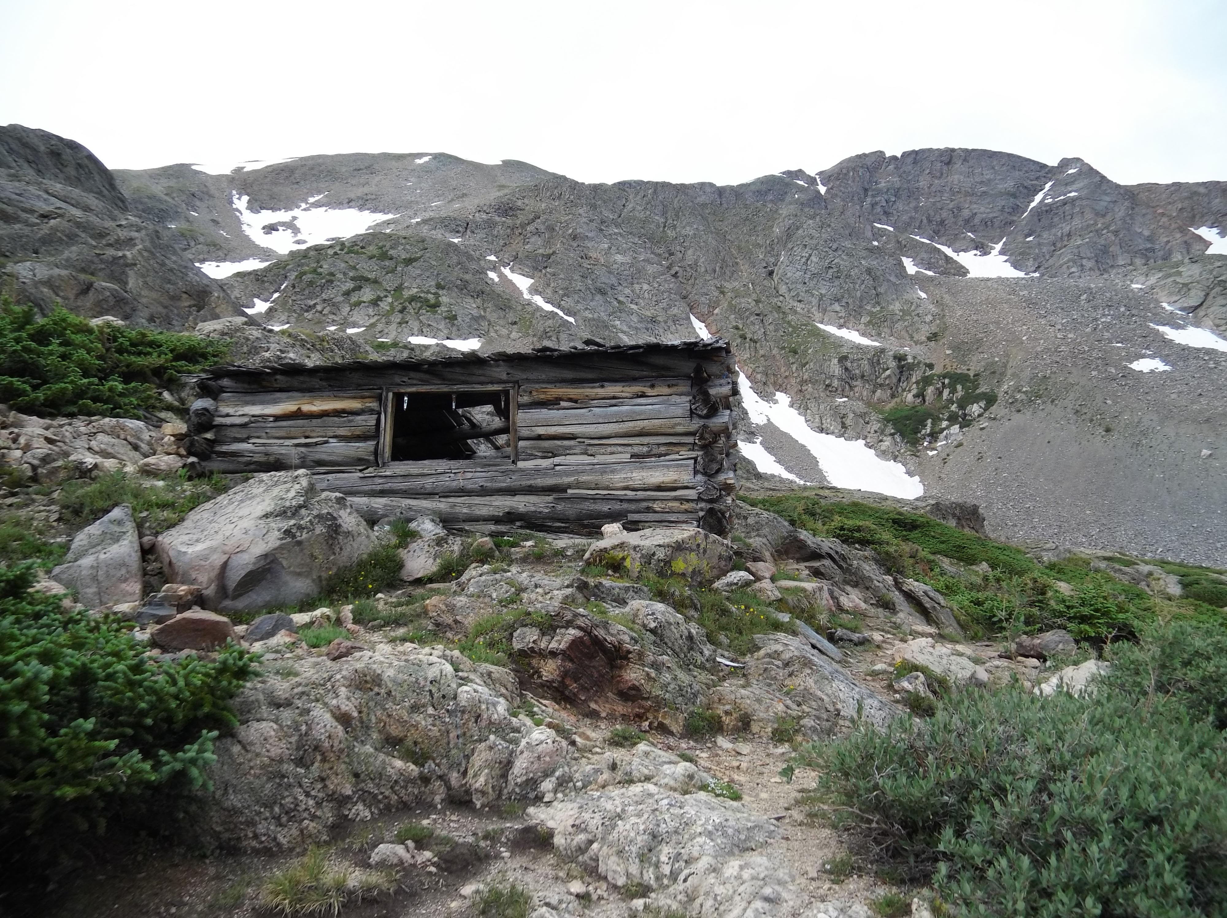
While my fly gear was safely in the truck high above me, and the wind still whipped around, changing directions from my back to my face every so often the lake slowly revealed itself to me. On James Lake there’s a discolored channel towards the outlet where the ice cold snow melt cuts through rocks to the many lakes further down valley, and a clearly visible shelf that would allow a wet wader to get into the lake for some truly amazing casts. I saw some trout cruising the shallows while I spent time resting near the old cabin just off the lake.
As I rested lakeside and watched the trout cruise I couldn’t help but think that this was one of the most rewarding adventures I’d done in Colorado to date. I’d gone into the trip thinking the route would be easy, but knew that once I’d made the trek out to Rollinsville I couldn’t bear to turn around. A sense of the chance of danger is appealing, but you should always know your limits, and test them to within a safe range — especially knowing what you have to come home to.
Turning around and doing the trail in reverse gave a better vantage point to the roaring snow melt engorged creeks feeding the lakes below, but very soon a lump appeared in my throat. The trail I’d just descended stood like a wall in front of me. The most taunting part was that for the last half mile I could see my truck hundreds of yards in advance, but it was slow going. A 500ft ascent over .5 miles is steep. Real steep.
I arrived back at my truck coated in a veneer of sweat but having enjoyed the hike, not having seen a single soul on my trek into the valley over the course of several hours. Not far from a road, but far from anywhere.
Secret Spot
An older couple passed me in a large Toyota pickup truck towing a largeish off-road trailer and followed by a built Wrangler. He looked like Ted Nugent and wanted me to keep his spot a secret, but he only wanted to know from me whether the seasonal gate was open. It was. I passed several more vehicles on the way in, all picking their way through the rocks and making slow but steady progress to their weekend campsites. During my time in the area it was clear that there had been people into the Wilderness area. The cabin had litter inside of it, but at least it was contained, outside of the cabin only rusty remnants of a bygone era survived the rugged windswept landscape. I get the feeling that this place is everyone’s secret — this is public land but the barrier to entry is so high that it will likely be safe from the masses for time to come. We do, however need to protect these places. When I return I’m bringing a trash bag. I just can’t stand to see these places littered with tin cans and candybar wrappers.
How to Get There
From Rollinsville, CO
- From Rollinsville on Colorado Highway 119, turn west onto County Road 16 head and west for approximately five miles.
- At the town of Tolland, turn left onto Mammoth Gulch (County Road 4N).
- After 3.5 miles take a right onto National Forest System Road 353. This is a rough, native surface road not plowed in the winter. Only high clearance vehicles with 4WD are recommended.
- Follow NFSR 353 west for 3.3 miles to James Peak Lake Trailhead.