The hunting maps we created in our first article are great, using the shapefiles provided by either the state or federal government to enrich your understanding of the world that surrounds you. The second article took a look at some more esoteric data sources for use in your public land hunting paradise. But what if you have a GPS full of years of waypoints? What if you wanted to focus on managing the habitat here at home, or map out your hunting stands for everyone at deer camp along with the trails on how to get to each? How do you add those to the physical map, should you? Here we explore exporting your waypoints and placing pins on your newly created custom maps.
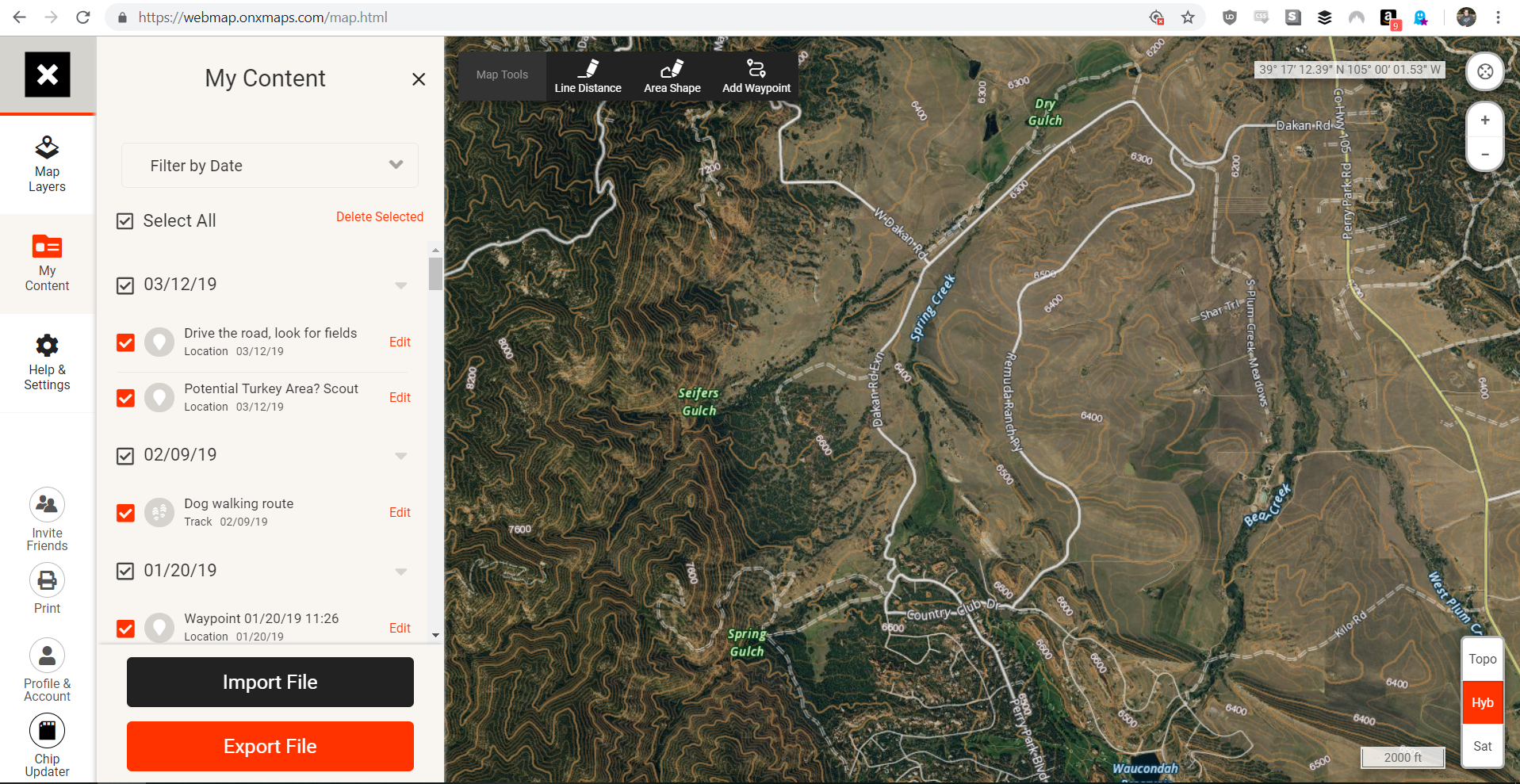
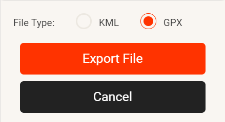
First let’s get our waypoints into a file that our map editing software (QGis, or ArcGIS if you’re a baller or work/school is footing the bill) can load. From the OnXmaps Web App it’s super easy, just go to the My Content menu item, and select which waypoints you want to export (default it all) and click export. The only other choice you need to make is the file format, GPX is recognized by most GPSes and KML is easily loaded into Google Earth as it’s Google’s Keyhole Markup Language. Both file formats work well with QGis.
For your GPS I’d recommend something like Garmin Basecamp to export your waypoints in a similar fashion. It’s just as easy with Basecamp, once your GPS is plugged in via USB and you’ve launched Basecamp you should see your waypoints on screen as “Internal Storage” or something to that effect. Select the folder containing your waypoints and go to File->Export. Basecamp supports KML, GPX, CSV, and several other file formats. I’d recommend using GPX format since it’s standardized and most pieces of software work with them. The only one QGis is unlikely to accept is the seemingly super-proprietary Garmin Training Center file format — which I’m not entirely sure why it even exists. Now that you have your waypoints saved, fire up QGis!
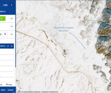
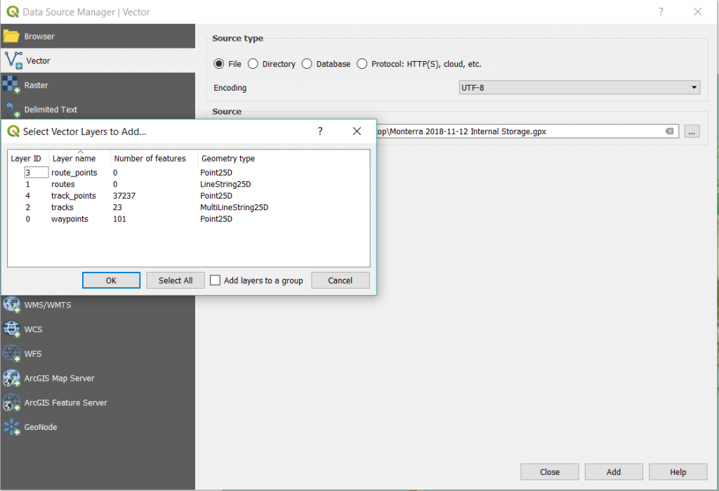
Add a basemap to your canvas inside a new project, or load an existing map you’re working on, and go to Layers -> Add Layer -> Vector Layer. Select your GPX file you’ve exported from OnX, BaseCamp or elsewhere and you’ll get a new dialog to select which features inside the GPX file you’d like to import. We’re just going to import our waypoints today, but you’ll see that you can also bring in trackpoints (collections of points along a track), tracks, and routes. These are handy in mapping trails or doing some fine tuning work with your maps, I’ve previously taken a GPS track on skidder trails while grouse hunting that I’ve later overlayed on maps and marked flushes with GPS waypoints. Over time this becomes a valuable asset in locating grouse coverts later.
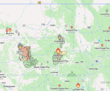
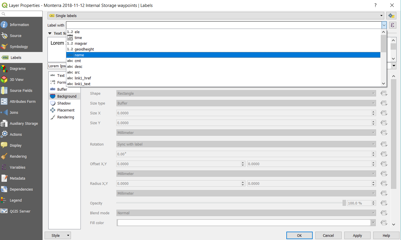
Once you’ve added your waypoints to the map you now have points speckling your canvas similar to our previous article about using other data sources. From there, edit the symbology to make the dots a more aesthetically pleasing color. QGis always picks a random color for new labels and they’re not always perfect. I’m pretty sure my wife would call the color that was chosen for me Lilac. I changed it to Orange in the Layer Properties dialog (right click the layer of choice, properties sub menu) and then switched to the Labels tab. From there let’s select single label, and it’ll really depend on whatever format you’ve imported — GPX files should be standardized, I found that labeling with the name field got good results.
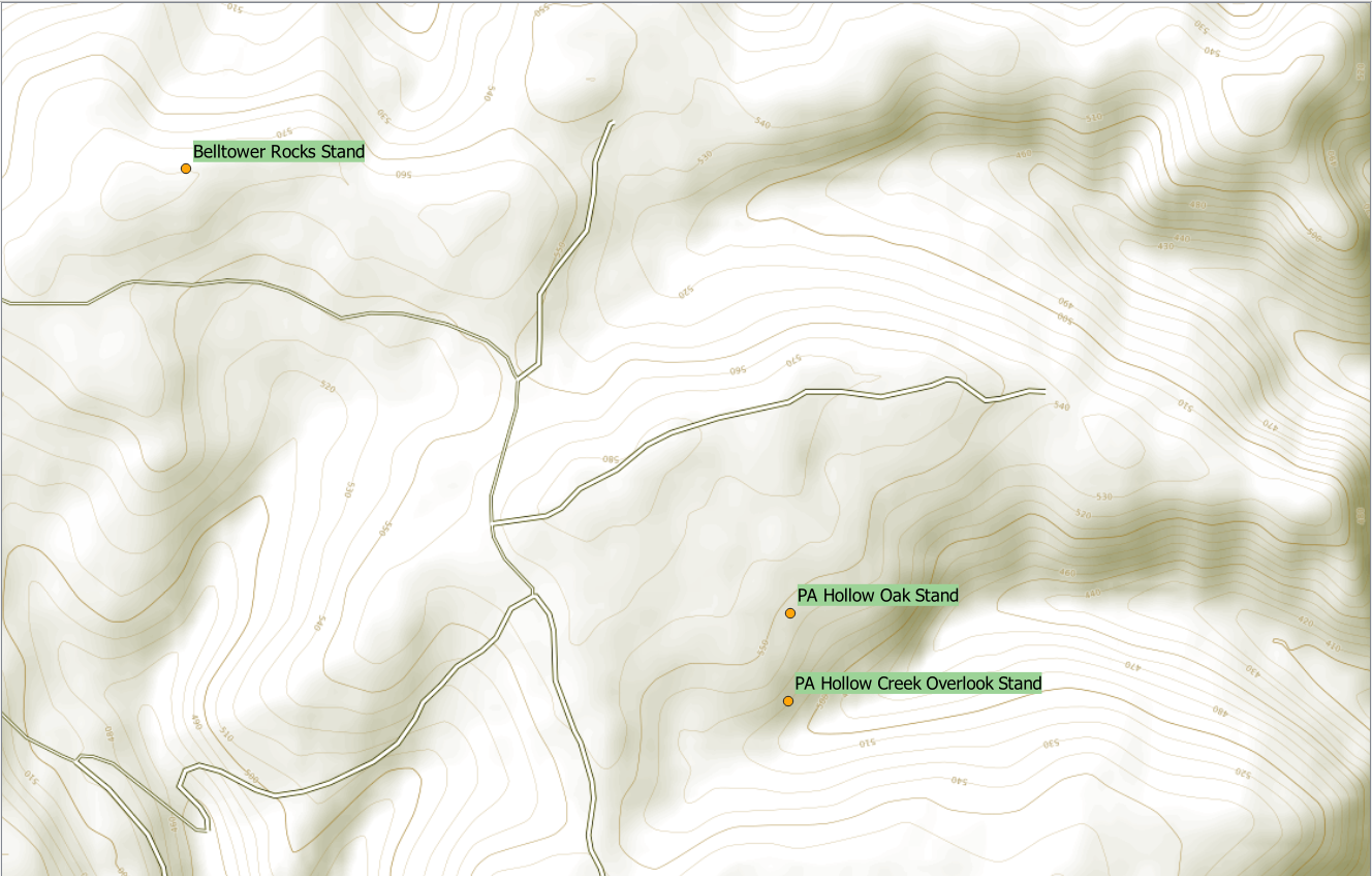
If you’re anything like me, importing your entire collection of waypoints would be nuts. At least displaying them all at the same time would be, so if we right click the Layer we just added and select Filter we can filter down what’s getting displayed. In my map I’m only interested in places I consider a hunting stand location. All of my stands happen to have the word stand in the name, which is convenient. For that I can select the name field, and build the expression:
| “name” LIKE ‘%Stand%’ |
When we go back to our map, we find that only objects with Stand in the name are being displayed.
Not much to it, right? Combined with the lessons in the other two articles, this mapping thing is beginning to be pretty powerful and despite the bar to get here, this is just the beginning of what GIS is capable of showing us as hunters, anglers, and outdoorsfolk.