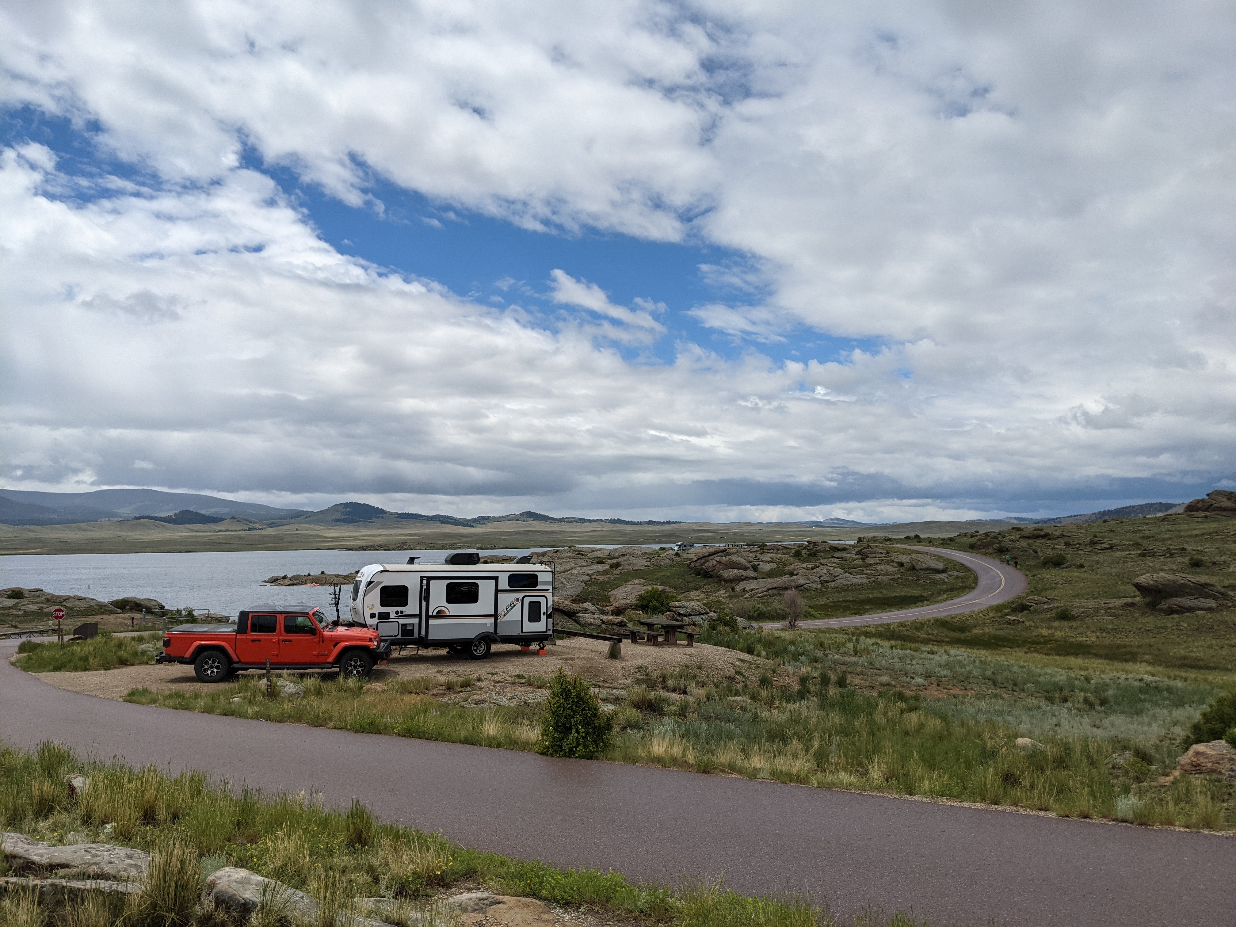
Like most hunters, I like scouring maps for new places to hunt. Some years ago I made the move outside of my home state, and while it took some time, I eventually learned the lay of the land. I did that through some pretty intense cyber scouting and with some good old fashioned hiking when the weather was warm. I use maps during the off-season to identify new places to check out, and establish a travel radius from my house for places that I can go to on a weeknight or on a weekend, or further if I can find somewhere else to stay. Inside of those bubbles I then think of what game I’m going to hunt. Narrow the list of properties down based on features you want. This year I really wanted to learn how to effectively hunt swamps, which is something I’d never done back home. So I looked for properties near the water that I could do a half day hunt in, commutable from my house within reason. I found three properties near me that I could practice hunting for an elusive swamp donkey. Alas, I didn’t tag one, but it was through research that I found several new spits of property to hunt, fish, and go raspberrying in.
I’m slowly going through the states and compiling the information. Once I’ve got all 50 there’ll be a separate page here on the website you can use as reference for your scouting or pipedreaming needs. Below is the data I could find Alabama to Iowa. Enjoy!
State Sponsored Interactive Maps
Alabama
WMA Lands
http://www.arcgis.com/home/webmap/viewer.html?webmap=da756dbc6c2247499b313809c853a93e
http://www.outdooralabama.com/wildlife-management-areas
Alaska
http://dnr.alaska.gov/MapAK/browser?set=map&id=3144
Arizona
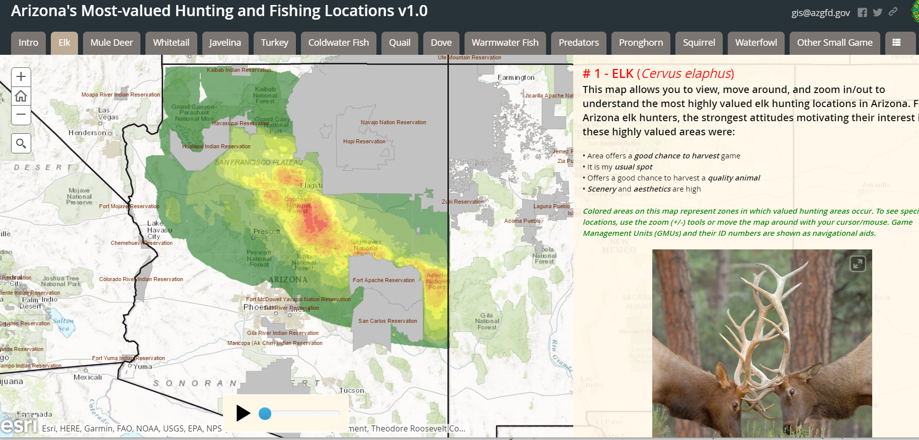
Arizona public land map
http://gis.azgfd.gov/
Map based on hunter survey results with heatmap!
http://azgfd.maps.arcgis.com/apps/MapSeries/index.html?appid=72ef284e22ab441b81c72472409c5d24&autoplay
Arkansas
WMA List
http://www.agfc.com/hunting/Pages/wmaList.aspx
https://gis.agfc.com/
California
https://map.dfg.ca.gov/lands/
Colorado
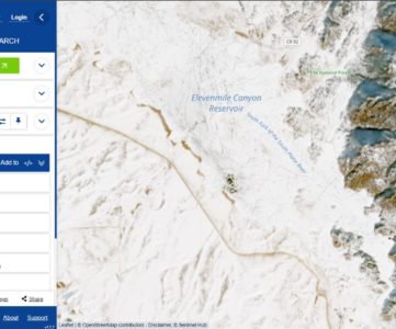
The Colorado Hunting Atlas
http://ndismaps.nrel.colostate.edu/index.html?app=HuntingAtlas
KMZ Boundaries for GMUs
http://cpw.state.co.us/learn/Pages/KMZ-Maps.aspx
More Outdoors Interactive Maps
http://cpw.state.co.us/learn/Pages/Maps.aspx
Connecticut
All Hunting Areas
http://www.depdata.ct.gov/wildlife/maps/huntingareas.asp
Delaware
Couldn’t find any interactive maps.
List of WMAs by county
http://www.eregulations.com/delaware/hunting/public-hunting-areas-county/
Individual PDF Maps
http://www.dnrec.delaware.gov/fw/hunting/pages/wildlifeareamaps.aspx
Florida
Couldn’t find any interactive maps.
Hunting zones listed
http://myfwc.com/hunting/season-dates/zone-map/
Georgia
https://www.georgiaoutdoormap.com/
PDF Maps from this landing page
http://www.georgiawildlife.com/maps/hunting
Hawaii
ArcMap link here, but no data to speak of
http://histategis.maps.arcgis.com/home/webmap/viewer.html?useExisting=1
KMZ Files (Google Earth) available here
http://dlnr.hawaii.gov/recreation/hunting/
Idaho
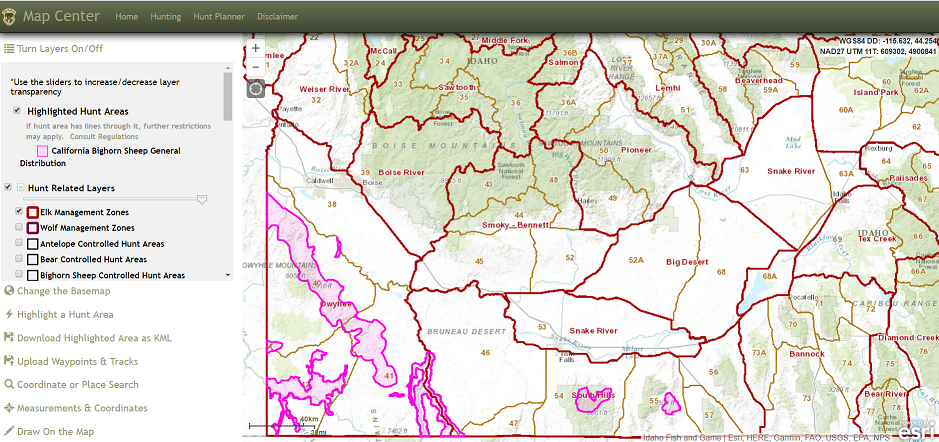
Fantastic layering to find specific game animals
https://fishandgame.idaho.gov/ifwis/huntplanner/mapcenter/
https://idaho.maps.arcgis.com/apps/webappviewer/index.html?id=2252207eb95b49f99b2c05228831dfbb
Illinois
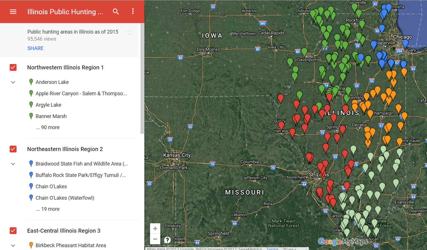
Engineered Pursuit — Looks like there’s someone else out there like me who hates wading through tons of pdf links and excel tables of WMAs
http://engineeredpursuit.com/illinois-public-hunting-areas/
Direct Link
https://www.google.com/maps/d/u/0/viewer?mid=13uDKYAWzIkzAl1BfP5kFexX0uqw&hl=en_US&ll=39.81323365634008%2C-89.45962070000002&z=6
Indiana
https://indnr.maps.arcgis.com/apps/webappviewer/index.html?id=05e37ac12a1345ceb1673228fb2793ce
Iowa
Hunting Atlas
http://programs.iowadnr.gov/maps/huntingatlas/default.html


[…] « Previous Story […]
[…] today marks the completion of the series I’ve been working on for Interactive Maps ( Part I | Part II ) in the US that you can use to explore new hunting land. With that launches the […]